Cassville in Bartow County, Georgia — The American South (South Atlantic)
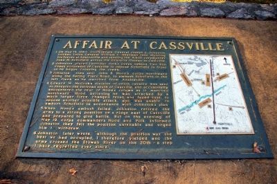
Affair at Cassville
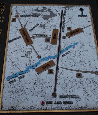
2. Johnston placed Leonidas Polk's corps behind Two Run Creek northwest of Cassville to oppose Schofield in front as he began crossing the creek.
3. Johnston then sent John B. Hood's corps northward along the Spring Place Road, to ambush Schofield in the left flank as he marched from Adairsville.
4. Edward M. McCook's division of union cavalry was sent to threaten the railroad south of Cassville, and accidentally encountered the rear of Hood's column as it marched northward. Hood, believing he was attacked by a much larger force, changed front and faced east, to oppose another possible attack, and was unable to ambush Schofield in accordance with Johnston's plan.
5. When Hood's ambush failed, Johnston retired the army to a strong position on a ridge east of Cassville and prepared to give battle. But on the evening of May 19, corps commanders Hood and Polk informed Johnston they felt the position untenable and urged him to withdraw.
6. Johnston later wrote, "although the position was the best we had occupied, I therefore yielded and the army crossed the Etowah River on the 20th - a step I have regretted ever since."
Topics. This historical marker is listed in this topic list: War, US Civil. A significant historical month for this entry is May 1853.
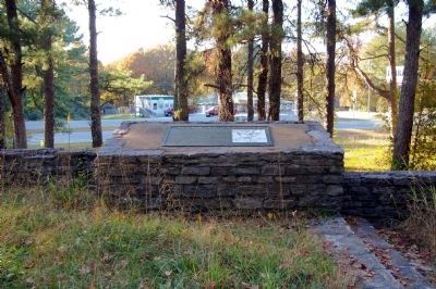
Location. 34° 14.018′ N, 84° 51.337′ W. Marker is in Cassville, Georgia, in Bartow County. Marker is on Cassville Road NW, on the right when traveling south. This marker is located at a WPA Pavilion Park on the Affair at Cassville. Touch for map. Marker is in this post office area: Cassville GA 30123, United States of America. Touch for directions.
Other nearby markers. At least 8 other markers are within one mile of this marker, measured as the crow flies. Atlanta Campaign (within shouting distance of this marker); Confederate Line (approx. half a mile away); Historic McKelvey House (approx. ¾ mile away); Gen. Leonidas Polk's Headquarters (approx. ¾ mile away); Noble Hill Rosenwald School (approx. 0.9 miles away); Confederate Army of Tenn. at Cassville (approx. 1.1 miles away); Site - Cassville Female College (approx. 1.1 miles away); Site of Cassville (approx. 1.1 miles away). Touch for a list and map of all markers in Cassville.
More about this marker. On the right side of the marker is a map depicting the action described in the text.
Related markers. Click here for a list of markers that are related to this marker. Battle of Cassville by markers.
Also see . . . WPA Pavilions. The Cassville Pavilion was one of five built in the 1930s as part of the Atlanta Campaign Historic site. The site was transferred from the National Park Service to the state of Georgia, but the pavilions remained. (Submitted on November 10, 2008, by Craig Swain of Leesburg, Virginia.)
Credits. This page was last revised on March 8, 2019. It was originally submitted on November 10, 2008, by David Seibert of Sandy Springs, Georgia. This page has been viewed 2,328 times since then and 67 times this year. Last updated on November 10, 2008, by David Seibert of Sandy Springs, Georgia. Photos: 1. submitted on November 10, 2008, by David Seibert of Sandy Springs, Georgia. 2. submitted on August 17, 2015, by Brandon Fletcher of Chattanooga, Tennessee. 3, 4. submitted on November 10, 2008, by David Seibert of Sandy Springs, Georgia. • Craig Swain was the editor who published this page.


