Near Kingston in Bartow County, Georgia — The American South (South Atlantic)
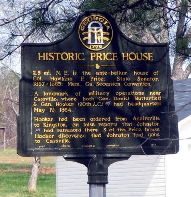
Historic Price House
A landmark of military operations near Cassville, where both Gen. Daniel Butterfield & Gen. Hooker (20th A.C.) [US] had headquarters May 19, 1864.
Hooker had been ordered from Adairsville to Kingston, on false reports that Johnston [CS] had retreated there. S. of the Price house Hooker discovered that Johnston had gone to Cassville.
Erected 1952 by Georgia Historical Commission. (Marker Number 008-8.)
Topics and series. This historical marker is listed in this topic list: War, US Civil. In addition, it is included in the Georgia Historical Society series list. A significant historical date for this entry is May 19, 1796.
Location. 34° 15.53′ N, 84° 53.345′ W. Marker is near Kingston, Georgia, in Bartow County. Marker is on Law Road, 1.2 miles north of Kingston Highway (Georgia Route 293), on the left when traveling north. Touch for map. Marker is at or near this postal address: 172 Law Road, Kingston GA 30145, United States of America. Touch for directions.
Other nearby markers. At least 8 other markers are within 3 miles of this marker, measured as the crow flies. Gravelly Plateau & Two Run Creek (approx. 1.7 miles away); Confederate Army of Tenn. at Cassville (approx. 1.9 miles away); Site - Cassville Female College (approx. 1.9 miles away); Noble Hill Rosenwald School (approx. 2 miles away); Old Cassville Post Office (approx. 2.2 miles away); Town Of Cassville (approx. 2.2 miles away); Site of Cassville (approx. 2.2 miles away); Confederate Dead (approx. 2˝ miles away).
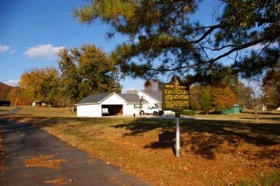
More about this marker. The marker was origially located on Ga 293, the old US Highway 411. At some time apparently in the 1970s or '80s it was moved to the yard of a private residence. The house is no longer standing.
Credits. This page was last revised on January 26, 2020. It was originally submitted on November 1, 2008, by David Seibert of Sandy Springs, Georgia. This page has been viewed 1,935 times since then and 54 times this year. Last updated on November 11, 2008, by David Seibert of Sandy Springs, Georgia. Photos: 1. submitted on November 1, 2008, by David Seibert of Sandy Springs, Georgia. 2. submitted on November 11, 2008, by David Seibert of Sandy Springs, Georgia. • Kevin W. was the editor who published this page.

