Near Gettysburg in Adams County, Pennsylvania — The American Northeast (Mid-Atlantic)
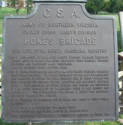
Hoke's Brigade
Early's Division - Ewell's Corps
— Army of Northern Virginia —
Army of Northern Virginia
Ewell's Corps Early's Division
Hoke's Brigade
6th. 21st. 57th. North Carolina Infantry
July 1 Advanced at 3 p.m. with Hays's Brigade flanked Eleventh Corps aided in taking two guns repulsed First Brigade Second Division and captured many prisoners. Late in the evening took position here.
July 2 Skirmished all day and at 8 p.m. with Hays's Brigade charged East Cemetery Hill. Severely enfiladed on the left by artillery and musketry it pushed on over infantry line in front scaled the Hill planted its colors on the lunettes and captured several guns. But assailed by fresh forces and having no supports it was soon compelled to relinquish what it had gained and withdrew. Its commander Col. Isaac E. Avery was mortally wounded leading the charge.
July 3 Ordered to railroad cut in rear and later to High Street in town.
July 4 At 2 a.m. moved to Seminary Ridge. After midnight began the march to Hagerstown.
Present about 900. Killed 35, wounded 216, missing 94. Total 345.
Erected 1910 by Gettysburg National Military Park Commission.
Topics. This historical marker is listed in this topic list: War, US Civil. A significant historical date for this entry is July 1, 1863.
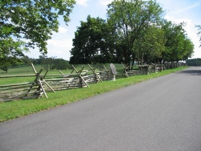
Location. 39° 49.678′ N, 77° 13.536′ W. Marker is near Gettysburg, Pennsylvania, in Adams County. Marker is on East Confederate Avenue, on the left when traveling south. The marker is located adjacent to the Gettysburg Middle School in the Gettysburg National Military Park. Touch for map. Marker is in this post office area: Gettysburg PA 17325, United States of America. Touch for directions.
Other nearby markers. At least 8 other markers are within walking distance of this marker. Gordon's Brigade (within shouting distance of this marker); Hays's Brigade (about 400 feet away, measured in a direct line); Early's Division (about 500 feet away); Henry Culp Farm (about 800 feet away); Culp's Hill (approx. 0.2 miles away); Trinity United Church of Christ (approx. 0.2 miles away); "…in less than half an hour…" (approx. 0.2 miles away); The Adams County Prison (approx. 0.2 miles away). Touch for a list and map of all markers in Gettysburg.
Also see . . .
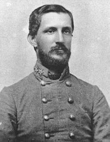
1. Robert Hoke. Wikipedia entry:
Brigadier General Robert Hoke had been wounded in May of 1863 at Chancellorsville and was still recovering at the time of the Battle of Gettysburg. Colonel Isaac Avery had temporary command of the brigade. (Submitted on November 11, 2023, by Larry Gertner of New York, New York.)
2. Early's Division, Hoke's Brigade. Stone Sentinels website entry (Submitted on May 23, 2020, by Larry Gertner of New York, New York.)
Photographed By Craig Swain, September 17, 2008
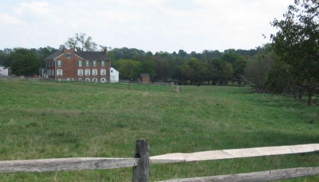
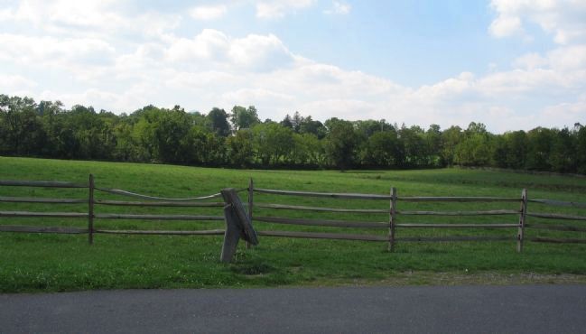
4. Hoke's Brigade Initial Position
Looking to the east of East Confederate Avenue at the open fields just south of the Culp Farm. Col. Avery deployed his Brigade across this ground in the evening of July 1 and held this line until late in the afternoon of July 2. Finally around 8 p.m. the Brigade advanced on Cemetery Hill, across grounds now occupied by the Middle School, wheeling to the right with Hays' Brigade.
Photographed By Craig Swain, September 17, 2008
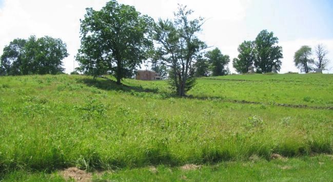
5. Hoke's Brigade Advances
The Brigade advanced south and wheeled to in order to remain on the left flank of Hays' Brigade as it turned on East Cemetery Hill. The wheel maneuver brought Hoke's Brigade across the open ground here, just south of the Middle School.
Photographed By Craig Swain, June 22, 2008
6. Furthest Advance of the Brigade
View from Wainwright Avenue, up Cemetery Hill, with the Cemetery Gate beyond the crest. Once turning west, the Brigade advanced against East Cemetery Hill. Avery's men encountered Von Gilsa's Federal Brigade along the Brickyard Lane (Now Wainwright Avenue). The North Carolina soldiers made some advances up the slope here, but they were caught in a cross fire of artillery. Some men reached the gates of the cemetery, but without reinforcements, could not hold.
Credits. This page was last revised on November 11, 2023. It was originally submitted on November 12, 2008, by Craig Swain of Leesburg, Virginia. This page has been viewed 1,251 times since then and 51 times this year. Last updated on July 29, 2022, by Carl Gordon Moore Jr. of North East, Maryland. Photos: 1. submitted on November 12, 2008, by Craig Swain of Leesburg, Virginia. 2. submitted on November 11, 2023, by Larry Gertner of New York, New York. 3, 4, 5, 6. submitted on November 12, 2008, by Craig Swain of Leesburg, Virginia. • J. Makali Bruton was the editor who published this page.
