Frostburg in Allegany County, Maryland — The American Northeast (Mid-Atlantic)
Braddock Stone
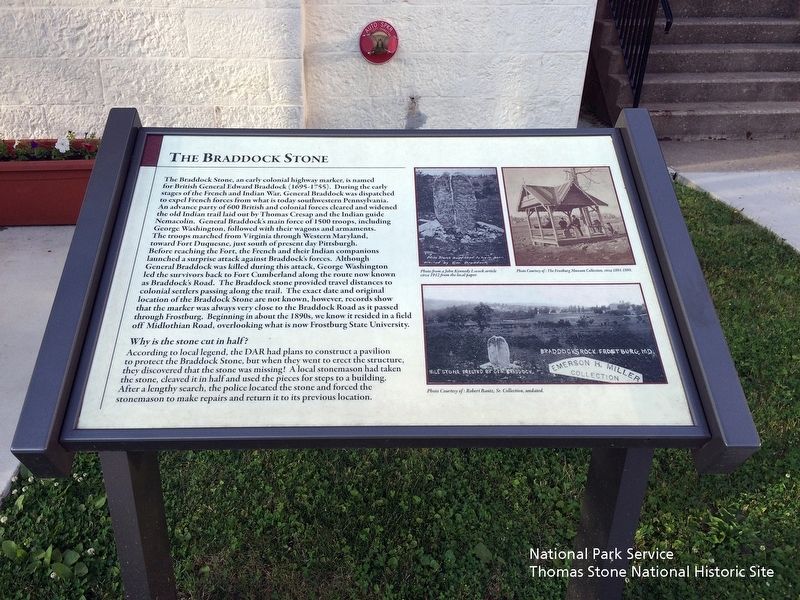
The Braddock Stone, an early colonial highway marker, is named for British General Edward Braddock (1695—1755). During the early stages of the French and Indian War, General Braddock was dispatched to expel French forces from what is today southwestern Pennsylvania. An advance party of 600 British and colonial forces cleared and widened the old Indian trail laid out by Thomas Cresap and the Indian guide Nemacolin. General Braddock's main force of 1500 troops, including George Washington, followed with their wagons and armaments. The troops marched from Virginia through Western Maryland toward Fort Duquesne, just south of present day Pittsburgh. Before reaching the Fort, the French and their Indian companions launched a surprise attack against Braddock's forces. Although General Braddock was killed during the attack, George Washington led the survivors back to Fort Cumberland along the route now known as Braddock's Road. The Braddock stone provided travel distances to colonial settlers passing along the trail. The exact date and original location of the Braddock Stone are not known, however, records show that the marker was always very close to the Braddock Road as it passed through Frostburg. Beginning in about the 1890s, we know it resided in a field off Midlothian Road, overlooking what is now Frostburg State University.
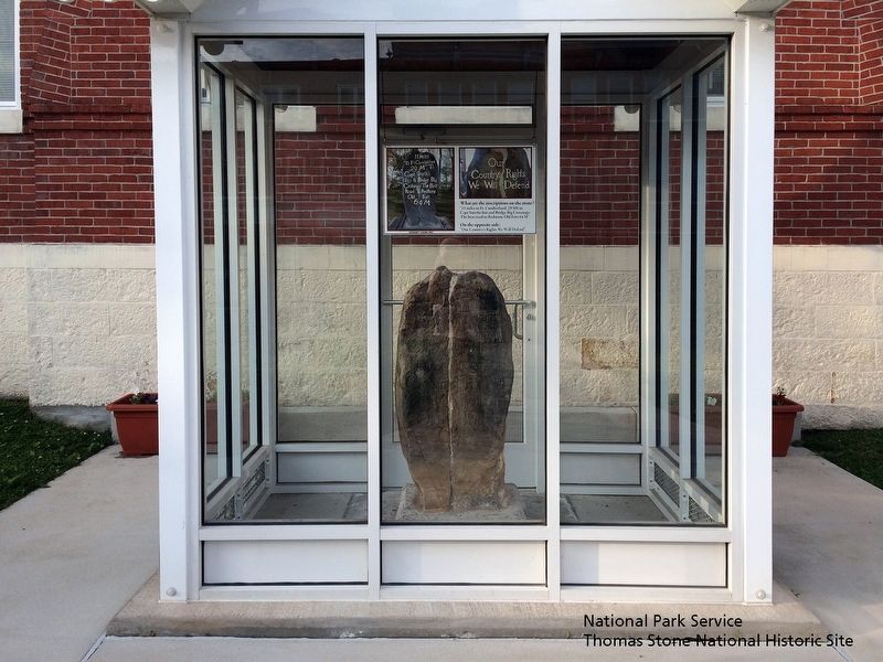
Why is the stone cut in half?
According to local legend, the DAR had plans to construct a pavilion to protect the Braddock Stone, but when they went to erect the structure, they discovered that the stone was missing! A local stonemason had taken the stone, cleaved it in half and used the pieces for steps to a building. After a lengthy search, the police located the stone and forced the stonemason to make repairs and return it to its previous location.
(Image of Braddock Stone with text reading "Mile Stone supposed to have been erected by Gen. Braddock".)
Photo from a John Kennedy Lacock article circa 1912 from the local paper.
(Image of shelter over Braddock Stone.)
Photo Courtesy of: The Frostburg Museum Collection, circa 1891-1898.
(Image of Braddock Stone with text reading "Milestone erected by Gen. Braddock", "Braddocks Rock Frostburg, MD" and "Emerson H. Miller Collection".)
Photo Courtesy of: Robert Bantz, Sr. Collection, undated.
Topics. This historical marker is listed in these topic lists: Colonial Era • Roads & Vehicles • War, French and Indian. A significant historical date for this entry is July 13, 1755.
Location. 39° 39.418′ N, 78° 55.641′ W. Marker is in Frostburg, Maryland, in Allegany County. Marker is on East Main Street, on the right. The marker is located on the north side of
East Main Street. It is halfway between Uhl Street and Welsh Street in front of the brick St. Michael Catholic Church, near an outdoor exhibit of the Braddock Stone. Touch for map. Marker is at or near this postal address: 44 East Main Street, Frostburg MD 21532, United States of America. Touch for directions.
Other nearby markers. At least 8 other markers are within walking distance of this marker. Frost Graves (here, next to this marker); St. Michael's Parish Hall (within shouting distance of this marker); In Memoriam (about 400 feet away, measured in a direct line); a different marker also named In Memoriam (about 400 feet away); a different marker also named In Memoriam (about 500 feet away); Frostburg (about 600 feet away); The Memorial Window (approx. 0.2 miles away); The Naming of Frostburg (approx. 0.2 miles away). Touch for a list and map of all markers in Frostburg.

National Park Service, Thomas Stone National Historic Site, June 17, 2019
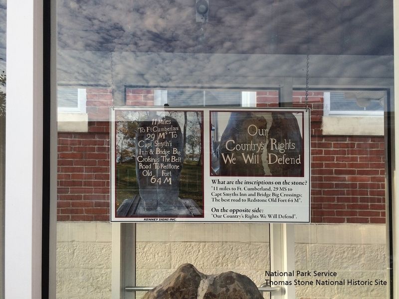
4. Braddock Stone exhibit text.
What are the inscriptions on the stone?
"11 miles to Ft. Cumberland, 29 MS to Capt Smyths Inn and Bridge Big Crossings; The Best road to Redstone Old Fort 64 M".
On the opposite side:
"Our Country's Rights We Will Defend".
Credits. This page was last revised on June 13, 2022. It was originally submitted on June 19, 2019. This page has been viewed 855 times since then and 84 times this year. Last updated on June 20, 2019. Photos: 1, 2, 3, 4. submitted on June 19, 2019. • Bill Pfingsten was the editor who published this page.


