Bristol in Morgan County, Ohio — The American Midwest (Great Lakes)
Miner's Memorial Park
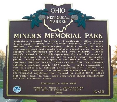
Agriculture dominated the economy of southeastern Ohio's Morgan County until the 1940s when harvests dwindled, the population declined, and land values dropped. Surface mining the area's rich underground coal deposits replaced agriculture as the major industry and revitalized the declining local economy. As the nation's demand for electricity grew over the next half-century, so did the demand for coal as fuel for nearby power generation plants. During mining's heyday in the 1960s to the late 1980s, American Electric Power's former Central Ohio Coal Company subsidiary employed nearly 1,000 people. Nearby communities-such as Cumberland, Caldwell and Chandlersville-thrived. As time passed, however, the robust coal industry was hit hard by environmental regulations that reduced the market for the area's high-sulfur coal. In turn, mine work forces shrank considerably and local businesses closed.
(Continued from other side)
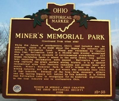
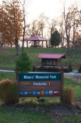
While the future of southeastern Ohio's coal industry may be unknown, there is no doubt about the legacy the industry left behind in ReCreation Land. Mined and reclaimed by Central Ohio Coal, ReCreation Land is a 30,000-acre wooded wonderland and an outstanding example of environmental stewardship. AEP began reclaiming lands it mined in the early 1940s-long before laws requiring reclamation were passed. ReCreation Land not only captures the area's surface mining history, it is an outdoor recreational area that features campsites and stocked lakes and ponds. Miner's Memorial Park is AEP's tribute to the area's mining industry and the men and women who dedicated their lives to that industry. Because of the long-term economic effects and the lasting legacy left behind by this industry, it is fitting that ReCreation Land is recognized for its historical significance to the coal industry and to southeastern Ohio.
Erected 2002 by Women in Mining - Ohio Chapter and The Ohio Historical Society. (Marker Number 10-58.)
Topics and series. This historical marker is listed in these topic lists: Environment • Industry & Commerce • Labor Unions • Parks & Recreational Areas. In addition, it is included in the Ohio Historical Society / The Ohio History Connection series list.
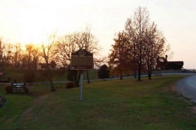
Location. 39° 41.95′ N, 81° 43.812′ W. Marker is in Bristol, Ohio, in Morgan County. Marker is on Ohio Route 78, 7 miles east of McConnelsville, on the right when traveling west. Touch for map. Marker is in this post office area: McConnelsville OH 43756, United States of America. Touch for directions.
Other nearby markers. At least 8 other markers are within 8 miles of this marker, measured as the crow flies. Big Muskie (about 300 feet away, measured in a direct line); Ronald V. Crews Memorial Park (about 300 feet away); Howard Chandler Christy (approx. 7.2 miles away); McConnelsville Persian Gulf War Memorial (approx. 7.2 miles away); Lelia Morris & Trinity Methodist Episcopal Church (approx. 7.2 miles away); McConnelsville World War I Memorial (approx. 7.2 miles away); First Presbyterian Church (approx. 7.3 miles away); Two River Towns: McConnelsville and Malta (approx. 7.3 miles away). Touch for a list and map of all markers in Bristol.
Credits. This page was last revised on January 21, 2020. It was originally submitted on November 15, 2008, by William Fischer, Jr. of Scranton, Pennsylvania. This page has been viewed 1,910 times since then and 33 times this year. Photos: 1, 2, 3, 4. submitted on November 15, 2008, by William Fischer, Jr. of Scranton, Pennsylvania. • Bill Pfingsten was the editor who published this page.


