West Liberty in Morgan County, Kentucky — The American South (East South Central)
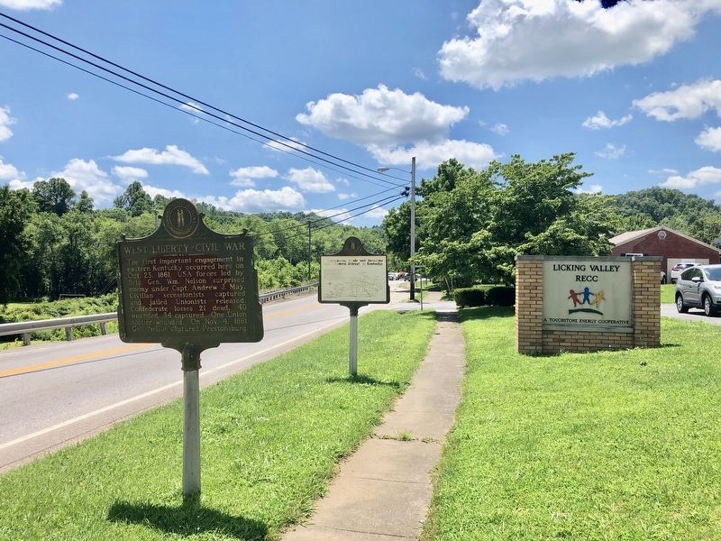
West Liberty~Civil War
Erected 1962 by Kentucky Historical Society, Kentucky Department of Highways. (Marker Number 512.)
Topics and series. This historical marker is listed in this topic list: War, US Civil. In addition, it is included in the Kentucky Historical Society series list. A significant historical date for this entry is October 4, 1861.
Location. 37° 55.013′ N, 83° 15.668′ W. Marker is in West Liberty, Kentucky, in Morgan County. Marker is on Main Street (U.S. 460) south of Gullett Street, on the right when traveling south. In front of Licking River Rural Electric Cooperative. Touch for map. Marker is at or near this postal address: 271 Main Street, West Liberty KY 41472, United States of America. Touch for directions.
Other nearby markers. At least 8 other markers are within 14 miles of this marker, measured as the crow flies. CSA Gens. Morgan USA (here, next to this marker); Founding of Morgan County / The Old Mill (approx. 0.4 miles away); Swango Springs Spa (approx. 11.4 miles away); USA Gens. Morgan CSA (approx. 11.8 miles away); Hazel Green Academy (approx. 11.8 miles away); Skirmish Here / Confederate Raids and Invasions and a Federal Retreat, in Kentucky. (approx. 11.8 miles away); A Masterful Retreat / Confederate Raids and Invasions and a Federal Retreat, in Kentucky. (approx. 13.9 miles away); County Named, 1869 (approx. 13.9 miles away). Touch for a list and map of all markers in West Liberty.
Credits. This page was last revised on March 28, 2021. It was originally submitted on July 14, 2019, by Mark Hilton of Montgomery, Alabama. This page has been viewed 585 times since then and 76 times this year. Photos: 1, 2, 3. submitted on July 14, 2019, by Mark Hilton of Montgomery, Alabama.


