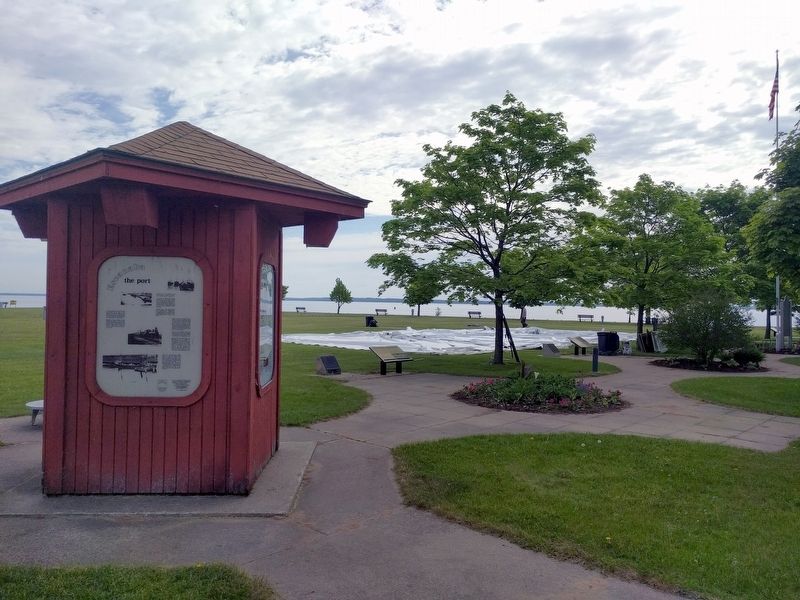
Escanaba in Delta County, Michigan — The American Midwest (Great Lakes)
Escanaba
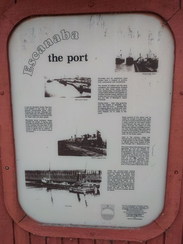
Escanaba: The Port
It was the abundant timber that first lured settlers to the area to start sawmill communities along rivers flowing into the bay. Although Escanaba itself was not heavily wooded, as a port it became a commercial hub for these mills and their people.
Merchants along Ludington Street supplied the camps. In spring, after the great log drives down the rushing rivers, workers who had been in the woods all winter came to town with money to spend and an urgency to spend it, often in the town's numerour saloons.
Escanaba and its waterfront have always been a magnet of activity, both commercial and recreational.
The canoes of Indians and the early voyageurs and missionaries stopped here on their Great Lakes travels. Later, sailing ships converged here to unload white settlers and supplies for northern frontier towns, taking on the lumber and iron ore of the vast forests and rich hills of Michigan's Upper Peninsula.
Fishing boats — their nets groaning with the weight of whitefish, sturgeon, pike and trout — stocked fish processing plants on shore with their bountiful daily catches which, in turn, were shipped out to cities to the south.
Rapid growth of the nation and its needs for lumber to build new cities and ties to extend railroad lines meant a ready market for the area's timber and enhanced the new port of Escanaba. Through the waters of Little Bay de Noc passed countless schooners, their decks piled high with sawn lumber for the building of America, or huge log rafts towed to mills in other areas of the Great Lakes.
Later in the century, when fire claimed much of the City of Chicago, a large portion of the lumber needed to rebuild came from forests of this area through the I. Stephenson Co.
Discovery along Lake Superior of vast quantities of iron ore needed for the Civil War and the country's industrialization lent further emphasis to Escanaba's role as a port. Transportation on the water was the chief means of shipping iron ore to steel mills so, by 1865, railroad lines stretched from the Marquette iron range to Escanaba, and ore docks extended from its waterfront, northwest of the present Municipal Dock.
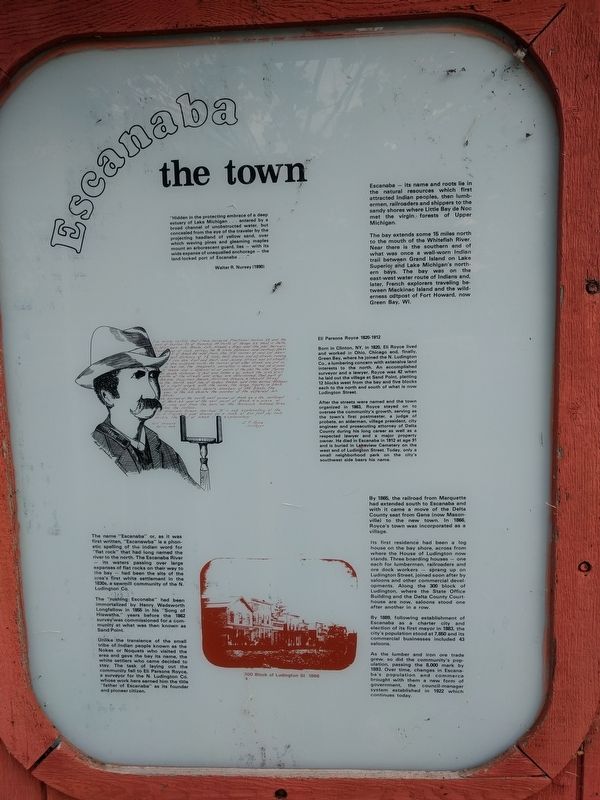
Escanaba: The Town
"Hidden in the protecting embrace of a deep estuary of Lake Michigan . . . entered by a broad channel of unobstructed water, but concealed from the eye of the traveler by the projecting headland of yellow sand, over which waving pines and gleaming maples mount an arborescent guard, lies — with its wide expanse of unequalled anchorage — the land-locked port of Escanaba . . ."
Walter R. Nursey (1890)
Escanaba — its name and roots lie in the natural resources which first attracted Indian peoples, then lumbermen, railroaders and shippers to the sandy shores where Little Bay de Noc met the virgin forests of Upper Michigan.
The bay extends some 15 miles north to the mouth of the Whitefish River. Near there is the southern end of what was once a well-worn Indian trail between Grand Island on Lake Superior and Lake Michigan's northern bays. The bay was on the east-west water route of Indians and, later, French explorers traveling between Mackinac Island and the wilderness outposts of Fort Howard, now Green Bay, WI.
The name "Escanaba" or, as it was first written, "Escanawba" is a phonetic spelling of the Indian word for "flat rock" that had long named the river to the north. The Escanaba River — its waters passing over large expanses of flat rocks on their way to the bay — had been the site of the area's first white settlement in the 1830s, a sawmill community of the N. Ludington Co.
The "rushing Escanaba" had been immortalized by Henry Wadsworth Longfellow in 1855 in his "Song of Hiawaatha," years before the 1862 survey was commissioned for a community at what was then known as Sand Point.
Unlike the transience of the small tribe of Indian people known as the Nokes or Noquets who visited the aarea and gave the bay its name, the white settlers who came decided to stay. The task of laying out the community fell to Eli Parsons Royce, a surveyor for the N. Ludington Co. whose work here earned him the title "father of Escanaba" as its founder and pioneer citizen.
Eli Parsons Royce 1820-1912
Born in Clinton, NY, in 1820, Eli Royce lived and worked in Ohio, Chicago and, finally, Green Bay, where he joined the N. Ludington Co., a lumbering concern with extensive land interests to the north. An accomplished surveyor and a lawyer, Royce was 42 when he laid out the village at Sand Point, platting 12 blocks west from the bay and five blocks each to the north and south of what is now Ludington Street.
After the streets were named and the town organized in 1863, Royce stayed on to oversee the community's growth, serving as the town's first postmaster, a judge of probate, an alderman, village president, city engineer and prosecuting attorney of Delta County during his long career as well as a respected lawyer and a major property owner. He died in Escanaba in 1912 at age 91 and is buried in Lakeview Cemetery on the west end of Ludington Street. Today, only a small neighborhood park on the city's southwest side bears his name.
By 1865, the railroad from Marquette had extended south to Escanaba and with it came a move of the Delta County seat from Gena (now Masonville) to the new town. In 1866, Royce's town was incorporated as a village.
Its first residence had been a log house on the bay shore, across from where the House of Ludington now stands. Three boarding houses — one each for lumbermen, railroaders and ore dock workers — sprang up on Ludington Street, joined soon after by saloons and other commercial developments. Along the 300 block of Ludington, where the State Office Building and the Delta County Courthouse are now, saloons stood one after another in a row.
By 1889, following establishment of Escanaba as a charter city and election of its first mayor in 1883, the city's population stood at 7,650 and its commercial businesses included 43 saloons.
As the lumber and iron ore trade grew, so did the community's population, passing the 8,000 mark by 1893. Over time, changes in Escanaba's population and commerce brought with them a new form of government, the council-manager system established in 1922 which continues today.
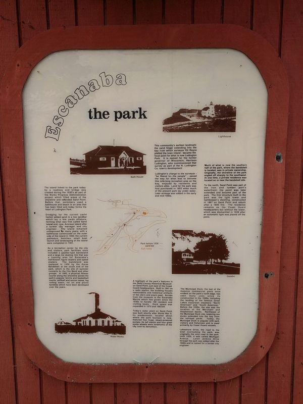
Escanaba: The Park
The island linked to the park today by a roadway and bridge was created during the 1930's as part of the Works Progress Administration project which filled areas of the shoreline and extended Sand Point. Before that, swimmers used a bathhouse and beach in an area that has been filled and today forms the heart of Ludington Park.
Dredging for the current yacht harbor added sand to a low sandbar which lay a few yards offshore, forming what was first called Sand Island and, now, Aronson Island after a former city manager and city engineer. The island remained unimproved for many years, with a bathhouse constructed on the outer side of the island in 1950; the current pathways, benches, small boat launch and landscaping of the island were completed in 1981.
As a recreation center for the city and visitors, park facilities once included a gazebo-type bandstand and a large ice skating rink that was a training area for Escanaba's well-known figure skaters and speed skaters. The bandstand was replaced in 1956 by the Karas Bandshell at the south end of the park, which is the site of summer concerts by the City Band and other groups. In 1983, a physical fitness course along the shoreline joined the park's popular tennis and basketball courts, softball and soccer areas, log rolling basin, tot lot and picnic facilities which have been developed oveer the years.
A highlight of the park's features is the Delta County Historical Museum on Sand Point, just east of the Coast Guard headquarters. Built in 1941 as a radio station, the building houses memorabilia and historical artifacts of the city's and area's past. Across from the museum is the Escanaba Marina which has grown since the 1930s to handle 108 resident and visiting boats. Dock space was expanded in 1974 and 1983-84.
Today's water plant on Sand Point was built shortly after World War II. Its predecessor, located about where the park fountain is now, featured four huge, steam-powered pumps; its tall stacks and four great pump wheels were landmarks of the city until its demolition.
The community's earliest landmark-the sand finger extending into the bay from which surveyor Eli Royce platted the town inland - became the focal point for what is now Ludington Park. It is named for the former governor of Wisconsin, Harrison Ludington, who commissioned that survey as part of the N. Ludington Co. town's development.
Ludington's charge to the surveyor - "be liberal to...the people" - paved the way for what was to become this mile-long recreation area on the bay, enjoyed by residents and visitors alike. Land for the park was first purchased in 1893 when much of the present park lay under water. Later acreage was added in the mid-1900s.
Much of what is now the southern half of the park, where the bandshell is located, was in private ownership. Originally, the shoreline of the park angled off sharply to the southwest. At one time, a private residence was located on or near the bandshell site.
To the north, Sand Point was part of the iron and lumber port's waterfront; the point was later extended and became part of the park. The first structure built in the park was the light tower and lightkeeper's dwelling, constructed in 1867 on Sand Point and rebuilt after a 1886 fire. The residence remains as the Coast Guard headquarters but without the tower, which was dismantled in 1939 after an automatic light was placed off the point.
The Municipal Dock, the last of the massive commercial piers once evident on the park's north edge, has seen many uses since its construction in the 1930s, including the landing of the famous Great Lakes excursion steamers "North American" and "South American." Before the 1930s, the site was the location of the Merchant and Stephenson docks. Northwest of the Municipal Dock site, towering ore docks extended into the bay from the railroad yards. Today, the Municipal Dock is popular with park visitors and fishermen and is used primarily by Coast Guard vessels.
Lakeshore Drive, the road to the west overlooking the park, was originally the only road in the park. Until 1920, it was called Michigan Avenue. Loren Jenkins Drive through the park was added after the 1940s and is named for a former city engineer.
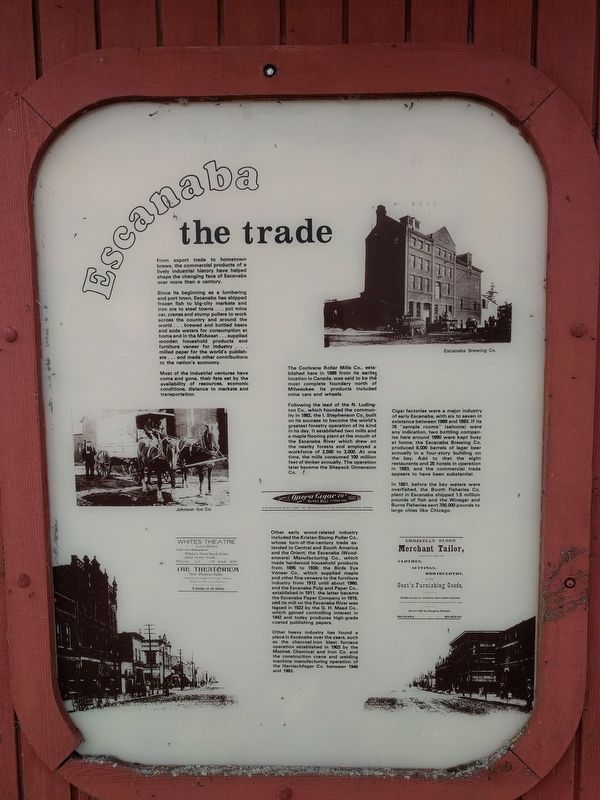
Escanaba: The Trade
From export trade to hometown brews, the commercial products of a lively industrial history have helped shape the changing face of Escanaba over more than a century.
Since its beginning as a lumbering and port town, Escanaba has shipped frozen fish to big-city markets and iron ore to steel towns . . . put mine car, cranes and stump pullers to work across the country and around the world . . . brewed and bottled beers and soda waters for consumption at home in the Midwest . . . supplied wooden household products and furniture veneer for industry . . . milled paper for the world's publishers . . . and made other contributions to the nation's economy.
Most of the industrial ventures have come and gone, their fate set by the availability of resources, economic conditions, distance to markets and transportation.
The Cochrane Roller Mills Co., established here in 1888 from its earlier location in Canada, was said to be the most complete foundary north of Milwaukee. Its products included mine cars adn wheels.
Following the lead of the N. Ludington Co., which founded the community in 1862, the I. Stephenson Co. built on its success to become the world's greatest forestry operation of its kind in its day. It established two mills and a maple flooring plant at the mouth of the Escanaba River which drew on the nearby forests and employed a workforce of 2,500 to 3,000. At one time, the mills consumed 100 million feet of timber annually. The operation later became the Shepeck Dimension Co.
Other early wood-related industry included the Kristen Stump Puller Co., whose turn-of-the-century trade extended to Central and South America and the Orient; the Escanaba (Woodenware) Manufacturing Co., which made hardwood household products from 1895 to 1930; the Birds Eye Veneer Co., which supplied maple and other fine veneers to the furniture industry from 1912 until about 1960, and the Escanaba Pulp and Paper Co., established in 1911. the latter became the Escanaba Paper Company in 1919, and its mill on the Escanaba River was leased in 1922 by the G. H. Mead Co., which gained controlling interest in 1942 and today produces high-grade coated publishing papers.
Other heavy industry has found a place in Escanaba over the years, such as the charcoal-iron blast furnace operation established in 1903 by the Mashek Chemical and Iron Co. and the construction crane and welding machine manufacturing operation of the Harnischfeger Co. between 1946 and 1983.
Cigar factories were a major industry of early Escanaba, with six to seven in existence between 1889 and 1893. If its 78 "sample rooms" (saloons) were any indication, two bottling companies here around 1890 were kept busy at home; the Escanaba Brewing Co. produced 8,000 barrels of lager beer annually in a four-story building on the bay. Add to that the eight restaurants and 25 hotels in operation in 1893, and the commercial trade appears to have been substantial.
In 1881, before the bay waters were overfished, the Booth Fisheries Co. plant in Escanaba shipped 1.5 million pounds of fish and the Winegar and Burns Fisheries sent 700,000 pounds to large cities like Chicago.
Erected by City of Escanaba Recreation Department.
Topics. This historical marker is listed in these topic lists: Industry & Commerce • Parks & Recreational Areas • Settlements & Settlers • Waterways & Vessels. A significant historical year for this entry is 1865.
Location. 45° 44.75′ N, 87° 2.871′ W. Marker is in Escanaba, Michigan, in Delta County. Marker is on Ludington Street east of South 2nd Street, on the left when traveling east. Marker is in the park at the Ludington Street Municipal Docks. Touch for map. Marker is at or near this postal address: 112 Ludington Street, Escanaba MI 49829, United States of America. Touch for directions.
Other nearby markers. At least 8 other markers are within walking distance of this marker. Escanaba's Docks (here, next to this marker); Before the Settlers (a few steps from this marker); Iron Ore Centennial (a few steps from this marker); The Peninsula Railroad (a few steps from this marker); The Ore Pellet (a few steps from this marker); Little Bay de Noc (within shouting distance of this marker); The Port - Early Years (within shouting distance of this marker); The Port - Today (within shouting distance of this marker). Touch for a list and map of all markers in Escanaba.
Credits. This page was last revised on October 16, 2023. It was originally submitted on July 26, 2019, by Joel Seewald of Madison Heights, Michigan. This page has been viewed 766 times since then and 90 times this year. Photos: 1, 2, 3, 4, 5. submitted on July 26, 2019, by Joel Seewald of Madison Heights, Michigan.
