Bridging the Mississippi
Un pont sur le Mississippi
— Fort Rosalie —
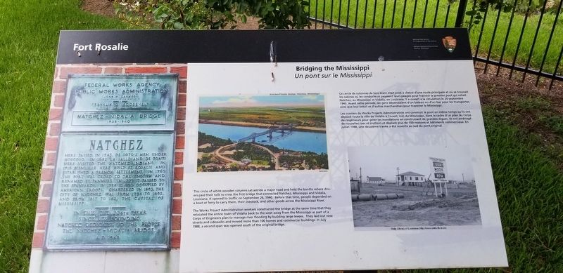
This circle of wooden columns sat astride a major road and held the booths where drivers paid their tolls to cross the first bridge that connected Natchez, Mississippi and Vidalia, Louisiana. It opened to traffic on September 26, 1940. Before that time, people depended on a boat ferry to carry them, their livestock and other goods across the Mississippi River.
The Works Project Administration workers constructed the bridge at the same time that they relocated the entire town of Vidalia back to the west away from the Mississippi as part of a Corps of Engineers plan to manage river flooding by building large levees. They laid out new streets and sidewalks and moved more than 100 homes and commercial buildings. In July 1988, a second bridge was opened south of the original bridge. Les ouvriers du Works Projects Administration ont construit le pont en même temps qu'ils ont du déplacé toute la ville de Vidalia à l'ouest, loin dans le cadre d'un plan du Corps des Ingénieurs pour gérer les inondations en construisant de grandes digues. Ils ont aménagé de nouvelles rues et trottoirs et déplacé plus de 100 maisons et bâtiments commerciaux. juillet 1988, une deuxiéme travée a été ouverte au sud du pont original.
French:
Ce cercle de colonnes de bois blanc était posè à cheval d'une route principale et où se trouvait les cabines où les conducteurs payaient leurs péages pour franchir le premier pont qui reliait Natchez, au Mississippi et Vidalia, en Louisiane. Il à ouvert a la circulation le 26 septembre 1940. Avant cette période, les
gens dépendaient d'un bateau ou d'un bac pour les transporter, ainsi que leur bétail et d'autres marchandises pour traverser le Mississippi.
Erected by National Park Service, U.S. Department of the Interior.
Topics. This historical marker is listed in these topic lists: Bridges & Viaducts • Waterways & Vessels. A significant historical date for this entry is September 26, 1940.
Location. 31° 33.307′ N, 91° 24.707′ W. Marker is in Natchez, Mississippi, in Adams County. Marker can be reached from South Canal Street near John R. Junkin Drive (U.S. 84/425), on the right when traveling south. Touch for map. Marker is in this post office area: Natchez MS 39120, United States of America. Touch for directions.
Other nearby markers. At least 8 other markers are within walking distance of this marker. Natchez National Historical Park (within shouting distance of this marker); Natchez (within shouting distance of this marker); The European Struggle for Control (within shouting distance of this marker); The French in North America (within shouting distance of this marker); The Introduction of Slavery in the Natchez District (within shouting distance of this marker); The Natchez People (within shouting distance of this marker); The French Build a Fort and a Colony (about 700 feet away, measured in a direct line); French Retaliation & the Second Fort Rosalie (about 700 feet away). Touch for a list and map of all markers in Natchez.
More about this marker. Located at the Natchez Visitors Reception Center
Credits. This page was last revised on July 28, 2019. It was originally submitted on July 27, 2019, by Cajun Scrambler of Assumption, Louisiana. This page has been viewed 241 times since then and 28 times this year. Photos: 1, 2. submitted on July 27, 2019.

