Marker Logo HMdb.org THE HISTORICAL
MARKER DATABASE
“Bite-Size Bits of Local, National, and Global History”
Utica in Macomb County, Michigan — The American Midwest (Great Lakes)
 

Historic Utica


Historic Utica Marker image. Click for full size.
Photographed By Joel Seewald, August 11, 2019
1. Historic Utica Marker
Inscription. {Title is Text}
 
Topics. This historical marker is listed in these topic lists: Industry & CommerceRailroads & StreetcarsWaterways & Vessels.
 
Location. 42° 37.567′ N, 83° 2.259′ W. Marker is in Utica, Michigan, in Macomb County. Marker is on Auburn Road, 0.1 miles west of Brownell Street, on the right when traveling west. Marker is along the trail on the east side of the Clinton River. Touch for map. Marker is in this post office area: Utica MI 48317, United States of America. Touch for directions.
 
Other nearby markers. At least 8 other markers are within 3 miles of this marker, measured as the crow flies. St. Lawrence Parish of Utica (approx. 0.3 miles away); Utica Cemetery (approx. 0.7 miles away); Spring Hill Farm / Utica Nike Base (approx. 1.9 miles away); Made for Speed (approx. 2.4 miles away); Extreme Testing (approx. 2.4 miles away); The Vincent Family (approx. 2.4 miles away); Packard Takes Flight (approx. 2.4 miles away); Packard Proving Grounds (approx. 2.4 miles away).
 
Paid Advertisement
Click on the ad for more information.
Please report objectionable advertising to the Editor.
Click or scan to see
this page online
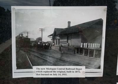
Historic Utica Marker - upper left image image. Click for full size.
2. Historic Utica Marker - upper left image
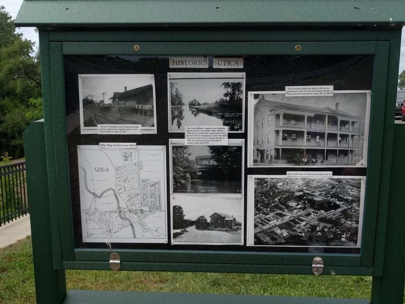
The new Michigan Central Railroad Depot which replaced the original, built in 1872, that burned on July 14, 1911.
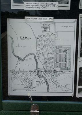
Historic Utica Marker - lower left image image. Click for full size.
3. Historic Utica Marker - lower left image
Plat Map of Utica from 1895
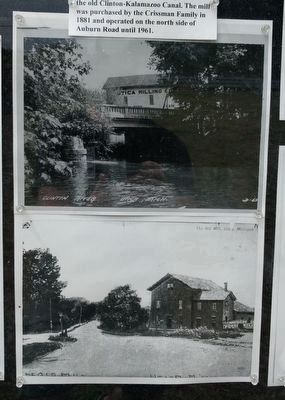
Historic Utica Marker - upper middle image image. Click for full size.
4. Historic Utica Marker - upper middle image
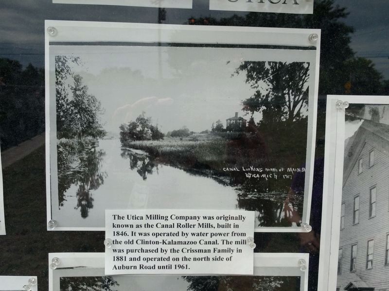
The Utica Milling Company was originally known as the Canal Roller Mills, built in 1846. It was operated by water power from the old Clinton-Kalamazoo Canal. The mill was purchased by the Crissman Family in 1881 and operated on the north side of Auburn Road until 1961.
Historic Utica Marker - lower middle images image. Click for full size.
5. Historic Utica Marker - lower middle images
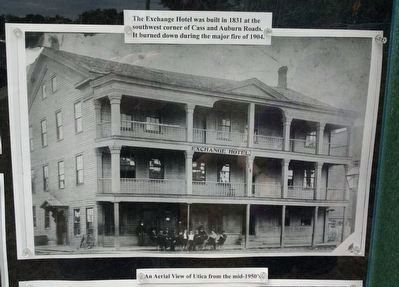
Historic Utica Marker - upper right image image. Click for full size.
6. Historic Utica Marker - upper right image
The Exchange Hotel was built n 1831 at the southwest corner of Cass and Auburn Roads. It burned down during the major fire of 1904.
Historic Utica Marker - lower right image image. Click for full size.
7. Historic Utica Marker - lower right image
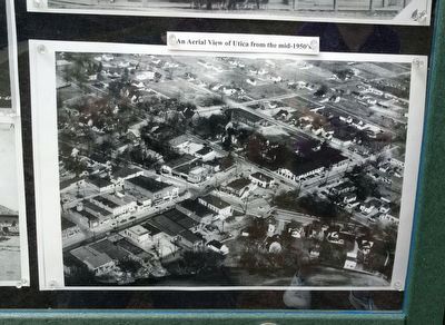
An Aerial View of Utica from the mid-1950's
Historic Utica Marker image. Click for full size.
Photographed By Joel Seewald, August 11, 2019
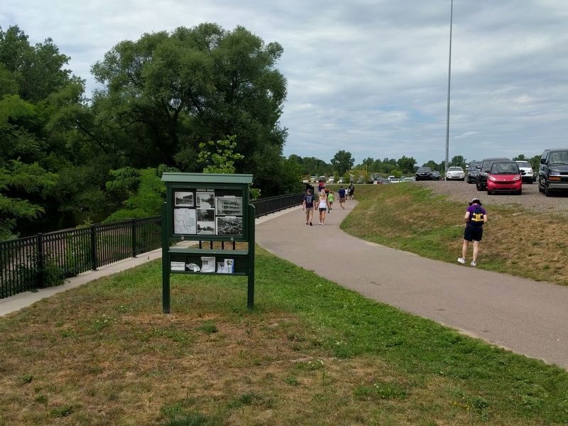
8. Historic Utica Marker
View looking north.
 
 
Credits. This page was last revised on March 31, 2020. It was originally submitted on August 13, 2019, by Joel Seewald of Madison Heights, Michigan. This page has been viewed 549 times since then and 48 times this year. Photos:   1, 2, 3, 4, 5, 6, 7, 8. submitted on August 13, 2019, by Joel Seewald of Madison Heights, Michigan.
Share this page.  
Share on Tumblr
m=137855

CeraNet Cloud Computing sponsors the Historical Marker Database.
This website earns income from purchases you make after using our links to Amazon.com. We appreciate your support.
Paid Advertisement
Apr. 16, 2024