Maplewood in Ramsey County, Minnesota — The American Midwest (Upper Plains)
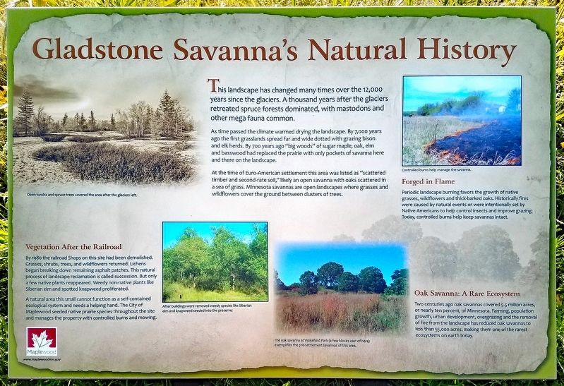
Gladstone Savanna's Natural History
As time passed the climate warmed drying the landscape. By 7,000 years ago the first grasslands spread far and wide dotted with grazing bison and elk herds. By 700 years ago "big woods" of sugar maple, oak, elm and basswood had replaced the prairie with only pockets of savanna here and there on the landscape.
At the time of Euro-American settlement this area was listed as "scattered timber and second-rate soil," likely an open savanna with oaks scattered in a sea of grass. Minnesota savannas are open landscapes where grasses and wildflowers cover the ground between clusters of trees.
Vegetation After the Railroad
By 1980 the railroad Shops on this site had been demolished. Grasses, shrubs, trees, and wildflowers had returned. Lichens began breaking down remaining asphalt patches. This natural process of landscape reclamation is called succession. But only a few native plants reappeared. Weedy non-native plants like Siberian elm and spotted knapweed proliferated.
A natural area this small cannot function as a self-contained ecological system and needs a helping hand. The City of Maplewood seeded native prairie species throughout the site and manages the property with controlled burns and mowing.
Forged in Flame
Periodic landscape burning favors the growth of native grasses, wildflowers and thick-barked oaks. Historically fires were caused by natural events or were intentionally set by Native Americans to help control insects and improve grazing. Today, controlled burns help keep savannas intact.
Oak Savanna: A Rare Ecosystem
Two centuries ago oak savannas covered 5.5 million acres, or nearly ten percent, of Minnesota. Farming, population growth, urban development, overgrazing and the removal of fire from the landscape has reduced oak savannas to less than 55,000 acres, making them one of the rarest ecosystems on earth today.
Caption:
Open tundra and spruce trees covered the area after the glaciers left.
Caption:
After buildings were removed weedy species like Siberian elm and knapweed seeded into the prairie.
Caption:
Controlled burns help manage the savanna.
Caption:
The oak savanna at Wakefield Park (a few blocks east of here) exemplifies the pre-settlement savannas of this area.
Erected by City of Maplewood.
Topics. This historical marker is listed in these topic lists: Environment • Parks & Recreational Areas.
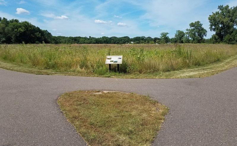
Location. 44° 59.873′ N, 93° 2.778′ W. Marker is in Maplewood, Minnesota, in Ramsey County. Marker is on English Street south of Frost Avenue, on the right when traveling south. Marker is at the trail junction near the east entrance to Gladstone Savanna. Touch for map. Marker is in this post office area: Saint Paul MN 55109, United States of America. Touch for directions.
Other nearby markers. At least 8 other markers are within walking distance of this marker. Building the "Skally" (about 300 feet away, measured in a direct line); History in Depth (about 400 feet away); Water: A Well Needed Resource (about 400 feet away); The Shops at Gladstone (about 400 feet away); A History of Change (about 700 feet away); Destination Lake Phalen (approx. 0.7 miles away); Phalen Regional Park Waterfall (approx. ¾ mile away); Frost Avenue (approx. 0.8 miles away). Touch for a list and map of all markers in Maplewood.
Credits. This page was last revised on August 19, 2019. It was originally submitted on August 18, 2019, by McGhiever of Minneapolis, Minnesota. This page has been viewed 301 times since then and 27 times this year. Photos: 1, 2. submitted on August 18, 2019, by McGhiever of Minneapolis, Minnesota. • Bill Pfingsten was the editor who published this page.

