Mount Olive in Macoupin County, Illinois — The American Midwest (Great Lakes)
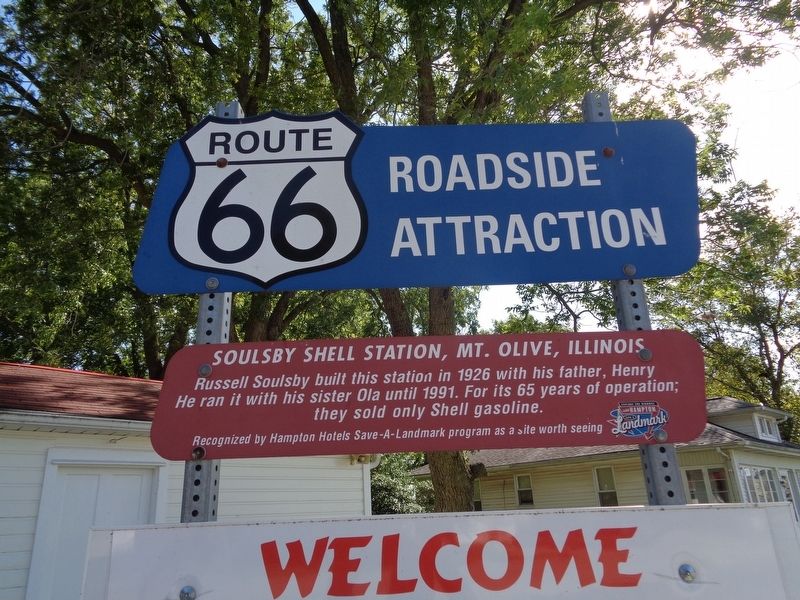
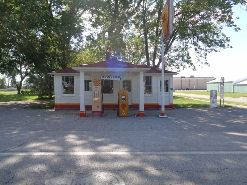
Soulsby Shell Station, Mt. Olive, Illinois
Route 66 Roadside Attraction
Erected by Hampton Hotels Save-A-Landmark Program.
Topics and series. This historical marker is listed in these topic lists: Industry & Commerce • Roads & Vehicles. In addition, it is included in the Route 66 Roadside Attractions, and the U.S. Route 66 series lists. A significant historical year for this entry is 1926.
Location. 39° 4.273′ N, 89° 44.124′ W. Marker is in Mount Olive, Illinois, in Macoupin County. Marker is at the intersection of West 1st Street and Old U.S. 66, on the left when traveling west on West 1st Street. The station is usually open during daylight hours. There is usually no attendant on duty, as it is all self-guided. Touch for map. Marker is at or near this postal address: 710 West 1st Street, Mount Olive IL 62069, United States of America. Touch for directions.
Other nearby markers. At least 8 other markers are within 6 miles of this marker, measured as the crow flies. Union Miners Cemetery at Mt. Olive, Illinois (approx. 0.7 miles away); Ill. Traction System (approx. 5 miles away); Veterans Memorial (approx. 5 miles away); Historic Route 66 Illinois (approx. 5.3 miles away); Henry's Rabbit Ranch, Staunton, Illinois (approx. 5.3 miles away); Heart of Coal Country (approx. 5.7 miles away); Founding of the Progressive Miners of America (approx. 5.8 miles away); Macoupin & Chestnut Streets (approx. 5.8 miles away).
More about this marker. There is a sign underneath the marker that reads
"Welcome
The Soulsby Station Society, in partnership with the "Route 66 Corridor Preservation Program, National Trails System-Santa Fe, National Park Service" has completed a 2009 preservation/restoration grant in memory of the Soulsby family. Henry and Anna, Russell, Ola, Velma and Route 66 historian Thomas (Tom) Teague
Our website www.rt66il.com
Make tax deductible donations at the Soulsby Station Society c/o First National Bank
Soulsby Station Bank
801 W Main St
Mt. Olive, IL 62069
NOTE: The website listed (rt66il.com) appears to be defunct as of late-August 2019.
Credits. This page was last revised on November 1, 2022. It was originally submitted on August 27, 2019, by Jason Voigt of Glen Carbon, Illinois. This page has been viewed 389 times since then and 58 times this year. Photos: 1, 2. submitted on August 28, 2019, by Jason Voigt of Glen Carbon, Illinois. • Bill Pfingsten was the editor who published this page.

