Sykesville in Carroll County, Maryland — The American Northeast (Mid-Atlantic)
Sykesville
Capturing Joe Hooker
ó Gettysburg Campaign ó
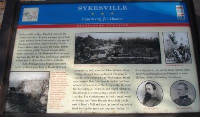
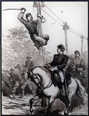
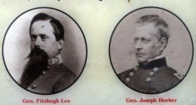
Gen. Fitzhugh Leeís brigade continued north on Washington Road to Hoodís Mill and occupied the Baltimore and Ohio Railroad there, cutting telegraph lines to disrupt communications between Frederick and Washington. Stuart soon learned that Gen. Joseph Hooker had been relieved of command of the Army of the Potomac the day before at Frederick and might return to Washington on a special train about 10:30 a.m. that day. The Confederates burned a small wooden bridge over Piney Branch about half a mile east of Hoodís Mill and tore up several sections of track to stop the train and capture Hooker. An alert engineer on an earlier train spotted them, however, and backed up to Frederick to warn Hooker, thereby thwarting the scheme.
Erected by Maryland Civil War Trails.
Topics. This historical marker is listed in this topic list: War, US Civil. A significant historical month for this entry is June 1863.
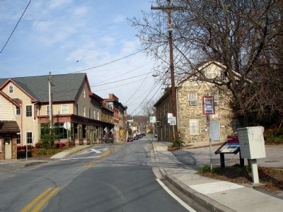
Location. 39° 21.865′ N, 76° 58.136′ W. Marker is in Sykesville, Maryland, in Carroll County. Marker is on Main Street (Maryland Route 851), on the right when traveling north. Touch for map. Marker is in this post office area: Sykesville MD 21784, United States of America. Touch for directions.
Other nearby markers. At least 8 other markers are within walking distance of this marker. Baldwin's Station (a few steps from this marker); Baltimore & Ohio Railroad Station (a few steps from this marker); St. Joseph's Roman Catholic Church (within shouting distance of this marker); The Town House (about 400 feet away, measured in a direct line); The Strawbridge Home for Boys (about 700 feet away); The Sykesville Bypass Bridge (approx. 0.2 miles away); The Historic Sykesville Colored Schoolhouse (approx. 0.3 miles away); Veterans Memorial (approx. 0.6 miles away). Touch for a list and map of all markers in Sykesville.
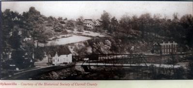
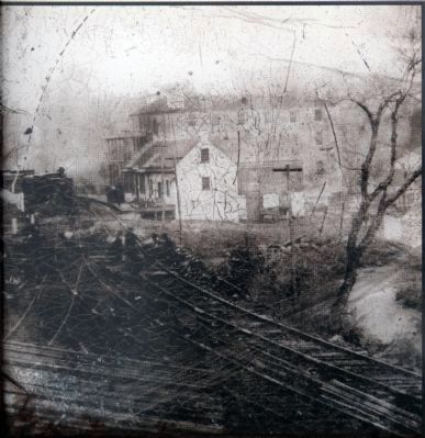
More about this marker. On the lower left of the marker is a photo captioned This 1860s tintype shows the Sykes Hotel which stood on the bank of the Patapsco River. The railroad tracks and telegraph lines in the foreground continue across the river into Howard County. The Sykes Hotel was destroyed when the Patapsco flooded in 1868. On the upper middle of the marker is a photo captioned Sykesville. On the lower right of the marker are portraits of Gen. Fitzhugh Lee and Gen. Joseph Hooker. On the upper right of the marker is a sketch captioned Cutting telegraph wire.
Also see . . . Sykesville, Maryland. Wikipedia entry (Submitted on December 22, 2020, by Larry Gertner of New York, New York.)
Photographed By Allen C. Browne, November 16, 2013
6. Sykes Hotel in the1860s
This 1860s tintype shows the Sykes Hotel which stood on the bank of the Patapsco River. The railroad tracks and telegraph lines in the foreground continue across the river into Howard County. The Sykes Hotel was destroyed when the Patapsco flooded in 1868.Close-up of photo on marker
Photographed By Allen C. Browne, November 16, 2013
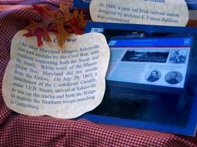
7. The Civil War
Photo of marker in a window display at the Wade H.D. Warfield building.
"Like other Maryland villages, Sykesville was torn asunder by the Civil War, with residents supporting both North and South. While south of the Mason-Dixon line, Maryland did not secede from the Union. On July 29, 1863, a detachment of Confederate Cavalry, under J.E.B. Stuart, arrived in Sykeville to tear up the tracks and burn the bridge to impede the Northern troops marching to Gettysburg."
"Like other Maryland villages, Sykesville was torn asunder by the Civil War, with residents supporting both North and South. While south of the Mason-Dixon line, Maryland did not secede from the Union. On July 29, 1863, a detachment of Confederate Cavalry, under J.E.B. Stuart, arrived in Sykeville to tear up the tracks and burn the bridge to impede the Northern troops marching to Gettysburg."
Credits. This page was last revised on December 22, 2020. It was originally submitted on November 26, 2008. This page has been viewed 5,212 times since then and 106 times this year. Photos: 1, 2. submitted on November 26, 2008. 3, 4, 5, 6, 7. submitted on November 17, 2013, by Allen C. Browne of Silver Spring, Maryland. • Craig Swain was the editor who published this page.
