Fort Stockton in Pecos County, Texas — The American South (West South Central)
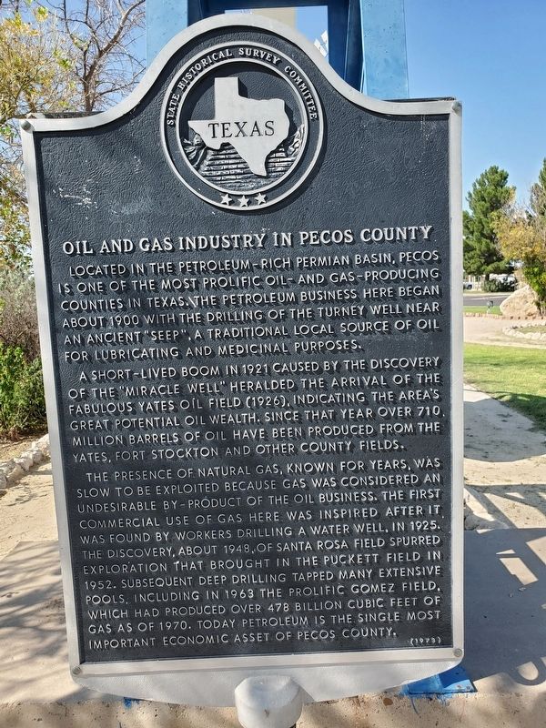
Oil and Gas Industry in Pecos County
Located in the petroleum-rich Permian Basin, Pecos is one of the most prolific oil-and gas-producing counties in Texas. The petroleum business here began about 1900 with the drilling of the Turney well near an ancient "seep", a traditional local source of oil for lubricating and medicinal purposes.
A short-lived boom in 1921 caused by the discovery of the "Miracle Well" heralded the arrival of the fabulous Yates oil field (1926), indicating the area's great potential oil wealth. Since that year over 710 million barrels of oil have been produced from the Yates, Fort Stockton and other county fields.
The presence of natural gas, known for years, was slow to be exploited because gas was considered an undesirable by-product of the oil business. The first commercial use of gas here was inspired after it was found by workers drilling a water well, in 1925. The discovery, about 1948, of Santa Rosa field spurred exploration that brought in the Puckett field in 1952. Subsequent deep drilling tapped many extensive pools, including in 1963 the prolific Gomez field, which had produced over 478 billion cubic feet of gas as of 1970. Today petroleum is the single most important economic asset of Pecos County.
Erected 1973 by State Historical Survey Committee. (Marker Number 3684.)
Topics. This historical marker is listed in this topic list: Industry & Commerce.
Location. 30° 53.63′ N, 102° 52.722′ W. Marker is in Fort Stockton, Texas, in Pecos County. Marker is on North Main Street (Farm to Market Road 1053), on the right when traveling north. Marker is located in front of the Fort Stockton Chamber of Commerce (housed in the old railroad depot). Touch for map. Marker is at or near this postal address: 1000 East Railroad Avenue, Fort Stockton TX 79735, United States of America. Touch for directions.
Other nearby markers. At least 8 other markers are within walking distance of this marker. The "Prairie Schooner" and Early Settlers (within shouting distance of this marker); Visitor Center (within shouting distance of this marker); Comanche Springs (about 300 feet away, measured in a direct line); The Great Comanche War Trail (about 300 feet away); The 9th Cavalry, Fort Stockton and Edward Hatch (about 300 feet away); Pecos County Fort Stockton Renewable Energy Park (about 300 feet away); Downtown Fort Stockton (about 400 feet away); Old Fort Cemetery (approx. 0.2 miles away). Touch for a list and map of all markers in Fort Stockton.
Credits. This page was last revised on November 28, 2020. It was originally submitted on September 5, 2019, by Brian Anderson of Humble, Texas. This page has been viewed 240 times since then and 33 times this year. Photos: 1, 2. submitted on September 5, 2019, by Brian Anderson of Humble, Texas.

