Cumberland in Allegany County, Maryland — The American Northeast (Mid-Atlantic)
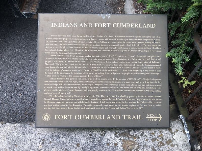
Indians and Fort Cumberland
Fort Cumberland Trail
Indians served on both sides during the French and Indian War. Some tribes seemed to switch loyalties during the war, when it better suited their purposes. Indians camped near here to consult with General Braddock just before his fateful expedition in 1755. He consulted them little, against the advice of colonial officers. Soldiers were attracted to the pretty Indian women making the Indian warriors angry. Rules issued by Braddock to prevent meetings between squaws and soldiers had little effect. They met across the river or beyond the picket lines. Most of the Indians became angry and eventually left because of various insults to them. Braddock lost valuable Indian allies. After his defeat, the Shawanese and Delaware Indians changed to the French side, in hopes of recovering lands from the British and other rewards.
British outposts were driven in, some smaller forts taken, and settlers fled eastward to Hancock, Maryland, and points east. "It was at the risk of life that anyone ventured a few rods from his door… The plantations were being deserted, and homes and property abandoned to plunder or the torch…" -Col. Washington. Some scalping parties were within thirty miles of Baltimore, Maryland. The governor called out the militia. In 1756, Fort Frederick was built a few miles east of Hancock. Indians continued raids during the war and after in Western Maryland as far east as Fort Frederick. One of Thomas Cresap's sons was killed in April 1756, by Indians. Washington wrote to Lt. Governor Dinwiddie of the local settlers: "I have done everything in my power to quiet the minds of the inhabitants, by detaching all the men…yet nothing I fear will prevent the people from abandoning their dwellings…" "They are now retiring the securest parts in droves of fifties."
Indians harrassed the garrison with small arms fire from nearby hills. In the summer of 1756, 70 to 75 of Major Livingston's men marched across town one night, remained hidden, and in the morning destroyed a war party who had been firing into the fort from McKaig's Hill. The same summer, under Major Livingston, some trecherous Indians were allowed into the fort (they planned to attack once inside), then disarmed by the vigilant garrison, dressed in petticoats, and driven out in complete humiliation. Fort Cumberland barely held it's own, however, as it was usually undermanned. The Indians continued to be active in the area, scalping and murdering almost at will.
Friendly Indians including Cherokees were here in 1758. They were useful in checking prowling bands of hostile Indians. Colonel Thomas Cresap led several small volunteer expeditions against the hostile Indians in this area. Negro Mountain was named for Cresap's negro
Topics and series. This historical marker is listed in these topic lists: Colonial Era • Forts and Castles • Native Americans • War, French and Indian. In addition, it is included in the Braddock’s Road and Maj. Gen. Edward Braddock series list. A significant historical month for this entry is April 1756.
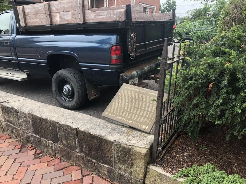
Location. 39° 39.057′ N, 78° 45.968′ W. Marker is in Cumberland, Maryland, in Allegany County. Marker is on Washington Street just east of Prospect Square, on the right when traveling east. Touch for map. Marker is at or near this postal address: 31 Washington Street, Cumberland MD 21502, United States of America. Touch for directions.
Other nearby markers. At least 8 other markers are within walking distance of this marker. The Fort Bastions (a few steps from this marker); Gov. Lloyd Lowndes 1845 - 1905 (within shouting distance of this marker); The Fort Proper (within shouting distance of this marker); Famous Personalities at Fort Cumberland (within shouting distance of this marker); First Church of Christ, Scientist (Hoyt House) (within shouting distance of this marker); Emmanuel Episcopal Church (within shouting distance of this marker); President Washington's Last Visit - 1794 (within shouting distance of this marker); Cumberland (within shouting distance of this marker). Touch for a list and map of all markers in Cumberland.
Credits. This page was last revised on November 21, 2022. It was originally submitted on September 7, 2019, by Devry Becker Jones of Washington, District of Columbia. This page has been viewed 593 times since then and 63 times this year. Photos: 1, 2. submitted on September 7, 2019, by Devry Becker Jones of Washington, District of Columbia.

