Near Loleta in Humboldt County, California — The American West (Pacific Coastal)
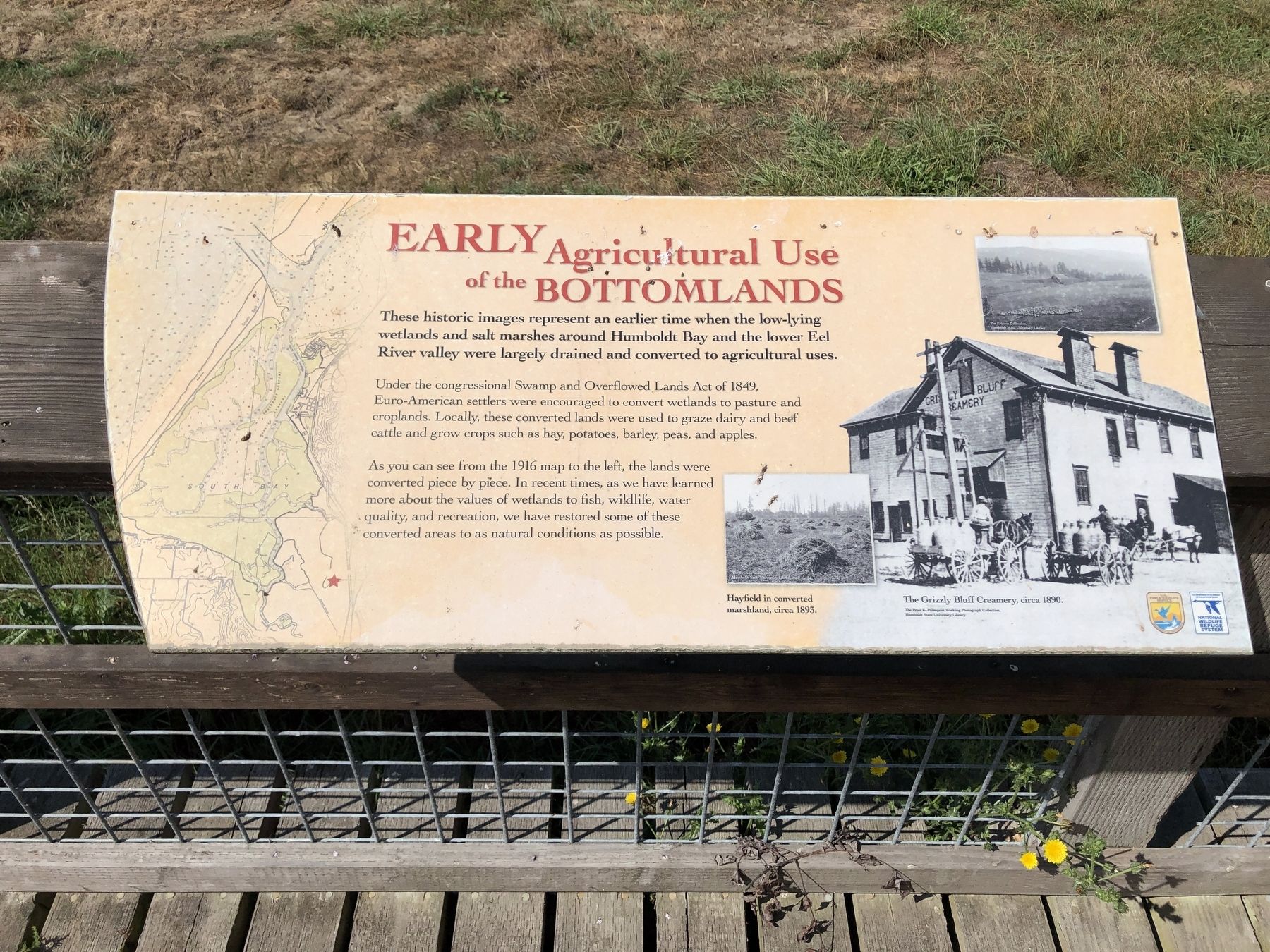
Early Agricultural Use of the Bottomlands
Inscription.
These historic images represent an earlier time when the low-lying wetlands and salt marshes around Humboldt Bay and the lower Eel River valley were largely drained and converted to agricultural uses.
Under the congressional Swamp and Overflow Lands Act of 1849, Euro-American settlers were encouraged to convert wetlands to pasture and croplands. Locally, these converted lands were used to graze dairy and beef cattle and grow crops such as hay, potatoes, barley, peas, and apples.
As you can see from the 1916 map to the left, the lands were converted piece by piece. In recent times as we have learned more about the values of wetland to fish, wildlife, water quality and recreation, we have restored some of these converted areas to as natural conditions as possible.
Erected by U.S. Fish & Wildlife Service and National Wildlife Refuge System.
Topics. This historical marker is listed in this topic list: Agriculture.
Location. 40° 41.172′ N, 124° 12.435′ W. Marker is near Loleta, California, in Humboldt County. Marker can be reached from Eel River Drive near Hookton Road. Touch for map. Marker is in this post office area: Loleta CA 95551, United States of America. Touch for directions.
Other nearby markers. At least 8 other markers are within 7 miles of this marker, measured as the crow flies. Historic Hunting on the, Refuge and Humboldt Bay (here, next to this marker); History of the McBride Ranch (a few steps from this marker); Fields Landing Hotel (approx. 2.7 miles away); Bank of Loleta (approx. 3.3 miles away); Harold G Larsen (approx. 4.1 miles away); Humboldt Harbor Historical District (approx. 4.1 miles away); Fernbridge (approx. 4.9 miles away); Fort Humboldt (approx. 6.4 miles away). Touch for a list and map of all markers in Loleta.
More about this marker. The McBride Ranch is located near the Humboldt Bay Wildlife Refuge Visitors Center parking lot.
Credits. This page was last revised on September 14, 2019. It was originally submitted on September 13, 2019, by Barry Swackhamer of Brentwood, California. This page has been viewed 137 times since then and 13 times this year. Photos: 1, 2. submitted on September 14, 2019, by Barry Swackhamer of Brentwood, California.

