Near Cheticamp in Inverness County, Nova Scotia — The Atlantic Provinces (North America)
Jeanne Dugas
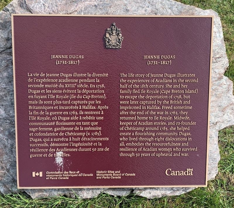
La vie de Jeanne Dugas illustre la diversité de l'expérience acadienne pendant la seconde moitié du XVIII siècle. En 1758, Dugas et les siens évitent la déportation en fuyant l'ile Royale (ile du Cap-Breton), mais ils sont plus tard capturés par les Britanniques et incarcérés à Halifax. Après la fin de la guerre en 1763, ils rentrent à l'ile Royale, où Dugas aide à rebâtir une communauté florissante en tant que sage femme, gardienne de la mémoire et cofondatrice de Chéticamp (v. 1785) Dugas, qui a survécu à huit déracinements successifs, démontre l'ingéniosité et la résilience des Acadfennes durant 50 ans de guerre et de tretibles.
Erected by Historic Sites and Monuments Board of Canada.
Topics and series. This historical marker is listed in these topic lists: Disasters • Settlements & Settlers • Women. In addition, it is included in the Canada, Historic Sites and Monuments Board series list. A significant historical year for this entry is 1758.
Location. 46° 38.582′ N, 61° 0.093′ W. Marker is near Cheticamp, Nova Scotia, in Inverness County. Marker is on Cabot Trail. Touch for map. Marker is in this post office area: Cheticamp NS B0E 1H0, Canada. Touch for directions.
Other nearby markers. At least 8 other markers are within 3 kilometers of this marker, measured as the crow flies. La fin d'un rêve / The End of a Dream (approx. 1.6 kilometers away); Dés l'année suivante, en 1927 / The following year, in 1927 (approx. 1.6 kilometers away); M. Joseph Macfarland / Mr. Joseph MacFarland (approx. 1.6 kilometers away); Tunnel et Quai de la mine / Tunnel and Mine Wharf (approx. 1.7 kilometers away); La Bouée du havre / The Harbour Bouy (approx. 1.7 kilometers away); Voie ferrée et « Lu vieille Louise » / The railroad and "The Old Louise" (approx. 1.7 kilometers away); The Gypsum Mine/La Mine De Plâtre (approx. 1.7 kilometers away); Chéticamp War Memorial (approx. 2.3 kilometers away).
Credits. This page was last revised on September 15, 2019. It was originally submitted on September 12, 2019, by Steve Stoessel of Niskayuna, New York. This page has been viewed 199 times since then and 14 times this year. Last updated on September 15, 2019, by Steve Stoessel of Niskayuna, New York. Photo 1. submitted on September 12, 2019, by Steve Stoessel of Niskayuna, New York. • Andrew Ruppenstein was the editor who published this page.
