Near Branchport in Yates County, New York — The American Northeast (Mid-Atlantic)
Bluff Point & Keuka Lake History
Names Tell a Story
Keuka Lake’s distinctive “Y” shape led early European settlers to call it “Crooked Lake,” perhaps believing one of the Native American names for the lake, Keuka, meant “Crooked.” In fact, it probably meant “Canoe Landing” or “Lake with Bent Elbow.”
Another early name used by the Seneca is Ogoyage, which translates as “the Promontory,” and may have referred to the Bluff. Any portion of the land between 54A and the tip may be called Bluff Point or the Bluff.
Penn Yan’s unique name combines the origins of Pennsylvania and New England settlers. Branchport was first known as Esperanza, from the Spanish for “hope,” later changed in 1831 to its more descriptive name.
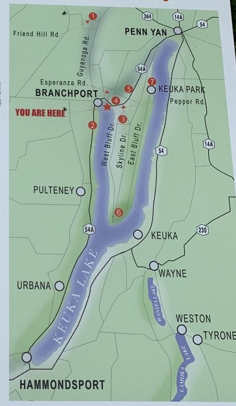
The district, later town, of Jerusalem was named in recognition of Jemima Wilkinson, The Publick Universal Friend, and her followers. Beginning in 1788, about 300 of the Friends settled near Seneca Lake and the Keuka Lake outlet. Because of land disputes, they relocated north of Branchport, building a sizable home on Friend Hill Road in 1814. [Map Point #1]
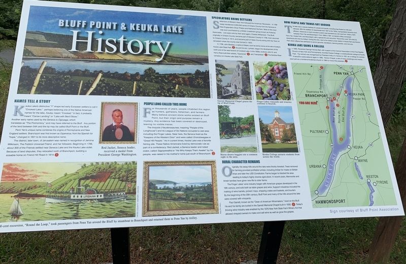
middle left painting:Red Jacket, Seneca leader, received a medal from President George Washington.
bottom illustration:The 30-cent excursion, “Round the Loop,” took passengers from Penn Yan around the Bluff by steamboat to Branchport and returned them to Penn Yan by trolley
People Long Called This Home
For thousands of years, people inh9abited this region as hunters, gathers, fishermen, and farmers. Many believe ancient stone works existed on Bluff Point, but their origin and purpose remain a mystery. Any evidence has been covered or destroyed, leaving no visible traces.
The Iroquois (Haudenosaunee, meaning “People of the Longhouse”) and its League of Six Nations occupied a vast area including the Finger Lakes. Near here, the Seneca lived as the “Keepers of the Western Door” and were called Onodowagnaw or “Great Hill People.” As in current times, Keuka Lake was a favorite fishing site. These Native American lived by democratic rule as part of a confederacy. Red jacket, a Seneca leader and noted orator, called Sagoyewatha or “He who Keeps them Awake by his people, was raised in his mother’s home just south of Branchport. [Map Point #2]
Speculators Bring Settlers
Settlement of Western New York followed the American Revolution. A 1788 treaty transferred 2,600,000 acres of Ontario County from the Seneca to New Englanders Oliver Phelps and Nathaniel Gorham. Most of this tract was soon purchased by a British investment group known as Pulteney Associates. Lots were sold by their land agent, Charles Williamson. The Bluff, originally in Ontario County, became part of Stueben County in 1796, then returned to Ontario County in 1814, and became part of Yates County along with the Town of Jerusalem when the county was formed in 1823.
In 1798, John Beddoe, a native of Wales, built his family home at the site of today’s Keuka Lake State Park. [Map Point #3] He and his son, Lynham, began the development of the north end of the west branch of Crooked Lake. In the late 1830s, brothers John N. and Henry Rose built their estates, “Esperanza” [Map Point #4] and “Hampstead.” [Map Point #5] The Beddoe-Rose cemetery is in Keuka Lake State Park.
Center Photo Captions, starting top left proceeding clockwise:
Garrett Memorial Chapel graces the tip of Bluff Point
Finger Lake vineyards and wineries continue to flourish
Horse-drawn buggies are a common site in the area.
Keuka College attracts student from across the world.
Rural Character Remains
Originally, the steep hills around the lake were thickly forested. Trees removed for farming provided profitable lumber, including timber for masts on British ships and later the USS Constitution. Farms began to blanket the area leading to today’s highly diverse agriculture. In recent years, Mennonite and Amish families have given new life to older farms.
The Finger Lakes’ wine industry began with American grapes developed in the 19th century, and sold both as table grapes and wine. Support industries included the making of wine barrels, pickers’ trays, shipping crates and baskets, and tourism. By the beginning of the 20th century, Bluff Point and many of the hills around the lake were covered with vineyards.
Paul Garrett, known as the “Dean of American Winemakers,” lived on the Bluff. He and his family are buried in the Garrett Memorial Chapel built in 1930. [Map Point #6] Today’s thriving wine industry was enabled by the 1976 New York State Farm Winery Act that allowed vineyard owners to make and sell wine as well as grow grapes.
How People and Things Got Around
The lake was a natural roadway for people and goods, including logs floated to mills and railroads. With the addition of steamboats from 1837 to the 1920’s, transportation became more efficient. Advances on land included a plank road operated as a toll road from 1849 to 1879 between Penn Yan and Branchport. From 1898 to 1927, an electric trolley connected Penn Yan, Keuka Park, and Branchport with a special 30-cent excursion “Round the Loop” (25 miles by steamboat and nine by trolley). During this time, next to the trolley’s power station in Keuka Park was Electric Park which offered free admission to picnic grounds, bandstand, dancing pavilion, and mini-zoo.
Keuka Lake Gains a College
in 1890, Reverend George Harvey Ball, with the support of the Central Association of the Free Baptist Church of New York and Pennsylvania, founded Keuka College, a coeducational college at Keuka Park. The school was reorganized by President Arthur H. Norton in 1921 as a college for women. It became coeducation again in 1985. Norton Chapel, a site of many weddings and events, was built as a nondenominational church in 1964 to honor this president. [Map Point #7]
Topics. This historical marker is listed in these topic lists: Agriculture • Native Americans • Settlements & Settlers • Waterways & Vessels. A significant historical year for this entry is 1831.
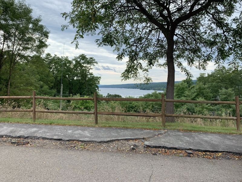
Location. 42° 35.693′ N, 77° 8.231′ W. Marker is near Branchport, New York, in Yates County. Marker is on New York State Route 54A, on the right. At rest stop near the north end of the west branch of Keuka Lake. Touch for map. Marker is in this post office area: Branchport NY 14418, United States of America. Touch for directions.
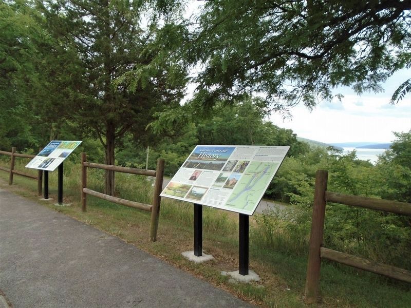
Other nearby markers. At least 8 other markers are within walking distance of this marker. Bluff Point & Keuka Lake Geology (here, next to this marker); Beddoe Tract (within shouting distance of this marker); Beddoe-Rose Cemetery (approx. half a mile away); "Ahweyneyoun" (Ah-Wey-Ne-Youn) (approx. ¾ mile away); Veterans Memorial (approx. ¾ mile away); Trolley Depot (approx. 0.8 miles away); Red Jacket (approx. 0.8 miles away); St. Luke's Episcopal Church (approx. 0.8 miles away). Touch for a list and map of all markers in Branchport.
Credits. This page was last revised on August 3, 2020. It was originally submitted on September 18, 2019, by Steve Stoessel of Niskayuna, New York. This page has been viewed 891 times since then and 90 times this year. Photos: 1, 2. submitted on September 18, 2019, by Steve Stoessel of Niskayuna, New York. 3. submitted on August 3, 2020, by William Fischer, Jr. of Scranton, Pennsylvania. 4. submitted on September 18, 2019, by Steve Stoessel of Niskayuna, New York. • Andrew Ruppenstein was the editor who published this page.


