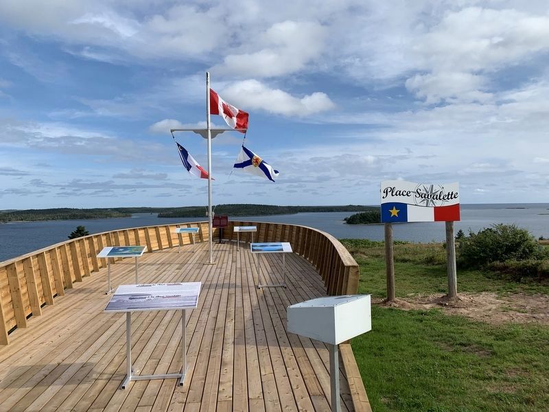
Port Felix in Guysborough County, Nova Scotia — The Atlantic Provinces (North America)
Welcome to Place Savalette
Welcome to Place Savalette
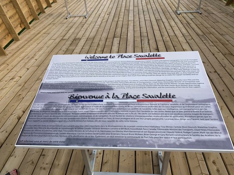
This park has been developed to mark and explain the site of the historic 1607 meeting between Basque fisherman/entrepreneur, Captain Savalette and explorer/cartographer Samuel de Champlain on the shores before you. Champlain knew of Savalette's seasonal presence here as well as his navigational knowledge, and desired to use his information in mapping the bay and surrounding area for King Henry IV of France. Champlain was so impressed by Savalette's knowledge, hospitality, work ethic and friendliness towards the Mi'kmaq (who spent summers fishing along this coast), that he named this inlet, Port Savalette on his maps. Note that the park is in the shape of a boat commemorating the legacy left by the Basque whose small working "chalupas” survived the challenges of time and were adopted by the Acadians that arrived and settled here in the late 1700s. Boats are symbolic and the mainstays of our coastal communities. They were/are a means of transportation, permitted a means of livelihood, discoveries, and served as early classrooms. From them, navigators learned astronomy, astrology, navigation, shapes and sizes of oceans, seas, rivers and lakes and their life sustaining importance. They led to inter-personal relationships, multi-culturalism, and opened minds and awareness. They were spiritual, in that the seamen had a Divine relationship and trust with their vessels and their God for their lives depended on them. In summary, boats represented development and survival. That is the reason we chose the boat-shape as the design of this historic park. Boats represent all the fore-mentioned and are an integral part of our identity. They are robust, they look after us, they respond, and they keep us afloat. Their bows point to our future and their sterns remind us of our past, or our origins. How much more fitting could this design be to relate the Captain Savalette and our Acadian stories?
We wish to acknowledge the following for their support and involvement in this project: builder/designer, Tino Winter; artist Moni Duersch; Waterline Graphix; Councillor Vern Pitts and the Municipality of the District of Guysborough; Guysborough Celebrates Canada 150 Committee; Honourable Minister of Transportation, Lloyd Hines; Honourable Minister of Immigration and Acadian Affairs, Lena Diab; Honourable Minister of Culture and Heritage, Leo Glavine; Mark Bannerman of Department of Acadian Affairs; Mark van der Wiel and the Atlantic Canada Opportunities Agency; Member of Parliament, Rodger Cuzner; Donors Lorraine and Bill Black; ExxonMobil; Keith Mercer, and Parks Canada; Cecil and Darlene (David) Cashin for the land; Lawyer Bruce McKeen; Brian George Construction and Gary Richard; La Société des Acadiens de la Région de Tor Baie for organizing, researching, writing and recording this information, and the community of Port Felix for their support. Please enjoy your visit and our park!
Ce site commémoratif a été développé afin de noter ce lieu qui fut la place d'une rencontre historique entre pêcheur/entreprenneur Basque, le Capitaine Savalette, et de l'explorateur/cartographe, Samuel de Champlain. Champlain fut déjà informé de la présence actuelle de ce capitaine bien connu, et de ses connaissances profondes de ces eaux Côtières. Celles furent désirées par le roi Henri IV qui voulait des images de son royaume trans-océanique. Les qualités de Savalette, telles que son Mikmaq, sa diligence, son accueil et son hospitalité furent assez impressionnant que Champlain a nommé ce port, Port Savalette sur ses cartes. Notez que ce parc prend la forme d'un bateau symbolique, qui nous rappelle des "chalupas” Basques utilisés à l'époque et adoptés pars les Acadiens vers la fin du 18e siècle. Les bateaux ont servi nos ancêtres comme moyen de transport, salle de classe, moyen de découvertes astronomiques, astrologiques, et de navigation. Ils ont facilité les relations interpersonnelles, multiculturelles et spirituelles. N'oublions jamais que les bateaux font parties intégrales de nos vies quotidiennes côtière. Ils nous portent sur l'eau, ils nous protègent et ils ont leur propre personalité. La proue nous dirige vers l'avenir, tant que l'arrière nous rappelle au passé. Voilà pourquoi on a choisi la forme d'un bateau afin de nous rappeler de cette riche histoire. régionnaux qu'il désirait pour ses cartes intelligence, son comportement vers les
On veut offrir des mots de remerciements aux suivants pour leur rôles importants dans le développement de ce Conseiller, Vern Pitts et la Municipalité de Guysborough; le Comité Canada 150 local; donneurs Lorraine et Bill Black; Exxon Mobil; Parcs Canada; I'Honorable Ministre des Transports, Lloyd Hines; l'Honorable Ministre des Affaires Acadiennes, Lena Diab; I'Honorable Ministre de la Culture et du Patrimoine, Leo Glavine; Mark Bannerman et son Equipe provincial; Député Fédéral, Rodger Cuzner; Mark van der Wiel et I'Agence de Promotion Économiques du Canada Atlantique; Cecil et Darlene David/Cashin pour le terrain; l'avocat Bruce McKeen; Brian George et Gary Richard-constructeurs; la Société des Acadiens de la Région de Tor Baie pour leurs recherches, l'écriture, et la planification de ce lieu. Également, on veut remercier la communauté de Port Felix pour leur appui et leur participation. projet: constructeur/réalisateur Tino Winter; l'artiste Moni Deursch; Waterline Graphix; SVP informez-vous et merci de votre visite! 18/ R
--------------------
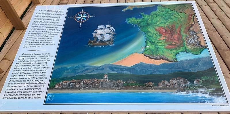
Le capitaine Basques, Savalette, était pêcheur/entrepreneur de St. Jean de Luz, France, durant la deuxième moitié du 16e jusqu'au début du 17e siècle. Les rois Henri III, et Henri IV, l'encouragerent à participer dans la pêcherie de la Nouvelle France afin de soutenir un marché européen qui existait à l'époque. Comme autres explorateurs européens, il avait
déjà une connaissance de cette pêcherie et de la richesse des eaux au long des côtes est de la Nouvelle France. D'après des rapportages de Jacques Cartier, il paraît que le père et grand-père de Savalette avaient, eux aussi participé à la pêcherie de cette région, possiblement aussi tôt que la fin du 15e siècle.
Painting by: Moni Deursch
--------------------
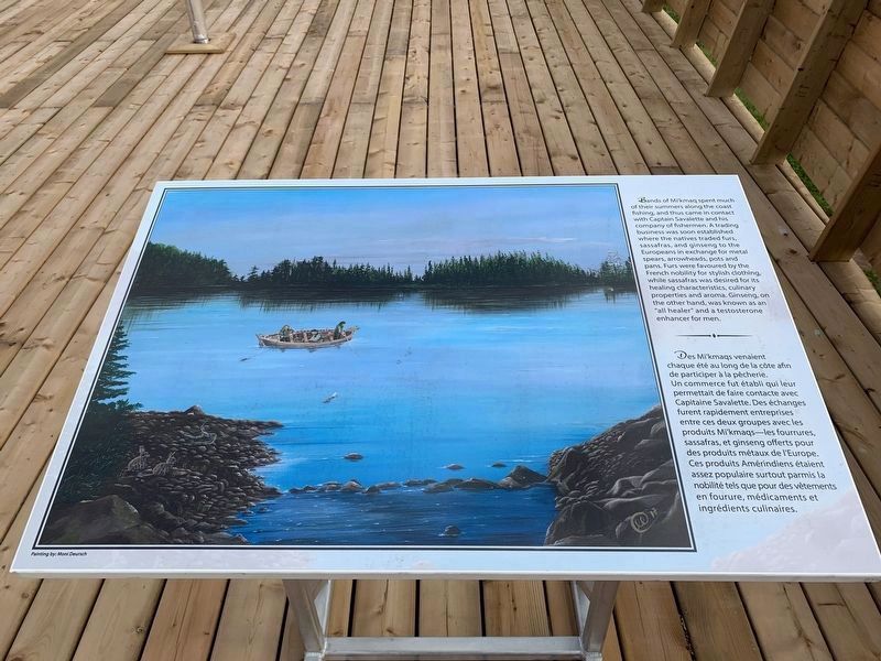
Des Mi'kmaqs venaient chaque été au long de la côte afin de participer à la pêcherie. Un commerce fut établi qui leur permettait de faire contacte avec Capitaine Savalette. Des échanges furent rapidement entreprises entre ces deux groupes avec les produits Mi'kmaqs - les fourrures, sassafras, et ginseng offerts pour des produits métaux de l'Europe, Ces produits Amérindiens étaient assez populaire surtout parmis la nobilité tels que pour des vêtements en fourure, médicaments et ingrédients culinaires.
Painting by: Moni Deursch
--------------------
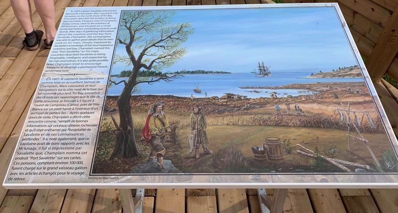
En 1607, le capitaine Savalette a servi comme hôte en accueillant Samuel de Champlain, Marc Lescarbot et leur navigateurs sur la côte nord de la baie qui fut nommée plus tard, Tor Bay. Lescarbot décrit dans ses rapportages que le site de cette rencontre se trouvait à 4 ligues à l'ouest de Campseau (Canso), près de Tête Blance sur un petit havre à l'intérieur d'un archipel de petites îles". Après quelques jours de visite, Champlain a décrit cette rencontre comme, "remplit de bonnes informations sur ces eaux côtières rocheuses et qu'il était encharmé par l'hospitalité de Savalette et de ses connaissances profondes". Ila noté également, que ce capitaine avait de bons rapports avec les Mi'kmaqs. Il fut si impressioné par Savalette que, Champlain nomma cet endroit "Port Savalette" sur ses cartes. Ces poissons, comptant environ 100 000, furent chargé sur le grand vaisseau galéon avec les articles échangés pour le voyage de retour.
Painting by: Moni Deursch
Topics and series. This historical marker is listed in these topic lists: Exploration • Industry & Commerce • Native Americans. In addition, it is included in the Acadian History series list. A significant historical year for this entry is 1607.
Location. 45° 14.961′ N, 61° 13.066′ W. Marker is in Port Felix, Nova Scotia, in Guysborough County. Marker is at the intersection of Marine Street (Nova Scotia Route 316) and Port Felix Loop, on the left when traveling west on Marine Street. Touch for map. Marker is in this post office area: Port Felix NS B0H 1T0, Canada. Touch for directions.
Other nearby markers. At least 8 other markers are within 5 kilometers of this marker, measured as the crow flies. Captain Savalette (here, next to this marker); Folklore & Trivia (approx. 2.2 kilometers away); Port Felix (approx. 2.2 kilometers away); Yankee Cove (approx. 2.3 kilometers away); The Canal (approx. 2.3 kilometers away); Whitehead (approx. 2.3 kilometers away); #5 Radar Unit R.C.A.F Station (approx. 4.8 kilometers away); We Will Remember/Nous Nous Souviendrons (approx. 4.8 kilometers away).
Credits. This page was last revised on November 23, 2019. It was originally submitted on August 31, 2019, by Steve Stoessel of Niskayuna, New York. This page has been viewed 252 times since then and 24 times this year. Last updated on September 19, 2019, by Steve Stoessel of Niskayuna, New York. Photos: 1. submitted on August 31, 2019, by Steve Stoessel of Niskayuna, New York. 2, 3, 4. submitted on September 19, 2019, by Steve Stoessel of Niskayuna, New York. 5. submitted on August 31, 2019, by Steve Stoessel of Niskayuna, New York. • Bill Pfingsten was the editor who published this page.
