Markham in Fauquier County, Virginia — The American South (Mid-Atlantic)
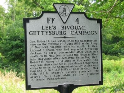
Lee’s Bivouac, Gettysburg Campaign
Erected 1997 by Department of Historic Resources. (Marker Number FF-4.)
Topics and series. This historical marker is listed in this topic list: War, US Civil. In addition, it is included in the Virginia Department of Historic Resources (DHR) series list. A significant historical date for this entry is June 17, 1863.
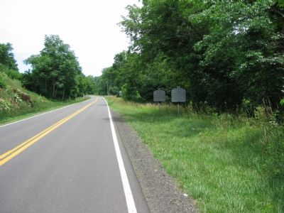
Location. 38° 54.339′ N, 77° 59.722′ W. Marker is in Markham, Virginia, in Fauquier County. Marker is on John Marshall Highway (Virginia Route 55) 0.1 miles Leeds Manor Road (Route 688), on the left when traveling west. Touch for map. Marker is in this post office area: Markham VA 22643, United States of America. Touch for directions.
Other nearby markers. At least 8 other markers are within 5 miles of this marker, measured as the crow flies. Brig. Gen. Turner Ashby, C.S.A. (here, next to this marker); The Hollow (approx. ¼ mile away); John Marshall's Leeds Manor Rural Historic District (approx. 2.8 miles away); The Episcopal Church of Leeds Parish (approx. 3.8 miles away); In Memory of Officers of the C.S.A. (approx. 3.8 miles away); Delaplane (approx. 4 miles away); Piedmont Station (approx. 4 miles away); Discovery Shenandoah Valley (approx. 4.3 miles away). Touch for a list and map of all markers in Markham.
Regarding Lee’s Bivouac, Gettysburg Campaign. Despite being the birth place and home of Turner Ashby, the gap here through the Blue Ridge is known as Manassas Gap. The historic Manassas Gap Railroad, now the Southern Railroad, passes through here, alongside Interstate 66 and Virginia 55. Ashby’s Gap, named for an older namesake, is actually further north (where US Highway 50 crosses the Blue Ridge). Snickers Gap mentioned on the marker is further North in Loudoun County where present day US 7 crosses the Blue Ridge. Chester Gap is further South from here, where the three counties of Fauquier, Rappahannock and Warren meet, and US 522 passes.
Additional commentary.
1. The Original Marker
This marker replaces an earlier marker with the same number, but titled simply “Gettysburg Campaign.” The 1985 edition of A Guidebook to Virginia’s Historical Markers compiled by Margaret Peters shows this marker as missing by that time while the 1932 edition of Key to Inscriptions on Virginia Highway Historical Markers does not list it. My guess is that it was erected in the 1940s. The text read “General R. E. Lee established his headquarters here, June 17, 1863. Ewell’s advance had crossed the Potomac; Longstreet was near Snicker’s Gap; Stuart in contact with the Union cavalry near Aldie; A. P. Hill moving to Chester Gap. The Army of Northern Virginia was about to invade the North.”
— Submitted June 30, 2007, by J. J. Prats of Powell, Ohio.
Credits. This page was last revised on June 16, 2016. It was originally submitted on June 27, 2007, by Craig Swain of Leesburg, Virginia. This page has been viewed 2,095 times since then and 25 times this year. Photos: 1, 2. submitted on June 27, 2007, by Craig Swain of Leesburg, Virginia. • J. J. Prats was the editor who published this page.

