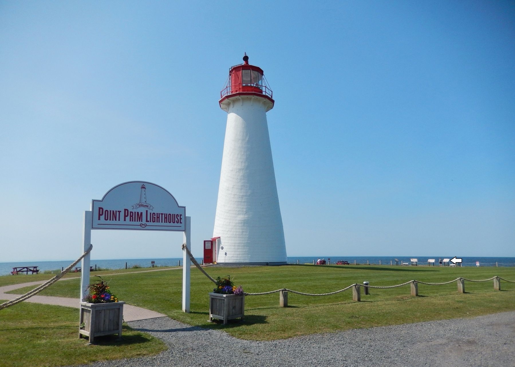
Belfast in Queens County, Prince Edward Island — The Atlantic Provinces (North America)
A Lighthouse is Born / La Naissance du Phare
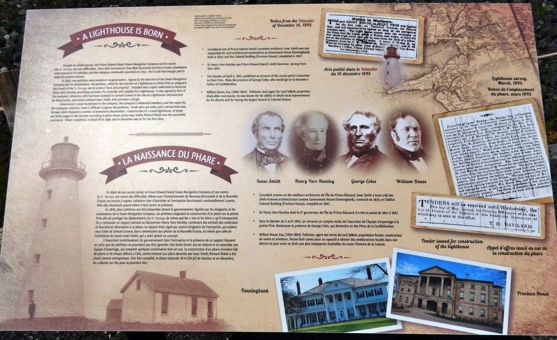
Despite its initial success, the Prince Edward Island Steam Navigation Company and its vessel, the St. George, ran into difficulties. Even with investments from New Brunswick and Nova Scotia, steamboats were expensive to maintain, and the company continually operated at a loss. But it still had enough pull to make its presence known.
In 1845, two petitions were presented to government. Signed by the directors of the Steam Navigation Company and its shareholders, the petitions called for the erection of a lighthouse on Point Prim to safeguard the travels of the St. George, and to protect "lives and property". Included was a report addressed to Governor Henry Vere Huntley, providing estimates for materials and supplies for a lighthouse. It was signed by four of the company's directors, who had been assisted by Samuel Cunard in his role as a lighthouse commissioner for Nova Scotia, and noted architect Isaac Smith, who provided a design.
Government's large investment in the company, the company's influential members, and the report by the company's directors made it difficult to ignore the petitions. Funds were set aside, and a survey team was formed, which featured a number of prominent shareholders. Construction of a round lighthouse, of stone and brick, began in the summer according to plans drawn up by Isaac Smith; Richard Walsh was the successful contractor. When completed, it stood 60 ft. high, and in December was lit for the first time.
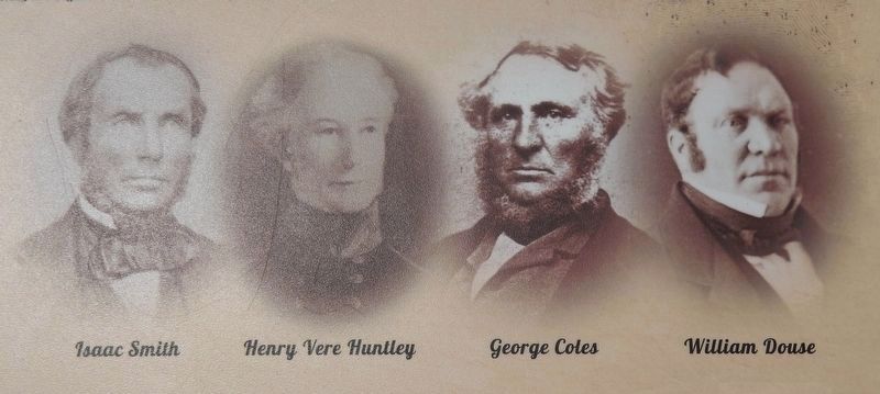
• Considered one of Prince Edward Island's premiere architects, Isaac Smith was also responsible for such architectural masterpieces as Government House (Fanningbank), built in 1834, and the Colonial Building (Province House), completed in 1847.
• Sir Henry Vere Huntley was Prince Edward Island's ninth Governor, serving from 1841-1847.
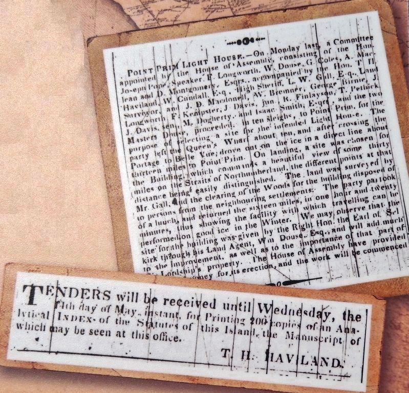
• The Islander of April 5, 1845, published an account of the survey party's excursion to Point Prim. Note the presence of George Coles, who would go on to become a Father of Confederation.
• William Douse, Esq. (1800-1864). Politician, land agent for Lord Selkirk, proprietor, shipbuilder and master, he was known for his ability to obtain local improvements for his district and for having the largest funeral in Colonial history.
En dépit de son succès initial, la Prince Edward Island Steam Navigation Company et son navire, le St. George, ont connu des difficultés. Même avec l'investissement du Nouveau-Brunswick
et de la Nouvelle-Écosse, les navires à vapeur coûtaient cher d'entretien et l'entreprise fonctionnait continuellement à perte. Mais elle réussissait quand même à faire sentir sa présence.
En 1845, deux pétitions ont été présentées devant le gouvernement. Signées par les dirigeants et les actionnaires de la Steam Navigation Company, ces pétitions exigeaient la construction d'un phare sur la pointe Prim afin de protéger les déplacements du St. George, de même que les « vies et les biens » qu'il transportait. On y retrouvait un rapport adressé au Gouverneur Henry Vere Huntley, contenant des estimés des matériaux et fournitures nécessaires à ce phare. Le rapport était signé par quatre dirigeants de l'entreprise, qui avaient reçu l'aide de Samuel Cunard, alors commissaire aux phares de la Nouvelle-Écosse, de même que celle de l'architecte de renom Isaac Smith, qui y avait ajouté un concept.
L'important investissement du gouvernement dans l'entreprise et la présence de ce rapport faisaient en sorte que les pétitions ne pouvaient pas être ignorées. Des fonds furent mis en réserve et on assembla une équipe d'arpentage, qui comptait quelques actionnaires bien en vue. La construction d'un phare circulaire fait de pierre et de brique débuta à l'été, conformément aux plans dessinés par Isaac Smith; Richard Walsh a été choisi comme entrepreneur. Une fois complété, le phare mesurait 18 m (60 pi) de hauteur et en décembre, on a allumé son feu pour la première fois.
• Considéré comme un des meilleurs architectes de l'île-du-Prince-Édouard, Isaac Smith a aussi créé des chefs-d'œuvre architecturaux comme Government House (Fanningbank), construit en 1834, et l'édifice Colonial Building (Province House), complété en 1847.
• Sir Henry Vere Huntley était le 9e gouverneur de l'Île-du-Prince-Édouard. Il a été en poste de 1841 à 1847.
• Dans le Islander du 5 avril 1845, on retrouve un compte-rendu de l'excursion de l'équipe d'arpentage à la pointe Prim. Remarquez la présence de George Coles, qui deviendra un des Pères de la Confédération.
• William Douse, Esq. (1800-1864). Politicien, agent des terres de Lord Selkirk, propriétaire foncier, constructeur de navire et armateur, Douse était connu pour sa capacité à obtenir des améliorations locales dans son district et pour avoir eu droit aux plus imposantes funérailles de toute l'histoire de la Colonie.
Topics and series. This historical marker is listed in these topic lists: Colonial Era • Government & Politics • Man-Made Features • Waterways & Vessels. In addition, it is included in the Lighthouses series list. A significant historical month for this entry is December 1845.
Location. 46° 3.002′ N, 63° 2.38′
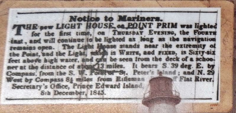
4. Marker detail: Notice from the / Avis publié dans le
Islander, December 16, 1845
Islander, December 16, 1845
Secretary’s Office, Prince Edward Island, 8th December, 1845.
Other nearby markers. At least 8 other markers are within 18 kilometers of this marker, measured as the crow flies. Reliable Communication / Des Communications Fiables (here, next to this marker); The 1864 Charlottetown Conference / La Conférence de Charlottetown de 1864 (here, next to this marker); Point Prim Lighthouse / Le Phare de Point Prim (here, next to this marker); The Early Years / Les Premières Années (a few steps from this marker); Survey of Prince Edward Island / Arpentage de Ľîle-du-Prince-Édouard (approx. 17.2 kilometers away); History All Around You / Quand l’histoire vous entoure (approx. 17.6 kilometers away); Port-la-Joye – Fort Amherst (approx. 17.8 kilometers away); The Deportation of the Inhabitants of Île Saint-Jean (approx. 17.8 kilometers away). Touch for a list and map of all markers in Belfast.
Related markers. Click here for a list of markers that are related to this marker. Point Prim Lighthouse, Belfast, PE
Credits. This page was last revised on September 29, 2019. It was originally submitted on September 28, 2019, by Cosmos Mariner of Cape Canaveral, Florida. This page has been viewed 172 times since then and 16 times this year. Photos: 1. submitted on September 28, 2019, by Cosmos Mariner of Cape Canaveral, Florida. 2, 3, 4, 5, 6. submitted on September 29, 2019, by Cosmos Mariner of Cape Canaveral, Florida.
