Near Winchester in Frederick County, Virginia — The American South (Mid-Atlantic)
John Rutherford's Farm
Interrupted by War
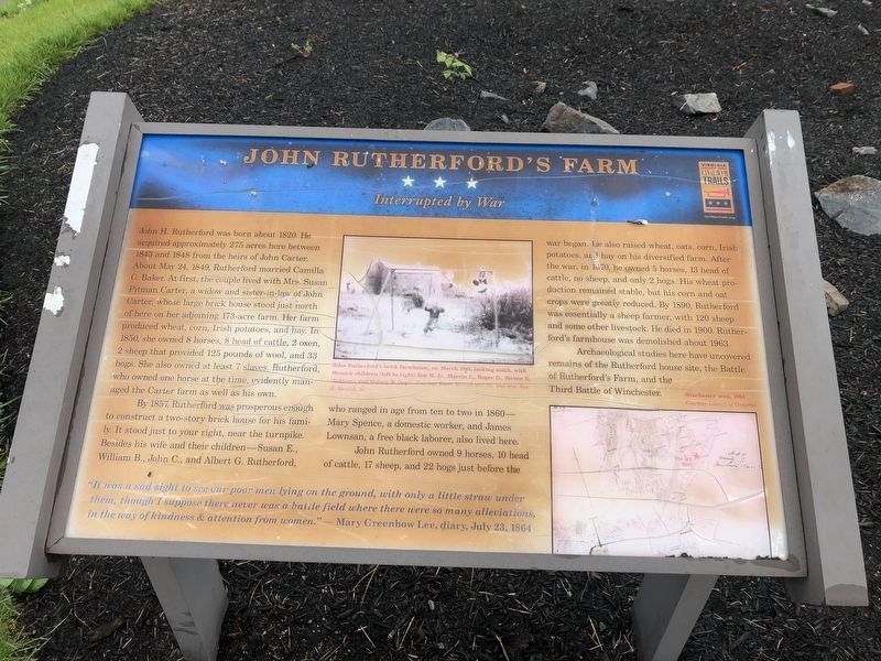
John H. Rutherford was born about 1820. He acquired approximately 275 acres here between 1843 and 1848 from the heirs of John Carter. About May 24, 1849, Rutherford married Camilla C. Baker. At first, the couple lived with Mrs. Susan Pitman Carter, a widow and sister-in-law of John Carter, whose large brick house stood just north of here on her adjoining 173-acre farm. Her farm produced wheat, corn, Irish potatoes, and hay. In 1850, she owned 8 horses, 8 head of cattle, 2 oxen, 2 sheep that provided 125 pounds of wool, and 33 hogs. She also owned at least 7 slaves. Rutherford, who owned one horse at the time, evidently managed the Carter farm as well as his own.
By 1857, Rutherford was prosperous enough to construct a two-story brick house for his family. It stood just to your right, near the turnpike. Besides his wife and their children—Susan E., William, B., John C., and Albert G. Rutherford, who ranged in age from ten to two in 1860—Mary Spence, a domestic worker, and James Lownsan, a free black laborer, also lived here.
John Rutherford owned 9 horses, 10 head of cattle, 17 sheep, and 22 hogs just before the war began. He also raised wheat, oats, corn, Irish potatoes, and hay on his diversified farm. After the war, in 1870, he owned 5 horses, 13 head of cattle, no sheep, and only 2 hogs. His wheat production remained stable, but his corn and oat crops were greatly reduced. By 1890, Rutherford was essentially a sheep farmer, with 120 sheep and some other livestock. He died in 1900. Rutherford’s farmhouse was demolished about 1963.
Archaeological studies here have uncovered remains of the Rutherford house site, the Battle of Rutherford’s Farm, and the Third Battle of Winchester.
“It was a sad sight to see our poor men lying on the ground, with only a little straw under them, although I suppose there was never a battle field where there were so many alleviations, in the way of kindness & attention from women.”
– Mary Greenhow Lee, diary, July 23, 1864
Erected by Virginia Civil War Trails.
Topics and series. This historical marker is listed in this topic list: War, US Civil. In addition, it is included in the Virginia Civil War Trails series list. A significant historical date for this entry is May 24, 1861.
Location. 39° 13.24′ N, 78° 7.854′ W. Marker has been reported damaged. Marker is near Winchester, Virginia, in Frederick County. Marker is on Martinsburg Pike (U.S. 11), on the right when traveling south. Touch for map. Marker is at or near this postal address: 1876 Martinsburg Pike, Winchester VA 22603, United States of America. Touch for directions.
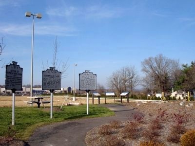
Other nearby markers. At least 8 other markers are within walking distance of this location. Rutherford's Farm (here, next to this marker); Battle of Rutherford's Farm
(here, next to this marker); Hackwood Park (within shouting distance of this marker); Action of Rutherford’s Farm (about 600 feet away, measured in a direct line); The Great Indian (and Wagon) Road (approx. 0.2 miles away); Three Battlefields (approx. 0.7 miles away); The First Battle of Kernstown (approx. 0.7 miles away); The First Battle of Winchester (approx. 0.7 miles away). Touch for a list and map of all markers in Winchester.
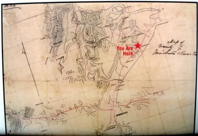
More about this marker. In the upper middle of the marker is a photo captioned, John Rutherford's brick farmhouse, ca. March, 1961, looking south, with Messick children (left to right) Roy R. Jr., Marvin L., Roger D., Steven R. (bottom), and Sidney W. (top). On the lower right of the marker is a map captioned, Winchester area, 1864.
Also see . . . Battle of Rutherford's Farm. Wikipedia entry (Submitted on July 24, 2022, by Larry Gertner of New York, New York.)

Photographed By Devry Becker Jones (CC0), May 28, 2020
4. John Rutherford's Farm Marker
The marker has suffered significant weather damage.
Credits. This page was last revised on July 24, 2022. It was originally submitted on December 1, 2008. This page has been viewed 2,222 times since then and 57 times this year. Photos: 1, 2, 3. submitted on December 1, 2008. 4. submitted on May 28, 2020, by Devry Becker Jones of Washington, District of Columbia. • Craig Swain was the editor who published this page.


