Near Glenwood in Idaho County, Idaho — The American West (Mountains)
The Land Lewis and Clark Walked
Changing Face of the American Forest
— History of the Clearwater —
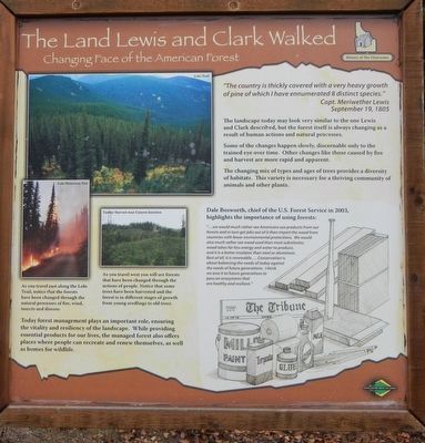
The landscape today may look very similar to the one Lewis and Clark described, but the forest itself is always changing as a result of human actions and natural processes.
Some of the changes happen slowly, discernable (sic) only to the trained eye over time. Other changes like those caused by fire and harvest are more rapid and apparent.
The changing mix of types and ages of trees provides a diversity of habitats. This variety is necessary for a thriving community of animals and other plants.
Dale Bosworth, chief of the U.S. Forest Service in 2003, highlights the importance of using forests:
"... we would much rather see Americans use products from our forests and in turn get jobs out of it than import the wood from countries with fewer environmental protections. We would also much rather see wood used that most substitutes; wood takes far less energy and water to produce, and it is a better insulator that steel or aluminum. Best of all, it is renewable.... Conservation is about balancing the needs of today against the needs of future generations to pass on ecosystems that are healthy and resilient."
Todays forest management plays an important role, ensuring the vitality and resiliency of the landscape. While providing essential products for our lives, the managed forests also offers places where people can recreated and renew themselves, as well as homes for wildlife.
Erected by Forest Service, U.S. Department of Agriculture.
Topics and series. This historical marker is listed in these topic lists: Exploration • Horticulture & Forestry. In addition, it is included in the Lewis & Clark Expedition series list. A significant historical date for this entry is September 19, 1805.
Location. 46° 19.233′ N, 115° 36.149′ W. Marker is near Glenwood, Idaho, in Idaho County. Marker is at the intersection of Lolo Motorway (Forest Road 500) and Smith Creek Road on Lolo Motorway. Touch for map. Marker is in this post office area: Kooskia ID 83539, United States of America. Touch for directions.
Other nearby markers. At least 8 other markers are within 16 miles of this marker, measured as the crow flies. Salmon Trout Camp (approx. 2.7 miles away); Small Prairie Camp (approx. 3.8 miles away); Pheasant Camp (approx. 7.8 miles away); Gass Creek (approx. 8.3 miles away); Oro Fino City (approx. 14.4 miles away); Chinese Cemetery (approx. 15 miles away); Pierce Courthouse (approx. 15 miles away); a different marker also named Pierce Courthouse (approx. 15.1 miles away). Touch for a list and map of all markers in Glenwood.

Photographed By Barry Swackhamer, August 22, 2019
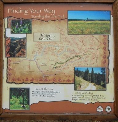
3. Finding Your Way
Traveling the Lolo Trail
Protect the Land Please protect our historic landscape. Use motorized and mechanized vehicles only were permitted.
Enjoy Your Stay It you need help discovering the Lolo Trail, guided tours are available.
Contact your local Ranger District for a list of outfitters.
Photos: (clockwise from the top right) Bald Man.; Brilliant colors along the Lolo Trail; Whitebark Pine; Early Winter on the Lolo Trail; Sinque Hole
Credits. This page was last revised on June 15, 2020. It was originally submitted on October 10, 2019, by Barry Swackhamer of Brentwood, California. This page has been viewed 161 times since then and 13 times this year. Photos: 1, 2, 3. submitted on October 10, 2019, by Barry Swackhamer of Brentwood, California.

