Taming the Wild River
— Great River Road Minnesota —
Front
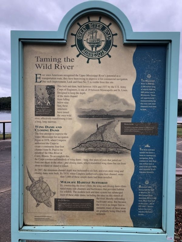
Ever since Americans recognized the Upper Mississippi River's potential as a transportation route, they have been trying to improve it for commercial navigation. One such improvement, Lock and Dam No.7, is visible from this site.
This lock and dam, built between 1934 and 1937 by the U.S. Army Corps of Engineers, is one of 29 between Minneapolis and St. Louis. Designed to keep the depth of the main channel from falling below nine feet, these structures have tamed the once-wild river, effectively transforming it into a long, long stairway.
Wing Dams and Closing Dams
The first attempt to improve the Upper Mississippi for navigation began in 1878, when Congress authorized the Corps to create a continuous four-foot channel from St. Paul to the mouth of the Ohio River at Cairo, Illinois. To accomplish this, the Corps constructed hundreds of wing dams -long, thin piers of rock that jutted out from one shore or the other- and closing dams, which resembled wing dams but ran from shore to island or island to island.
In 1907, the minimum channel depth was increased to six feet, and even more wing and closing dams were built. By 1930,when Congress authorized a nine-foot channel, more than 1,000 of these simple dams had been installed.
Wildlife Habitat Suffered
By constricting
the river's flow, the wing and closing dams eliminated many side channels and backwaters that provided habitat for wildlife. The modern lock and dam system has submerged most of these older dams, including the ones on this stretch of the river, thereby reflooding backwater areas. But because the river is no longer free to meander, many of these areas are gradually being filled with sediment.The Mississippi River is 3800 km (2,350 miles) long of which 1050 km (660 miles) are, in Minnesota. These are approximate measurements, for the river cuts new channels from time to time.
The lock and dam system has been a boon to commercial navigation. River commerce, less than one million tons a year in the mid-1920s, now exceeds 70 million tons annually.
Between Lake Itasca and the Gulf of Mexico, the Mississippi River descends 454 m (1,488 feet). More than half of that drop 261 m (857 feet) - occurs before the river reaches the Iowa border.
Back
On the Water
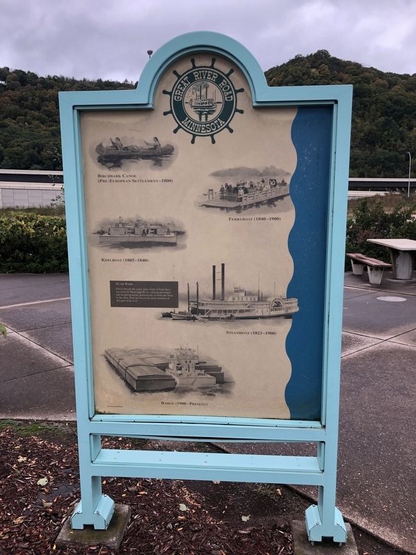
Down through the years, many kinds of boats have travelled the Mississippi River, carrying passengers and freight upstream, downstream, or from one shore to the other. Here are five of the most common on this part of the river.
Birchbark Canoe (Pre-European Settlement - 1800)
Ferryboat (1840 - 1900)
Keelboat (1805 - 1840)
Steamboat (1823 - 1900)
Barge
(1900 - Present)Erected 1988 by State of Minnesota Department of Natural Resources.
Topics and series. This historical marker is listed in these topic lists: Industry & Commerce • Settlements & Settlers • Waterways & Vessels. In addition, it is included in the Minnesota Great River Road series list. A significant historical year for this entry is 1934.
Location. 43° 51.58′ N, 91° 18.279′ W. Marker is near Dresbach, Minnesota, in Winona County. Marker is on Interstate 90 at milepost 275. Marker is at the westbound Dresbach Travel Information Center/Rest Area. Touch for map. Marker is in this post office area: La Crescent MN 55947, United States of America. Touch for directions.
Other nearby markers. At least 8 other markers are within 4 miles of this marker, measured as the crow flies. Symbol of America (a few steps from this marker); Minnesota’s “Fashionable Tour” / Welcome to Minnesota (within shouting distance of this marker); Theodore Foss Memorial Highway (within shouting distance of this marker); Major General C.C. Washburn (approx. 1.7 miles away in Wisconsin); The Upper Mississippi (approx. 1.7 miles away in Wisconsin); Wisconsin Veterans Memorial Highway (approx. 1.7 miles away in Wisconsin); The Development of Copeland Avenue (approx. 3.2 miles away in Wisconsin); George and Gohres (approx. 3.3 miles away in Wisconsin). Touch for a list and map of all markers in Dresbach.
Credits. This page was last revised on October 12, 2019. It was originally submitted on October 11, 2019, by Ruth VanSteenwyk of Aberdeen, South Dakota. This page has been viewed 184 times since then and 13 times this year. Photos: 1, 2, 3. submitted on October 11, 2019, by Ruth VanSteenwyk of Aberdeen, South Dakota. 4. submitted on October 12, 2019, by Ruth VanSteenwyk of Aberdeen, South Dakota. • Mark Hilton was the editor who published this page.


