Wellfleet in Barnstable County, Massachusetts — The American Northeast (New England)
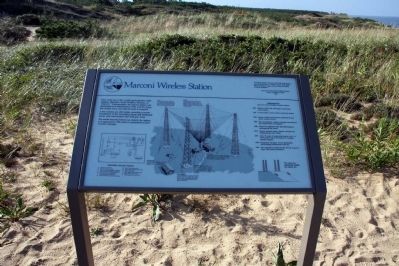
Marconi Wireless Station
A few remains are still visible, including concrete foundations for the transmitter house and northwest tower, and sand anchors that held guy wires.
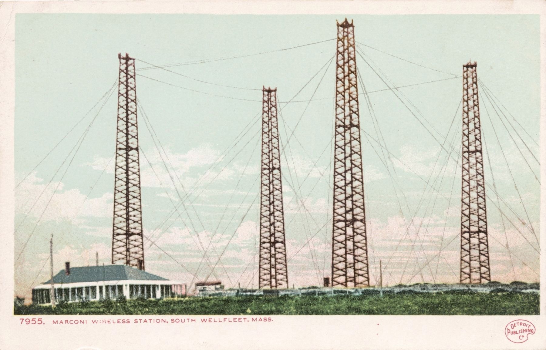
The model encased behind you depics the station as it appeared in 1903 when it transmitted its first overseas message.
(the model has been removed)
Transmitter schematic diagram
A - Alternator, 60 cycle
B - 110 Volt storage battery
C - High tension transmitter condenser
G - 110 volt battery charging generator
H - Oscillating circuit inductance
J - Antenna tuning inductance
K - Tape machine for automatic key
M - Rotary spark gap motor
N - Main high-voltage keying relay
R - Rotary spark gap
T - Main high-voltage transformer
U – Radio frequency chokes
V - Rotary gap motor start box
[caption – center, drawing of the station]
Tower
Four towers built almost entirely of 3” X 12” number provided support for the antenna. Each stood 210 feet high (64m). The towers stood on concrete bases, two of which are still in place.
Antenna
The wire antenna was shaped like an inverted pyramid. At the top was a square of heavy, stranded, copper wire. Attached to this were 200 smaller wires which converged in midair just above the transmitter house.
Headquarters
A manager, two engineers, and three operators lived in his large frame building. No trace of it remains.
Powerhouse
A 45-horsepower kerosene engine generator supplied 2,200 volts AC to a Tesla transformer which stepped it up to 20,000 volts. A smaller DC generator kept batteries charged.
Transmitter house
Here at the heart of the station were the 20,000 volt condenser, antenna tuning coil, and the whirling spark gap rotor which could be heard 4 miles (6km) downwind. The foundation is still visible.
Tower rigging
Twelve steel cables 1” (2.6cm) in diameter secured each tower against high winds. The guy wires were anchored to “dead men” of crossed timbers buried 8 feet (2.4m) in the sand.
[Upper right]
“The huge towers, the roar of the old spark-gapper, the excitement of wireless contact with some distant listener are gone forever from the dunes South Wellfleet.”
Marconi and his South Wellfleet Wireless
Cape
Cod History Guide
1969
Chronology
Marconi’s South Wellfleet Wireless Station
1901 – Marconi selects site in begins construction of the station.
1901 – In November a severe storm wrecked the station.
1902 – Station rebuilt with antenna supported by four heavy wooden towers.
1903 – First transatlantic wireless message sent between the United States and England.
1906 – Marconi’s engineers warned that cliff erosion is endangering the station.
1912 – Station operator hears a distant call from the sinking luxury liner Titanic.
1917 – After fifteen years of commercial service, the U.S. Government closes the station for wartime security reasons.
1920 – Equipment salvaged, towers dismantled, and buildings abandoned to the sea.
1961 – Site acquired by National Park Service as part of Cape Cod national seashore.
[picture showing beach erosion] The ocean has extensively eroded the station site.
Erected by National Park Service.
Topics. This historical marker is listed in these topic lists: Communications • Industry & Commerce • Science & Medicine. A significant historical year for this entry is 1920.
Location. Marker has been reported missing. It was located near 41° 54.838′ N, 69° 58.291′ W. Marker was in Wellfleet, Massachusetts, in Barnstable County. Marker could be reached from Marconi Station Road. Drive to the end of the Marconi Station Road and park in the lot. Follow the path to the marker. Touch for map. Marker was in this post office area: Wellfleet MA 02667, United States of America. Touch for directions.
Other nearby markers. At least 8 other markers are within 4 miles of this location, measured as the crow flies. Transatlantic Wireless Telegraph Station (here, next to this marker); Guglielmo Marconi (within shouting distance of this marker); The Outer Cape: Changing Faster Than Technology (within shouting distance of this marker); Cape Cod National Sea Shore Marconi Beach (approx. 1.6 miles away); Timothy Daniels House (approx. 3.4 miles away); Hamblen Park (approx. 3.4 miles away); Keeping the Light for 114 Years (approx. 3.8 miles away); Nauset Beach Light Station (approx. 3.8 miles away). Touch for a list and map of all markers in Wellfleet.
Also see . . .
1. Guglielmo Marconi. (Submitted on October 14, 2014, by Byron Hooks of Sandy Springs, Georgia.)
2. WCC (radio station). (Submitted on October 14, 2014, by Byron Hooks of Sandy Springs, Georgia.)
3. Morse code. (Submitted on October 14, 2014, by Byron Hooks of Sandy Springs, Georgia.)
4. RMS Titanic. (Submitted on October 14, 2014, by Byron Hooks of Sandy Springs, Georgia.)
5. Marconi Company. (Submitted on October 14, 2014, by Byron Hooks of Sandy Springs, Georgia.)
Credits. This page was last revised on November 29, 2023. It was originally submitted on October 14, 2014, by Byron Hooks of Sandy Springs, Georgia. This page has been viewed 744 times since then and 38 times this year. Last updated on October 15, 2019, by Alan M. Perrie of Unionville, Connecticut. Photos: 1. submitted on October 14, 2014, by Byron Hooks of Sandy Springs, Georgia. 2. submitted on April 20, 2018. • Michael Herrick was the editor who published this page.
Editor’s want-list for this marker. Wide shot of the marker in context. • Can you help?

