St. Marys in Camden County, Georgia — The American South (South Atlantic)
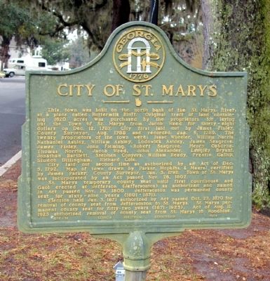
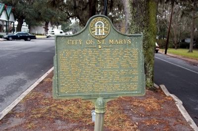
City of St. Marys
The city was laid out a second time as authorized by Act of Dec. 5, 1792. Map of town drawn by Parker, Hopkins, and Meers, certified by James Parker, County Surveyor, Jan. 3, 1792. The town of St. Marys was incorporated by an Act passed Nov. 26, 1802.
St. Marys was the temporary county seat until the first courthouse and Gaol (jail) was erected at Jefferson (Jeffersonton) as authorized and named in Act passed Nov. 29, 1800. Jeffersonton was the permanent county for sixty-nine years (1801- 1871).
An election held Jan. 3, 1871 authorized by an Act passed on Oct. 27, 1870 for removal of county seat from Jeffersonton to St. Marys. St. Marys was the first permanent county seat for fifty-two years (1871- 1923). An Act of Aug. 11, 1923 authorized the removal of the county seat from St. Marys to Woodbine.
Erected 1954 by Georgia Historical Commission. (Marker Number 020-10.)
Topics and series. This historical marker is listed in these topic lists: Colonial Era • Industry & Commerce • Law Enforcement. In addition, it is included in the Georgia Historical Society series list. A significant historical date for this entry is January 5, 1800.
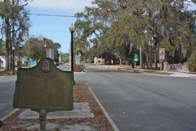
Location. 30° 43.561′ N, 81° 32.839′ W. Marker is in St. Marys, Georgia, in Camden County. Marker is at the intersection of Osborne Street (Georgia Route 40) and Dillingham Street, in the median on Osborne Street. Touch for map. Marker is in this post office area: Saint Marys GA 31558, United States of America. Touch for directions.
Other nearby markers. At least 8 other markers are within walking distance of this marker. Spanish Occupation of Georgia (here, next to this marker); First Presbyterian Church (about 400 feet away, measured in a direct line); St. Marys Methodist Church Established 1799-1800 (about 500 feet away); Washington Pump & Oak (about 500 feet away); George Washington Oak Tree Site (about 500 feet away); Clark-Bessant House (about 700 feet away); Orange Hall (about 700 feet away); First Pecan Trees Grown Here About 1840 (approx. ¼ mile away). Touch for a list and map of all markers in St. Marys.
Credits. This page was last revised on January 26, 2020. It was originally submitted on December 6, 2008, by David Seibert of Sandy Springs, Georgia. This page has been viewed 2,349 times since then and 37 times this year. Photos: 1. submitted on December 6, 2008, by David Seibert of Sandy Springs, Georgia. 2. submitted on December 7, 2008, by David Seibert of Sandy Springs, Georgia. 3. submitted on March 10, 2013, by Mike Stroud of Bluffton, South Carolina. • Bill Pfingsten was the editor who published this page.


