The Land Run
— The ‘89er Trail —
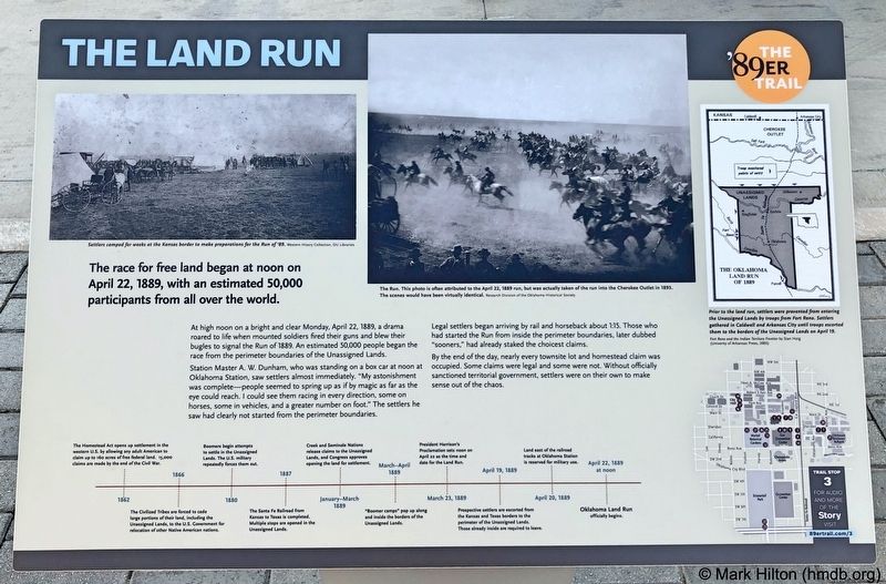
The race for free land began at noon on April 22, 1889, with an estimated 50,000 participants from all over the world.
At high noon on a bright and clear Monday, April 22, 1889, a drama roared to life when mounted soldiers fired their guns and blew their bugles to signal the Run of 1889. An estimated 50,000 people began the race from the perimeter boundaries of the Unassigned Lands.
Station Master A. W. Dunham, who was standing on a box car at noon at Oklahoma Station, saw settlers almost immediately. "My astonishment was complete - people seemed to spring up as if by magic as far as the eye could reach. I could see them racing in every direction, some on horses, some in vehicles, and a greater number on foot." The settlers he saw had clearly not started from the perimeter boundaries.
Legal settlers began arriving by rail and horseback about 1:15. Those who had started the Run from inside the perimeter boundaries, later dubbed "sooners," had already staked the choicest claims.
By the end of the day, nearly every townsite lot and homestead claim was occupied. Some claims were legal and some were not. Without officially sanctioned territorial government, settlers were on their own to make sense out of the chaos.
Photo captions:
Top left: Settlers camped for weeks at the Kansas border
to make preparations for the Run of 89.
Western History Collection, OU Libraries
Middle: The Run. This photo is often attributed to the April 22, 1889 run, but was actually taken of the run into the Cherokee Outlet in 1893.
The scenes would have been virtually identical. Research Division of the Oklahoma Historical Society
Top right: Prior to the land run, settlers were prevented from entering
the Unassigned Lands by troops from Fort Reno. Settlers
gathered in Caldwell and Arkansas City until troops escorted
them to the borders of the Unassigned Lands on April 19. Fort Reno and the Indian Territory Frontier by Stan Hoig (University of Arkansas Press, 2005)
Erected 2018 by Oklahoma City Community Foundation, Wiggin Properties. (Marker Number 3.)
Topics and series. This historical marker is listed in this topic list: Settlements & Settlers. In addition, it is included in the The '89er Trail series list. A significant historical date for this entry is April 22, 1889.
Location. 35° 27.971′ N, 97° 30.774′ W. Marker is in Oklahoma City, Oklahoma, in Oklahoma County. It is in Central Oklahoma City. Marker is at the intersection of South EK Gaylord
Other nearby markers. At least 8 other markers are within walking distance of this marker. The Building of Oklahoma City (within shouting distance of this marker); Ray Ackerman Dancing Fountains (within shouting distance of this marker); a different marker also named The Land Run (about 400 feet away, measured in a direct line); City Hall by Forfeiture (about 500 feet away); A Summer of Political Unrest (about 500 feet away); Hell's Half Acre (about 500 feet away); Angelo C. Scott (about 600 feet away); The Election of May 1, 1889 (about 600 feet away). Touch for a list and map of all markers in Oklahoma City.
Also see . . . Wikipedia entry on the Land Rush of 1889. (Submitted on October 31, 2019, by Mark Hilton of Montgomery, Alabama.)
Credits. This page was last revised on February 16, 2023. It was originally submitted on October 29, 2019, by Mark Hilton of Montgomery, Alabama. This page has been viewed 287 times since then and 46 times this year. Photos: 1, 2. submitted on October 29, 2019, by Mark Hilton of Montgomery, Alabama.

