Saint John in Saint John County, New Brunswick — The Atlantic Provinces (North America)
Simonds, Hazen and White
A Partnership / Un partenariat
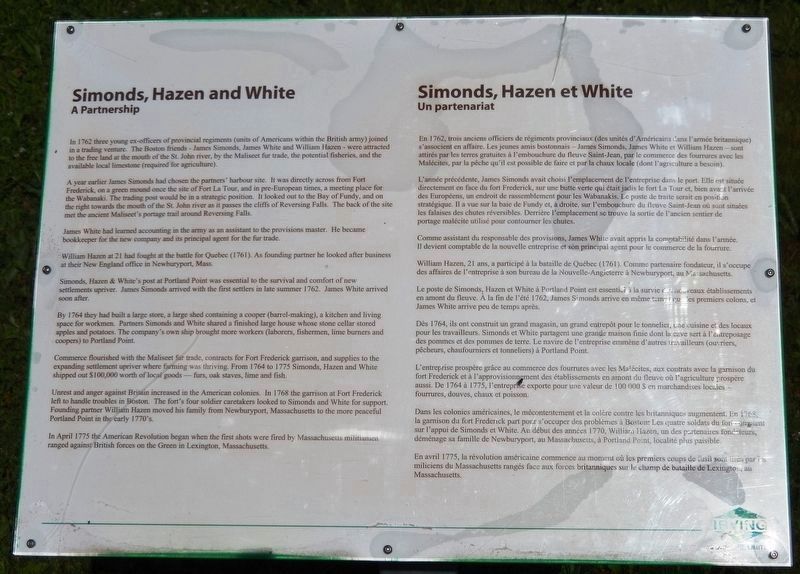
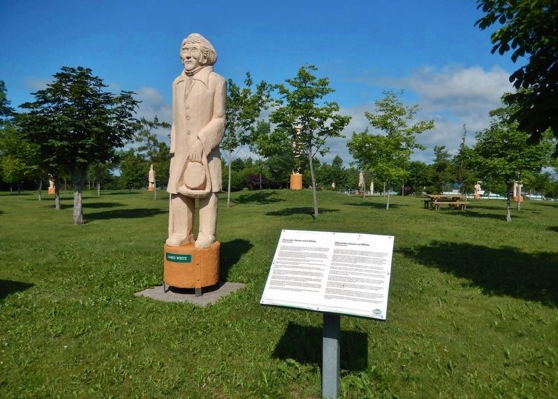
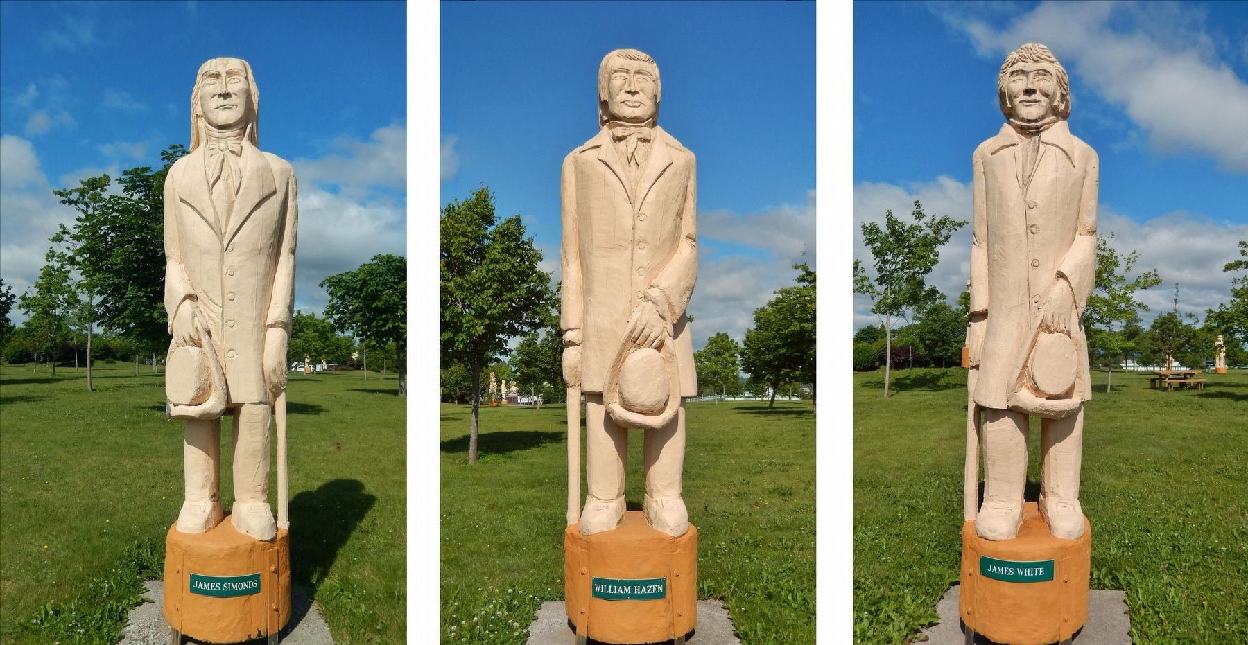
In 1762 three young ex-officers of provincial regiments (units of Americans within the British army) joined in a trading venture. The Boston friends - James Simonds, James White and William Hazen - were attracted to the free land at the mouth of the St. John River, by the Maliseet fur trade, the potential fisheries, and the available local limestone (required for agriculture).
A year earlier James Simonds had chosen the partners' harbour site. It was directly across from Fort Frederick, on a green mound once the site of Fort La Tour, and in pre-European times, a meeting place for the Wabanaki. The trading post would be in a strategic position. It looked out to the Bay of Fundy, and on the right towards the mouth of the St. John River as it passes the cliffs of Reversing Falls. The back of the site met the ancient Maliseet's portage trail around Reversing Falls.
James White had learned accounting in the army as an assistant to the provisions master. He became bookkeeper for the new company and its principal agent for the fur trade.
William Hazen at 21 had fought at the battle for Quebec (1761). As founding partner he looked after business at their New England office in Newburyport, Mass.
Simonds, Hazen & White's post at Portland Point was essential to the survival and comfort of new settlements upriver. James Simonds arrived with the first settlers in late summer 1762. James White arrived soon after.
By 1764 they had built a large store, a large shed containing a cooper (barrel-making), a kitchen and living space for workmen. Partners Simonds and White shared a finished large house whose stone cellar stored apples and potatoes. The company's own ship brought more workers (laborers, fishermen, lime burners and coopers) to Portland Point.
Commerce flourished with the Maliseet fur trade, contracts for Fort Frederick garrison, and supplies to the expanding settlement upriver where farming was thriving. From 1764 to 1775 Simonds, Hazen and White shipped out $100,000 worth of local goods — furs, oak staves, lime and fish.
Unrest and anger against Britain increased in the American colonies. In 1768 the garrison at Fort Frederick left to handle troubles in Boston. The fort's four soldier caretakers looked to Simonds and White for support. Founding partner William Hazen moved his family from Newburyport, Massachusetts to the more peaceful Portland Point in the early 1770's.
In April 1775 the American Revolution
began when the first shots were fired by Massachusetts militiamen ranged against British forces on the Green in Lexington, Massachusetts.
En 1762, trois anciens officiers de régiments provinciaux (des unités d'Américains dans l'armée britannique) s'associent en affaire. Les jeunes amis bostonnais — James Simonds, James White et William Hazen — sont attirés par les terres gratuites à l'embouchure du fleuve Saint-Jean, par le commerce des fourrures avec les Malécites, par la pêche qu'il est possible de faire et par la chaux locale (dont l'agriculture a besoin).
L'année précédente, James Simonds avait choisi l'emplacement de l'entreprise dans le port. Elle est située directement en face du fort Frederick, sur une butte verte qui était jadis le fort La Tour et, bien avant l'arrivée des Européens, un endroit de rassemblement pour les Wabanakis. Le poste de traite serait en position stratégique. Il a vue sur la baie de Fundy et, à droite, sur l'embouchure du fleuve Saint-Jean où sont situées les falaises des chutes réversibles. Derrière l'emplacement se trouve la sortie de l'ancien sentier de portage malécite utilisé pour contourner les chutes.
Comme assistant du responsable des provisions, James White avait appris la comptabilité dans l'armée. Il devient comptable de la nouvelle entreprise et son principal agent
pour le commerce de la fourrure.
William Hazen, 21 ans, a participé à la bataille de Québec (1761). Comme partenaire fondateur, il s'occupe des affaires de l'entreprise à son bureau de la Nouvelle-Angleterre à Newburyport, au Massachusetts.
Le poste de Simonds, Hazen et White à Portland Point est essentiel à la survie des nouveaux établissements en amont du fleuve. A la fin de l'été 1762, James Simonds arrive en même temps des premiers colons, et James White arrive peu de temps après.
Dès 1764, ils ont construit un grand magasin, un grand entrepôt pour le tonnelier, une cuisine et des locaux pour les travailleurs. Simonds et White partagent une grande maison finie dont la cave sert à l'entreposage des pommes et des pommes de terre. Le navire de l'entreprise emmène d'autres travailleurs (ouvriers, pêcheurs, chaufourniers et tonneliers) à Portland Point.
L'entreprise prospère grâce au commerce des fourrures avec les Malécites, aux contrats avec la garnison du fort Frederick et à l'approvisionnement des établissements en amont du fleuve où l'agriculture prospère aussi. De 1764 à 1775, l'entreprise exporte pour une valeur de 100 000 $ en marchandises locales —fourrures, douves, chaux et poisson.
Dans les colonies américaines, le mécontentement et la colère contre les britanniques augmentent. En 1768, la garnison du fort Frederick part pour s'occuper des problèmes à Boston. Les quatre soldats du fort comptent sur l'appui de Simonds et White. Au début des années 1770, William Hazen, un des partenaires fondateurs, déménage sa famille de Newburyport, au Massachusetts, à Portland Point, localité plus paisible.
En avril 1775, la révolution américaine commence au moment où les premiers coups de fusil sont tiré par les miliciens du Massachusetts rangés face aux forces britanniques sur le champ de bataille de Lexington, au Massachusetts.
Erected by J.D. Irving, Limited.
Topics. This historical marker is listed in these topic lists: Colonial Era • Industry & Commerce • Settlements & Settlers • Waterways & Vessels. A significant historical year for this entry is 1762.
Location. 45° 15.407′ N, 66° 5.388′ W. Marker is in Saint John, New Brunswick, in Saint John County. Marker can be reached from Lancaster Avenue, 0.2 kilometers east of Bridge Road (New Brunswick Route 100), on the left when traveling east. Marker is located along the walking path in Wolastoq Park, near the center of the park. Touch for map. Marker is at or near this postal address: 211 Lancaster Avenue, Saint John NB E2M 2K8, Canada. Touch for directions.
Other nearby markers. At least 8 other markers are within walking distance of this marker. Rebels Attack (a few steps from this marker); K.C. Irving (within shouting distance of this marker); Colonel Gabriel G. Ludlow (within shouting distance of this marker); The New Community of Saint John (within shouting distance of this marker); Benedict Arnold (within shouting distance of this marker); William Kilby Reynolds (within shouting distance of this marker); Charles Gorman (within shouting distance of this marker); John Robertson (within shouting distance of this marker). Touch for a list and map of all markers in Saint John.
Related markers. Click here for a list of markers that are related to this marker. Wolastoq Park
Credits. This page was last revised on November 2, 2019. It was originally submitted on October 31, 2019, by Cosmos Mariner of Cape Canaveral, Florida. This page has been viewed 346 times since then and 26 times this year. Photos: 1, 2, 3. submitted on November 1, 2019, by Cosmos Mariner of Cape Canaveral, Florida.


