Kendall-Whittier in Tulsa in Tulsa County, Oklahoma — The American South (West South Central)
Admiral Place
— Tulsa's Historic Route 66 —
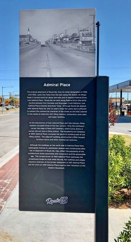
At the intersection of East Admiral Place and Yale Avenue, filling stations occupied three of the four corners. Only the northwest corner, the edge of Rose Hill Cemetery, where Cyrus Avery is buried, did not have a filling station. The Daugherty Ice Company. at 4915 Admiral Place, occupied the low brick building east of one filling station. The adjacent building, constructed c.1934, housed furniture stores and other commercial ventures.
Although the buildings on the north side of Admiral Place from Indianapolis Avenue to Jamestown Avenue were constructed after the re-alignment of Route 66, they reflect the popularity of the architectural styles associated with movement and
the automobile age. The curved corner of 3401 Admiral Place expresses the streamlined moderne style while the low, flat rooflines and simple masonry exteriors of the former restaurant at 3411 Admiral Place and the store at 3419 Admiral Place express later iterations of the Modern Movement.Erected 2019 by Tulsa Route 66 Commission. (Marker Number 20.)
Topics and series. This historical marker is listed in these topic lists: Architecture • Industry & Commerce • Roads & Vehicles. In addition, it is included in the U.S. Route 66 series list. A significant historical year for this entry is 1926.
Location. 36° 9.642′ N, 95° 56.484′ W. Marker is in Tulsa, Oklahoma, in Tulsa County. It is in Kendall-Whittier. Marker is at the intersection of East Admiral Place North and North Harvard Avenue, on the right when traveling east on East Admiral Place North. Touch for map. Marker is at or near this postal address: 3230 East Admiral Place North, Tulsa OK 74115, United States of America. Touch for directions.
Other nearby markers. At least 8 other markers are within one mile of this marker, measured as the crow flies. In Recognition of Elizabeth Russell Sullivan (approx. 0.6 miles away); Confederate Memorial (approx. 0.6 miles away); Wolf Robe Hunt's Indian Trading Post (approx. 0.9 miles away); The University of Tulsa. (approx. 0.9 miles away);
Whittier Square (approx. 0.9 miles away); a different marker also named Whittier Square (approx. 0.9 miles away); Bama Pie Company (approx. one mile away); Casa Loma Hotel (Campbell Hotel) (approx. 1.1 miles away). Touch for a list and map of all markers in Tulsa.
Credits. This page was last revised on February 16, 2023. It was originally submitted on November 6, 2019, by Mark Hilton of Montgomery, Alabama. This page has been viewed 661 times since then and 85 times this year. Photos: 1, 2, 3. submitted on November 6, 2019, by Mark Hilton of Montgomery, Alabama.


