Near Mechanicsville in Hanover County, Virginia — The American South (Mid-Atlantic)
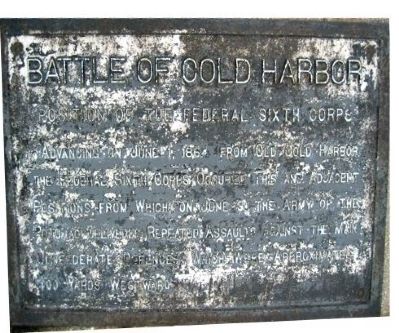
Battle of Cold Harbor
Position of the Federal Sixth Corps
Erected by Battlefield Markers Association. (Marker Number 25.)
Topics and series. This historical marker is listed in this topic list: War, US Civil. In addition, it is included in the Freeman Markers (Richmond Battlefields) series list. A significant historical month for this entry is June 1845.
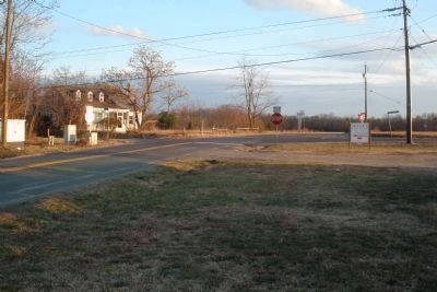
Location. 37° 35.309′ N, 77° 16.9′ W. Marker is near Mechanicsville, Virginia, in Hanover County. Marker is on Cold Harbor Road (Route 156), on the right when traveling west. Located 300 feet west of the Cold Harbor National Cemetery just outside the Cold Harbor unit of the Richmond National Battlefield Park. Touch for map. Marker is in this post office area: Mechanicsville VA 23111, United States of America. Touch for directions.
Other nearby markers. At least 8 other markers are within walking distance of this marker. Pennsylvania Monument (about 400 feet away, measured in a direct line); Eighth N. Y. Heavy Artillery (about 400 feet away); Keep Digging (about 600 feet away); A Captured Trench (about 600 feet away); We Have Broken Through (about 600 feet away); Keep Your Head Down (about 600 feet away); Tomb of the Unknown Soldier (about 600 feet away); A Bloody Baptism of Fire (about 600 feet away). Touch for a list and map of all markers in Mechanicsville.
Also see . . .
1. Cold Harbor Battlefield. Civil War Preservation Trust listed the battlefield as on of the most endangered sites in 2008. (Submitted on December 8, 2008, by Craig Swain of Leesburg, Virginia.)
2. The Battle of Cold Harbor. (Submitted on December 8, 2008, by Craig Swain of Leesburg, Virginia.)
3. Cold Harbor Battlefield Virtual Tour by Markers. This is one of the many markers along the walking trail, extended loop trail, and auto tour route in the Cold Harbor Battlefield Unit of the Richmond National Battlefield Park. (Submitted on March 9, 2009, by Bernard Fisher of Richmond, Virginia.)
Additional keywords. Freeman Markers, Richmond Battlefield Parks Corporation, Douglas Southall Freeman

Photographed By Bernard Fisher, January 20, 2009
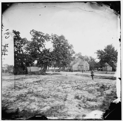
3. Old Cold Harbor Crossroads (facing south).
This modern structure is near the site of the Burnett's Inn at Cold Harbor, ½ mile east of this marker. On May 31, 1864 Torbert's Federal Cavalry gained control of this key intersection. The following day Confederate infantry failed to retake this vital crossroads (casualties: 300).
Credits. This page was last revised on June 16, 2016. It was originally submitted on December 8, 2008, by Bernard Fisher of Richmond, Virginia. This page has been viewed 2,298 times since then and 40 times this year. Photos: 1, 2. submitted on December 8, 2008, by Bernard Fisher of Richmond, Virginia. 3. submitted on January 20, 2009, by Bernard Fisher of Richmond, Virginia. 4. submitted on March 27, 2009, by Bernard Fisher of Richmond, Virginia. • Craig Swain was the editor who published this page.


