Near Atlee in Hanover County, Virginia — The American South (Mid-Atlantic)
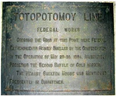
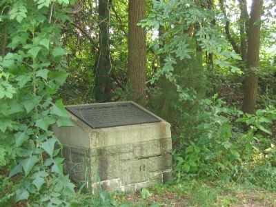
Totopotomoy Line
Federal Works
Erected by Battlefield Markers Association. (Marker Number 51.)
Topics and series. This historical marker is listed in this topic list: War, US Civil. In addition, it is included in the Freeman Markers (Richmond Battlefields) series list. A significant historical date for this entry is May 29, 1865.
Location. 37° 39.673′ N, 77° 20.926′ W. Marker is near Atlee, Virginia, in Hanover County. Marker can be reached from Studley Road, 0.8 miles east of Avondale Drive, on the right when traveling east. Located alongside a steep pullover. Use extreme caution when leaving or entering Studley Road. Touch for map. Marker is in this post office area: Mechanicsville VA 23116, United States of America. Touch for directions.
Other nearby markers. At least 8 other markers are within walking distance of this marker. Lives on the Line (about 400 feet away, measured in a direct line); Totopotomoi (about 600 feet away); Damaged but not Destroyed (about 600 feet away); Rural Plains (about 700 feet away); Totopotomoy Creek (about 700 feet away); Digging In Under Fire (about 800 feet away); a different marker also named Totopotomoy Line (approx. 0.4 miles away); Attacking the High Ground (approx. 0.6 miles away).
Also see . . .
1. Totopotomoy Creek Battlefield at Rural Plains. Richmond National Battlefield Park (Submitted on November 29, 2014.)
2. The Battle of Totopotomoy Creek, May 29-31, 1864. Richmond National Battlefield Park (Submitted on November 29, 2014.)
Additional keywords. Freeman Markers, Richmond Battlefield Parks Corporation, Douglas Southall Freeman
Credits. This page was last revised on June 16, 2016. It was originally submitted on December 8, 2008, by Bernard Fisher of Richmond, Virginia. This page has been viewed 1,704 times since then and 35 times this year. Photos: 1, 2. submitted on December 8, 2008, by Bernard Fisher of Richmond, Virginia. 3. submitted on July 9, 2009, by Bernard Fisher of Richmond, Virginia. • Craig Swain was the editor who published this page.


