Near Jenkinsville in Fairfield County, South Carolina — The American South (South Atlantic)
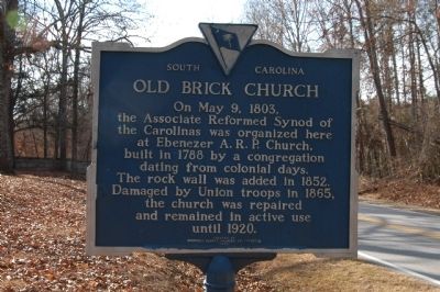
Old Brick Church
American Presbyterian and Reformed Historical Site
Erected 1962 by Fairfield County Chamber of Commerce. (Marker Number 20-2 / 272.)
Topics and series. This historical marker is listed in these topic lists: Cemeteries & Burial Sites • Churches & Religion • War, US Civil. In addition, it is included in the American Presbyterian and Reformed Historic Sites series list. A significant historical month for this entry is May 1865.
Location. 34° 19.177′ N, 81° 15.649′ W. Marker is near Jenkinsville, South Carolina, in Fairfield County. Marker is on Monjicono Road (State Highway 213) half a mile west of Landis Road, on the left when traveling west. Touch for map. Marker is in this post office area: Jenkinsville SC 29065, United States of America. Touch for directions.
Other nearby markers. At least 8 other markers are within 8 miles of this marker, measured as the crow flies. Kincaid-Anderson House (approx. 1.1 miles away); Industry Evolution on the Broad River (approx. 1½ miles away); a different marker also named Industry Evolution on the Broad River (approx. 1½ miles away); Nuclear Power (approx. 4½ miles away); The Oaks (approx. 4.8 miles away); Peak (approx. 6½ miles away); Hope Rosenwald School (approx. 6.8 miles away); St. John's Church (approx. 7.8 miles away).
Regarding Old Brick Church. The Ebenezer Associate Reformed Presbyterian Church was listed in the National Register of Historic Places in 1971. This church is also one of 445 American Presbyterian and Reformed Historical Sites registered between 1973 and 2003 by the Presbyterian Historical Society (PHS), headquartered in Philadelphia. Approved sites received a metal plaque featuring John Calvin’s seal and the site’s registry number (PHS marker location unknown).
The following text is taken from the Presbyterian Historical Society website:
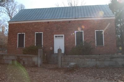
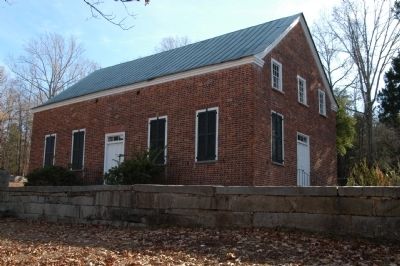
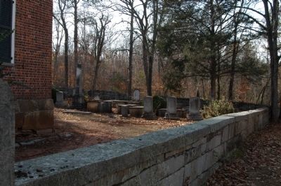
Usually known as “the Brick Church,” the present building was constructed in 1788. It was the first brick house of worship in the area. The Associate Reformed Synod of the Carolinas was organized here in 1803, and James Rogers, the church’s minister, was elected the first moderator. In 1852, the church and the cemetery were enclosed by a granite wall. In the Civil War, much of the flooring and the woodwork were removed by Union troops to rebuild a nearby bridge. After the war, the congregation declined, surviving only until 1920. The site was placed on the National Register of Historic Places in 1971. The present owner is the Catawba Presbytery, ARPC, and an annual commemorative service is held here in October.
Also see . . . South Carolina Department of Archives and History. (Submitted on December 10, 2008, by Michael Sean Nix of Spartanburg, South Carolina.)
Credits. This page was last revised on August 5, 2021. It was originally submitted on December 9, 2008, by Michael Sean Nix of Spartanburg, South Carolina. This page has been viewed 2,297 times since then and 47 times this year. Last updated on August 16, 2018, by Douglass Halvorsen of Klamath Falls, Oregon. Photos: 1, 2, 3, 4, 5. submitted on December 9, 2008, by Michael Sean Nix of Spartanburg, South Carolina. • Bernard Fisher was the editor who published this page.


