Manalapan Township in Monmouth County, New Jersey — The American Northeast (Mid-Atlantic)
The British Rush the Hedgerow
The Battle of Monmouth
— 28 June 1778. 12:45 PM - 1:00 PM —
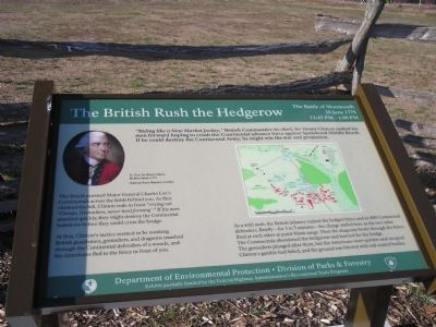
The British pursued Major General Charles Lee’s Continentals across the fields behind you. As they climbed the hill, Clinton rode in front “crying out ‘Charge, Grenadiers, never heed forming’.” If his men attacked quickly, they might destroy the Continental battalions before they could cross the bridge.
At first, Clinton’s tactics seemed to be working. British guardsmen, grenadiers, and dragoons smashed through the Continental defenders of a woods, and the Americans fled to the fence in front of you.
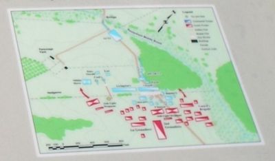
As a wild mob, the British infantry rushed the hedged fence and its 800 Continental defenders. Briefly – for 3 to 5 minutes – the charge stalled here as the two sides fired at each other at point-blank range. Then the dragoons broke through the fence. The Continentals abandoned the hedgerow and hurried for the bridge. The grenadiers plunged after them, but the Americans were quicker and escaped. Clinton’s gamble had failed, and the ground was littered with red-coated bodies.
Erected by NJ Department of Environmental Protection – Division of Parks & Forestry.
Topics. This historical marker is listed in these topic lists: Notable Events • Notable Places • War, US Revolutionary.
Location. 40° 16.157′ N, 74° 18.664′ W. Marker is in Manalapan Township, New Jersey, in Monmouth County. Marker can be reached from Freehold Road (County Route 522), on the right when traveling east. Marker is located on the Monmouth Battlefield hiking trail. Touch for map. Marker is in this post office area: Englishtown NJ 07726, United States of America. Touch for directions.
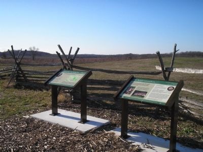
Other nearby markers. At least 8 other markers are within walking distance of this marker. The British Grenadiers (here, next to this marker); Hold the Hedgerow! (about 800 feet away, measured in a direct line); Retreat? (approx. 0.3 miles away); Washington Checked Lee’s Retreat (approx. 0.3 miles away); Molly Pitcher (approx. 0.3 miles away); Battle at the Parsonage (approx. 0.6 miles away); a different marker also named Molly Pitcher (approx. 0.6 miles away); Monmouth Battlefield State Park (approx. 0.6 miles away). Touch for a list and map of all markers in Manalapan Township.
More about this marker. The upper left of the marker contains a portrait of Lt.-Gen. Sir Henry Clinton by John Smart, 1777, courtesy of the National Army Museum, London. The right of the marker
contains a battle map.
Also see . . .
1. The Battle of Monmouth. New Jersey during the Revolution. (Submitted on December 13, 2008, by Bill Coughlin of Woodland Park, New Jersey.)
2. The Battle of Monmouth, 1778. A British perspective of the Battle of Monmouth on BritishBattles.com. (Submitted on December 13, 2008, by Bill Coughlin of Woodland Park, New Jersey.)
Credits. This page was last revised on February 7, 2023. It was originally submitted on December 13, 2008, by Bill Coughlin of Woodland Park, New Jersey. This page has been viewed 1,269 times since then and 18 times this year. Photos: 1, 2, 3, 4, 5. submitted on December 13, 2008, by Bill Coughlin of Woodland Park, New Jersey.
