Mesquite in Clark County, Nevada — The American Mountains (Southwest)
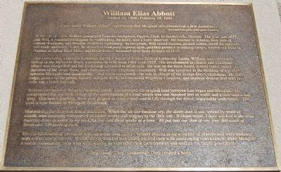
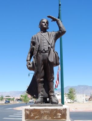
William Elias Abbott
October 16, 1869 – February 19, 1949
It was under William Abbott’s supervision that Mesquite was founded on a firm foundation. —Howard Pulsipher, Mesquite Pioneer.
At the age of eight, William journeyed from his birthplace in Ogden, Utah, to Bunkervile, Nevada. The year was 1877, and Will, a youthful participant in establishing the town, was a keen observer. He listened to debates, took note of critical decisions, and became skilled in diplomacy. In his youth, Will raised melons, picked cotton,, cared for animals, and made molasses. Later, he delivered mail pony express style, peddled produce to mining camps, hauled salt from St. Thomas to Silver Reef mine, and herded three thousand steer from Arizona to Utah.
After completing a mission to Illinois for the Church of Jesus Christ of Latter-day Saints, William was called to be bishop of the Mesquite Ward, a position he held from 1901 until 1927. His involvement in church and community affairs was unequaled and his leadership extended to all people. He was on the town board, school board, board of directors of the grape farm, and chairman of the telephone committee. Will was involved in the building of a bridge between Mesqute and Bunkerville—and when completed—he was in charge of the Bridge Day Celebration. He was a judge, justice of the peace, farmer, delegate to the International Irrigation Congress, and amateur dentist, and with his wife, ran a hotel and café.
William championed the road-building cause He surveyed the original road between Las Vegas and Mesquite. He campaigned for and took charge of the construction of a road which was one hundred feet in width and a mile-and-a-half long. This was a grueling, three year project as even a bird couldn’t fly through the dense, impassable underbrush The road is now known as Mesquite Boulevard.
Maintaining the dam was also a challenge. When the all-too-familiar cry, the damn dam is out, spread by word of mouth, men promptly transported available teams and wagons to the dam site. William wrote, I have worked in the river building dams in water to my neck for two and three weeks at a time. We put into our dam at one time 300 loads of brush and 500 loads of rock.
The establishment of Mesquite was not a one-man effort. Settlers moved in for a variety of reasons and were endowed with a diversity of talents. It tool strong minded and strong-backed men with unwavering conviction to make Mesquite a viable community; men who were willing to surrender their own comfort and welfare for future generations.
They came! They conquered! They created a home!
Erected 2003 by City of Mesquite
.
Topics. This historical marker is listed in these topic lists: Roads & Vehicles • Settlements & Settlers. A significant historical date for this entry is February 19, 1915.
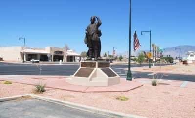
Location. 36° 48.227′ N, 114° 3.992′ W. Marker is in Mesquite, Nevada, in Clark County. Marker is on Mesquite Boulevard, on the right when traveling east. Touch for map. Marker is at or near this postal address: 2 E Mesquite Boulevard, Mesquite NV 89027, United States of America. Touch for directions.
Other nearby markers. At least 5 other markers are within walking distance of this marker. Mary Jane Leavitt Abbott (here, next to this marker); History of Mesquite (here, next to this marker); Tithing Lot (within shouting distance of this marker); Dairy Barn (about 400 feet away, measured in a direct line); Rock House (about 600 feet away). Touch for a list and map of all markers in Mesquite.
Credits. This page was last revised on November 24, 2019. It was originally submitted on June 28, 2007, by Dawn Bowen of Fredericksburg, Virginia. This page has been viewed 3,123 times since then and 67 times this year. Photos: 1, 2, 3, 4. submitted on June 28, 2007, by Dawn Bowen of Fredericksburg, Virginia. • J. J. Prats was the editor who published this page.


