Petersburg in Grant County, West Virginia — The American South (Appalachia)
Welcome to Fort Mulligan Civil War Site
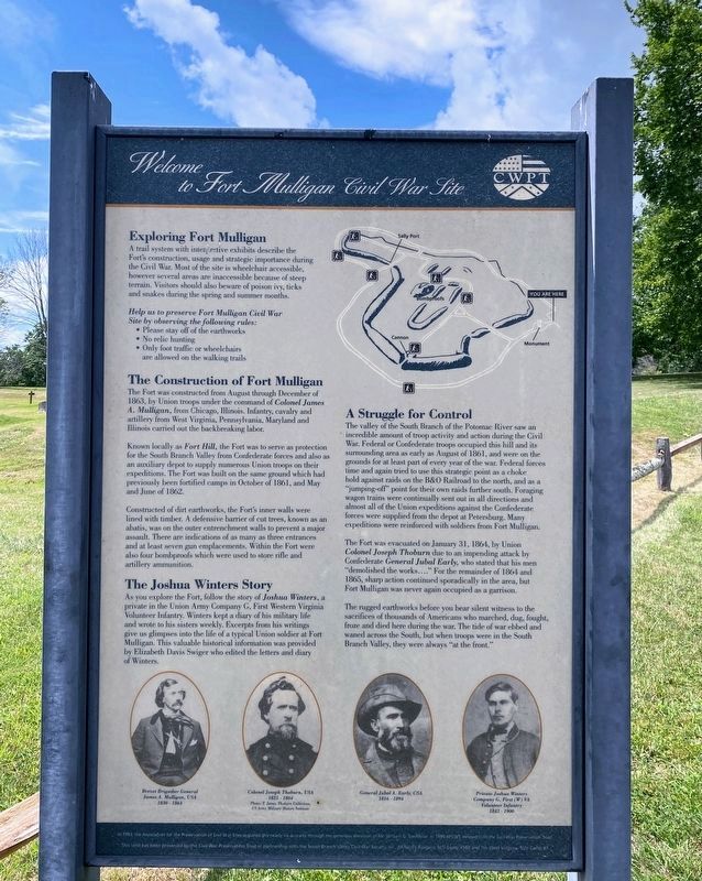
Exploring Fort Mulligan. A trail system with interpretive exhibits describe the Fortís construction, usage and strategic importance during the Civil War. Most of the site is wheelchair accessible, however several areas are inaccessible because of steep terrain. Visitors should also beware of poison ivy, ticks and snakes during the spring and summer months.
Help us to preserve Fort Mulligan Civil War Site by observing the following rules: Please stay off of the earthworks ē No relic hunting ē Only foot traffic or wheelchairs are allowed on the walking trails.
The Construction of Fort Mulligan. The Fort was constructed from August through December of 1863, by Union troops under the command of Colonel James A. Mulligan, from Chicago, Illinois. Infantry, cavalry and artillery from West Virginia, Pennsylvania, Maryland and Illinois carried out the backbreaking labor.
Known locally as Fort Hill, the Fort was to serve as protection for the South Branch Valley from Confederate forces and also as an auxiliary depot to supply numerous Union troops on their expeditions. The Fort was built on the same ground which had previously been fortified camps in October of 1861, and May and June of 1862.
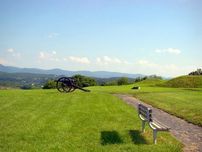
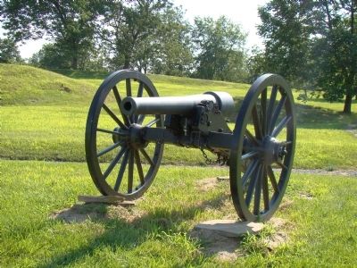
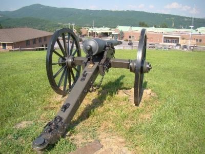
Constructed of dirt earthworks, the Fortís inner walls were lined with timber. A defensive barrier of cut trees, known as an abatis, was on the outer entrenchment walls to prevent a major assault. There are indications of as many as three entrances and at least seven gun emplacements. Within the Fort were also four bombproofs which were used to store rifle and artillery ammunition.
The Joshua Winters Story. As you explore the Fort, follow the story of Joshua Winters, a private in the Union Army Company G, First Western Virginia Volunteer Infantry. Winters kept a diary of his military life and wrote to his sisters weekly. Excerpts from his writings give us glimpses into the life of a typical Union soldier at Fort Mulligan. This valuable historical information was provided by Elizabeth Davis Swiger who edited the letters and diary of Winters.
A Struggle for Control. The valley of the South Branch of the Potomac River saw an incredible amount of troop activity and action during the Civil War. Federal or Confederate troops occupied this hill and its surrounding area as early as August of 1861, and were on the grounds for at least part of every year of the war. Federal forces time and again tried to use this strategic point as a choke hold against raids on the B&O Railroad to the north, and as a “jumping-off” point for their own raids further south. Foraging wagon
Photographed By J. J. Prats, July 15, 2008
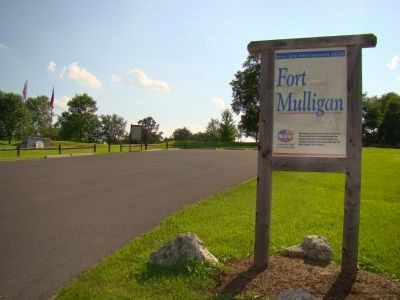
2. Parking Lot, Sign, and Marker
This parking lot is off of the hospitalís parking lot. Marker can be seen in the distance in the center left of the photograph. Sign in the foreground reads “Civil War Preservation Trust. Fort Mulligan. This land has been preserved by the Civil War Preservation Trust in partnership with the South Branch Valley Civil War Society, Inc., McNeillís Rangers, SCV Camp #582 and 7th West Virginia, SUV Camp #7. 1-888-606-1400 www.civilwar.org”
The Fort was evacuated on January 31, 1864, by Union Colonel Joseph Thoburn due to an impending attack by Confederate General Jubal Early, who stated that his men “demolished the works....” For the remainder of 1864 and 1865, sharp action continued sporadically in the area, but Fort Mulligan was never again occupied as a garrison.
The rugged earthworks before you bear silent witness to the sacrifices of thousands of Americans who marched, dug, fought, froze and died here during the war. The tide of war ebbed and waned across the South, but when troops were in the South Branch Valley, they were always “at the front.”
In 1993, the Association for the Preservation of Civil War Sites acquired this nearly six-acre site through generous donations of Mr. William G. Van Meter. In 1999 APCWS merged with the Civil War Preservation Trust. This land has been preserved by the Civil War Preservation Trust in partnership with the South Branch Valley Civil War Society, Inc., McNeillís Rangers, SCV Camp #582 and 7th West Virginia SUV Camp #7.
Erected by
Civil War Preservation Trust.
Topics and series. This historical marker is listed in these topic lists: Forts and Castles • War, US Civil. In addition, it is included in the Sons of Confederate Veterans/United Confederate Veterans series list. A significant historical month for this entry is January 1847.
Location. 39° 0.089′ N, 79° 8.346′ W. Marker is in Petersburg, West Virginia, in Grant County. Marker can be reached from the Grant Memorial Hospital West Parking Lot south of Houghlin Lane (West Virginia Route 55). Touch for map. Marker is in this post office area: Petersburg WV 26847, United States of America. Touch for directions.
Other nearby markers. At least 8 other markers are within walking distance of this marker. The Irish Brigade & the McNeill Rangers / The Civil War Comes to Hardy County (a few steps from this marker); Parrott Rifle (within shouting distance of this marker); The Last Days of Fort Mulligan (within shouting distance of this marker); Civil War Cannons (about 300 feet away, measured in a direct line); Protecting Supplies (about 300 feet away); Defending the Fort (about 400 feet away); A Strategic Location (about 400 feet away); The Impregnable Fortress (about 500 feet away). Touch for a list and map of all markers in Petersburg.
Related markers. Click here for a list of markers that are related to this marker. Fort Mulligan Virtual tour by Markers
Credits. This page was last revised on August 6, 2021. It was originally submitted on December 18, 2008. This page has been viewed 5,707 times since then and 86 times this year. Last updated on August 30, 2020, by Bradley Owen of Morgantown, West Virginia. Photos: 1. submitted on December 17, 2020, by Shane Oliver of Richmond, Virginia. 2, 3, 4, 5. submitted on December 18, 2008, by J. J. Prats of Powell, Ohio. • J. Makali Bruton was the editor who published this page.
