Cumberland Township near Gettysburg in Adams County, Pennsylvania — The American Northeast (Mid-Atlantic)
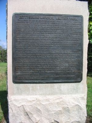
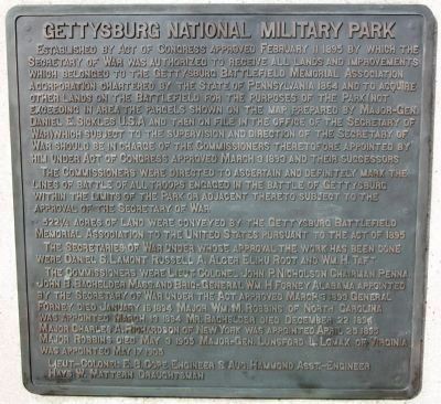
Gettysburg National Military Park
The Commissioners were directed to ascertain and definitely mark the lines of battle of all troops engaged in the battle of Gettysburg within the limits of the Park or adjacent thereto subject to the approval of the Secretary of War.
522 1/4 acres of land were conveyed by the Gettysburg Battlefield Memorial Association to the United States pursuant to the act of 1895.
The Secretaries of War under whose approval the work has been done were Daniel S. Lamont, Russell A. Alger, Elihu Root, and Wm. H. Taft.
The Commissioners were Lieut. Colonel John P. Nicholson, Chairman, Penna., John B. Bachelder, Mass. and Brig-General Wm. H. Forney, Alabama appointed by the Secretary of War under the Act approved March 3, 1893. General Forney died January 16 1894, Major Wm. M. Robbins of North Carolina was appointed March 13 1894. Mr. Bachelder died December 22, 1894. Major Charles A. Richardson of New York was appointed April 25, 1895. Major Robbins died May 3, 1905. Major-Gen. Lunsford L. Lomax of Virginia was appointed May 17, 1905.
Lieut. Colonel E. B. Cope, Engineer S. Aug. Hammond Asst.-Engineer, Hays W. Mattern Draughtsman.
Erected 1908 by Gettysburg National Military Park Commission.
Topics and series. This historical marker is listed in these topic lists: Government & Politics • War, US Civil. In addition, it is included in the Former U.S. Presidents: #27 William Howard Taft series list. A significant historical month for this entry is January 1847.
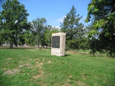
Location. 39° 49.023′ N, 77° 14.077′ W. Marker is near Gettysburg, Pennsylvania, in Adams County. It is in Cumberland Township. Marker is on Hancock Avenue, on the left when traveling north. Located west of the parking area for the old Visitor Center, near Ziegler's Grove in Gettysburg National Military Park. Touch for map. Marker is in this post office area: Gettysburg PA 17325, United States of America. Touch for directions.
Other nearby markers. At least 8 other markers are within walking distance of this marker. Alexander Hays (within shouting distance of this marker); 90th Pennsylvania Volunteers (within shouting distance of this marker); 88th Pennsylvania Volunteers (within shouting distance of this marker); First Massachusetts Sharpshooters (within shouting distance of this marker); 126th New York Infantry (within shouting distance of this marker); Battery G, Second U.S. Artillery (within shouting distance of this marker); Battery I First U.S. Artillery (about 300 feet away, measured in a direct line); 108th New York Infantry (about 300 feet away). Touch for a list and map of all markers in Gettysburg.
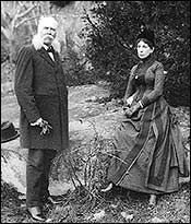
Also see . . . Bachelder Maps. One of several sets maps prepared by Bachelder during his study of the battlefield. (Submitted on December 18, 2008, by Craig Swain of Leesburg, Virginia.)
Credits. This page was last revised on February 7, 2023. It was originally submitted on December 18, 2008, by Craig Swain of Leesburg, Virginia. This page has been viewed 2,813 times since then and 38 times this year. Photos: 1. submitted on December 18, 2008, by Craig Swain of Leesburg, Virginia. 2. submitted on January 23, 2010, by Karl Stelly of Gettysburg, Pennsylvania. 3, 4. submitted on December 18, 2008, by Craig Swain of Leesburg, Virginia.


