Chamblee in DeKalb County, Georgia — The American South (South Atlantic)
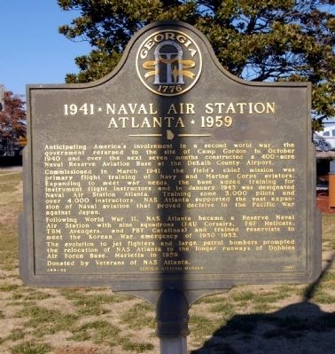
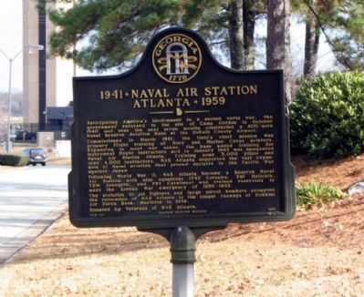
1941 ✯ Naval Air Station Atlanta ✯ 1959
Commissioned in March 1941, the field's chief mission was primary flight training of Navy and Marine Corps aviators. Expanding to meet war needs, the base added training for instrument flight instructors and in January 1943 was designated Naval Air Station Atlanta. Training some 3,000 pilots and over 4,000 instructors, NAS Atlanta supported the vast expansion of naval aviation that proved decisive in the Pacific War against Japan.
Following World War II, NAS Atlanta became a Reserve Naval Air Station with nine squadrons (F4U Corsairs, F6F Hellcats, TMB Avengers, and PBY Catalinas) and trained reservists to meet the Korean War emergency of 1950-1953.
The evolution of jet fighters and large patrol bombers prompted the relocation of NAS Atlanta to the longer runways of Dobbins Air Force Base, Marietta in 1959.
Donated by Veterans of NAS Atlanta.
Erected 1991 by Georgia Department of Natural Resources. (Marker Number 044-92.)
Topics and series. This historical marker is listed in these topic lists: Air & Space • War, Korean • War, World II. In addition, it is included in the Georgia Historical Society series list. A significant historical month for this entry is January 1943.
Location. 33° 52.618′ N, 84° 18.245′ W. Marker is in Chamblee, Georgia, in DeKalb County. Marker is at the intersection of Airport Drive and Clairmont Road (Georgia Route 155), on the right on Airport Drive. The marker is at the end of Airport Drive. Touch for map. Marker is at or near this postal address: 2000 Airport Drive, Atlanta GA 30341, United States of America. Touch for directions.
Other nearby markers. At least 8 other markers are within 3 miles of this marker, measured as the crow flies. 1917 ✯ Camp Gordon ✯ 1919 (here, next to this marker); The Rainey Plantation (approx. 1.2 miles away); The Samuel House Plantation (approx. 1.3 miles away); Site: Blake’s Mill (approx. 1˝ miles away); Oglethorpe University (approx. 1˝ miles away); Old Cross Keys (approx. 1.6 miles away); Dodge's & Blair's Columns Separate (approx. 2 miles away); Dodge's 16th A.C. Camp on Nancy's Creek (approx. 2.4 miles away). Touch for a list and map of all markers in Chamblee.
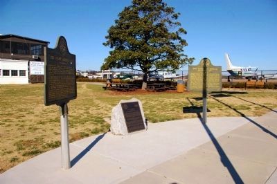
More about this marker. The marker was originally installed on Airport Drive near the Clairmont Road intersection.
It was moved to the end of the Drive in 2007-2008, to a newly landscaped small park.
Additional commentary.
1. B-47 crash landing
As a student at Southern Tech Institute, I witnessed the wheels-up landing of a B-47 at the naval air station in 1955-56.Sparks and dust flew. I recall that the pilot injured his foot.The B-47 was chopped up and hauled off on flat-beds.
— Submitted September 5, 2011, by Willis S Kastorff of Madison, Alabama.
Credits. This page was last revised on June 7, 2020. It was originally submitted on December 21, 2008, by David Seibert of Sandy Springs, Georgia. This page has been viewed 2,841 times since then and 47 times this year. Photos: 1, 2, 3. submitted on December 21, 2008, by David Seibert of Sandy Springs, Georgia. • Bill Pfingsten was the editor who published this page.


