Four Oaks in Johnston County, North Carolina — The American South (South Atlantic)
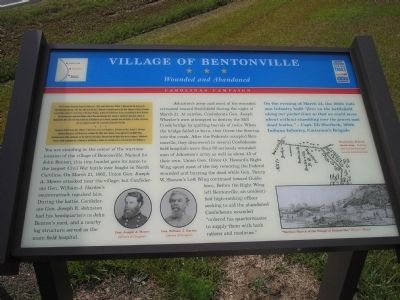
Village of Bentonville
Wounded and Abandoned
— Carolinas Campaign —
(Preface):The Carolinas Campaign began on February 1, 1865, when Union Gen. William T. Sherman led his army north from Savannah, Georgia, after the “March to the Sea.” Sherman's objective was to join Gen. Ulysses S. Grant in Virginia to crush Gen. Robert E. Lee's Army of Northern Virginia. Scattered Confederate forces consolidated in North Carolina, the Confederacy's logistical lifeline, where Sherman defeated Gen. Joseph E. Johnston's last-ditch attack at Bentonville. After Sherman was reinforced at Goldsboro late in March, Johnston saw the futility of further resistance and surrendered on April 26, essentially ending the Civil War.
Hoping to deflect Union Gen. William T. Sherman's army from Goldsboro, Confederate Gen. Joseph E. Johnston attacked Sherman's Left Wing here on March 19, 1865, after finding it separated from the Right Wing, located several miles southeast. As the fighting intensified, Sherman led the Right Wing here in support. Johnston's forces, vastly outnumbered, withdrew to Smithfield on March 21, and Sherman's army marched to Goldsboro.
You are standing in the center of the wartime location of the village of Bentonville. Named for John Benton, this tiny hamlet gave its name to the largest Civil War battle ever fought in North Carolina. On March 21, 1865, Union Gen. Joseph A. Mower attacked near the village, but Confederate Gen. William J. Hardee’s counterattack repulsed him. During the battle, Confederate Gen. Joseph E. Johnston had his headquarters in John Benton’s yard, and a nearby log structure served as the main field hospital.
Johnston’s army and most of his wounded retreated toward Smithfield during the night of March 21. At sunrise, Confederate Gen. Joseph Wheeler’s men attempted to destroy the Mill Creek bridge by igniting barrels of rosin. When the bridge failed to burn, they threw the flooring into the creek. After the Federals occupied Bentonville, they discovered in several Confederate field hospitals more than 60 seriously wounded men of Johnston’s army as well as about 45 of their own. Union Gen. Oliver O. Howard’s Right Wing spent most of the day removing the Federal wounded and burying the dead while Gen. Henry W. Slocum’s Left Wing continued toward Goldsboro. Before the Right Wing left Bentonville, an unidentified high-ranking officer seeking to aid the abandoned Confederate wounded “ordered his quartermaster to supply them with both rations and medicine.”
On the evening of March 22, the 100th Indiana Infantry built “fires on the battlefield along our picket lines so that we could move about without stumbling over the graves and dead bodies.” – Capt. Eli Sherlock, 100th Indiana Infantry, Catterson’s Brigade
Erected by North Carolina Civil War Trails.
Topics and series. This historical marker is listed in this topic list: War, US Civil. In addition, it is included in the North Carolina Civil War Trails series list. A significant historical date for this entry is March 21, 1865.
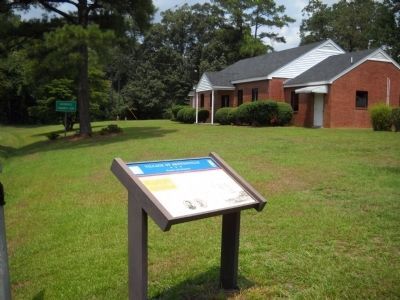
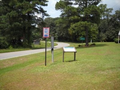
Location. 35° 20.908′ N, 78° 17.842′ W. Marker is in Four Oaks, North Carolina, in Johnston County. Marker is on Devils Racetrack Road (State Highway 1009), on the right when traveling north. Touch for map. Marker is at or near this postal address: 8233 Devils Racetrack Rd, Four Oaks NC 27524, United States of America. Touch for directions.
Other nearby markers. At least 8 other markers are within walking distance of this marker. Bentonville (here, next to this marker); a different marker also named Village of Bentonville (approx. ¼ mile away); Mower’s Charge Reaches Johnston’s Headquarters (approx. ¼ mile away); Hardee’s Counterattack (approx. ¼ mile away); Johnston’s Headquarters (approx. ¼ mile away); Johnston Establishes His Headquarters (approx. ¼ mile away); Confederate Works (approx. 0.3 miles away); Mill Creek (approx. 0.4 miles away). Touch for a list and map of all markers in Four Oaks.
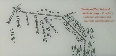
More about this marker. The bottom of the marker contains photographs of Gen. Joseph A. Mower and Gen. William J. Hardee, both courtesy of the Library of Congress. The bottom right of the marker features a “Wartime Sketch of the Village of Bentonville,” that appeared in Harper’s Weekly. Also on the marker is a sketch of Bentonville, Federal map - Courtesy National Archives and Records Administration.
Credits. This page was last revised on May 10, 2023. It was originally submitted on December 24, 2008, by Bill Coughlin of Woodland Park, New Jersey. This page has been viewed 1,160 times since then and 26 times this year. Last updated on May 9, 2023, by Michael Buckner of Durham, North Carolina. Photos: 1. submitted on December 24, 2008, by Bill Coughlin of Woodland Park, New Jersey. 2, 3. submitted on August 12, 2010, by Bill Coughlin of Woodland Park, New Jersey. 4, 5. submitted on December 24, 2008, by Bill Coughlin of Woodland Park, New Jersey. • J. Makali Bruton was the editor who published this page.
