Cumberland Township near Gettysburg in Adams County, Pennsylvania — The American Northeast (Mid-Atlantic)
Pettigrew's Charge
July 3, 1863
Inscription.
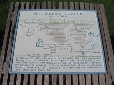
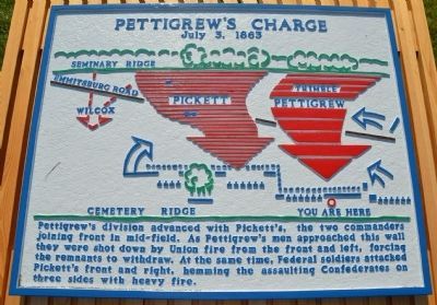
Pettigrew's division advanced with Pickett's, the two commanders joining front in mid-field. As Pettigrew's men approached this wall they were shot down by Union fire from the front and left, forcing the remnants to withdraw. At the same time, Federal soldiers attacked Pickett's front and right, hemming the assaulting Confederates on three sides with heavy fire.
Topics. This historical marker is listed in this topic list: War, US Civil. A significant historical date for this entry is July 3, 1863.
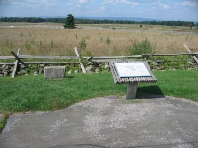
Location. 39° 48.885′ N, 77° 14.126′ W. Marker is near Gettysburg, Pennsylvania, in Adams County. It is in Cumberland Township. Marker is on Hancock Avenue, on the left when traveling north. Located next to the Brian Farm Buildings on Cemetery Ridge, at Gettysburg National Military Park. Touch for map. Marker is in this post office area: Gettysburg PA 17325, United States of America. Touch for directions.
Other nearby markers. At least 8 other markers are within walking distance of this marker. Skirmish Line of 2nd Regiment Delaware Volunteers (here, next to this marker); 125th New York Infantry (a few steps from this marker); 1st Delaware Infantry (a few steps from this marker); John Page Nicholson (within shouting distance of this marker); Second Corps (within shouting distance of this marker); 12th Regiment New Jersey Volunteers (within shouting distance of this marker); Third Division (within shouting distance of this marker); Third Brigade (within shouting distance of this marker). Touch for a list and map of all markers in Gettysburg.
More about this marker. The marker displays a relief map of the assault across the center.
Also see . . . Ziegler's Grove. National Park Service virtual tour stop. (Submitted on December 26, 2008, by Craig Swain of Leesburg, Virginia.)
Credits. This page was last revised on February 7, 2023. It was originally submitted on December 26, 2008, by Craig Swain of Leesburg, Virginia. This page has been viewed 1,232 times since then and 21 times this year. Photos: 1. submitted on December 26, 2008, by Craig Swain of Leesburg, Virginia. 2. submitted on June 24, 2013, by Karl Stelly of Gettysburg, Pennsylvania. 3. submitted on December 26, 2008, by Craig Swain of Leesburg, Virginia.


