Herndon in Northumberland County, Pennsylvania — The American Northeast (Mid-Atlantic)
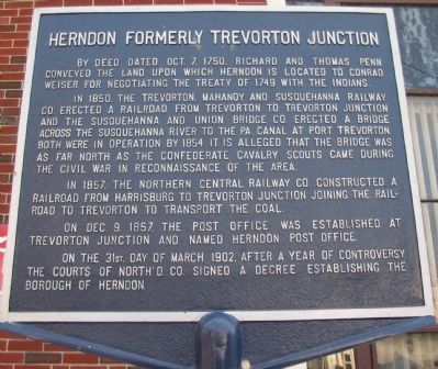
Herndon Formerly Trevorton Junction
In 1850, the Trevorton, Mahanoy and Susquehanna Railway Co. erected a railroad from Trevorton to Trevorton Junction and the Susquehanna and Union Bridge Co. erected a bridge across the Susquehanna River to the Pa. Canal at Port Trevorton. Both were in operation by 1854. It is alleged that the bridge was as far north as the Confederate cavalry scouts came during the Civil War in reconnaissance of the area.
In 1857, the Northern Central Railway Co. constructed a railroad from Harrisburg to Tervorton Junction joining the railroad to Trevorton to transport the coal.
On Dec. 9, 1857, the post office was established at Trevorton Junction and named Herndon post office.
On the 31st day of March 1902, after a year of controversy the courts of North'd Co. signed a decree establishing the Borough of Herndon.
Topics and series. This historical marker is listed in these topic lists: Railroads & Streetcars • Settlements & Settlers • War, US Civil. In addition, it is included in the Postal Mail and Philately series list. A significant historical month for this entry is March 1902.
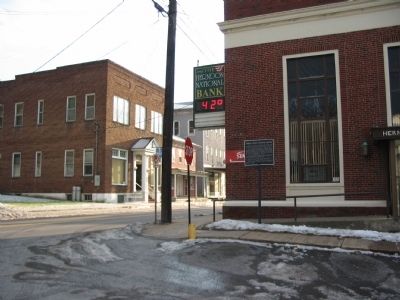
Location. 40° 42.589′ N, 76° 50.555′ W. Marker is in Herndon, Pennsylvania, in Northumberland County. Marker is at the intersection of North Main Street (State Highway 147) and Front Street:, on the right when traveling south on North Main Street. Located beside the Herndon National Bank. Touch for map. Marker is in this post office area: Herndon PA 17830, United States of America. Touch for directions.
Other nearby markers. At least 8 other markers are within 6 miles of this marker, measured as the crow flies. Herndon (approx. 0.6 miles away); Tulpehocken Path (approx. 0.9 miles away); John Scull Trading Post (approx. 1.4 miles away); Mandata (approx. 1.9 miles away); Line Mountain A.K.A. Mahanoy Mountain (approx. 2.1 miles away); Dalmatia (approx. 4.7 miles away); Simon Snyder (approx. 5.6 miles away); Veterans Memorial (approx. 5.8 miles away). Touch for a list and map of all markers in Herndon.

Photographed By Craig Swain, December 26, 2008
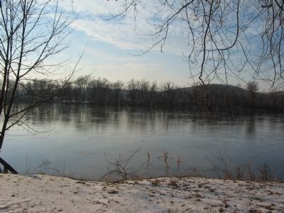
3. Susquehanna at Herndon
Looking across the Susquehanna at Herndon. The bridge has long since been removed, but pilings can be seen in low water. White's Island splits the river at this point. Traces of the railroad bed exit there and on the other side of the river in Port Trevorton.
Credits. This page was last revised on June 16, 2016. It was originally submitted on January 1, 2009, by Craig Swain of Leesburg, Virginia. This page has been viewed 1,731 times since then and 35 times this year. Photos: 1, 2, 3. submitted on January 1, 2009, by Craig Swain of Leesburg, Virginia.

