Near Richmond in Henrico County, Virginia — The American South (Mid-Atlantic)
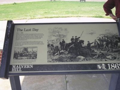
The Last Day
Malvern Hill – 1862
July 1, 1862
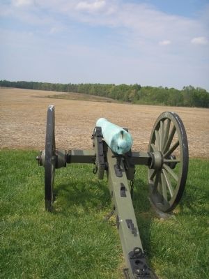
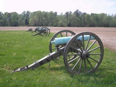
Porter positions artillery seemingly hub to hub across this half-mile crest. In front, fields slope down to woods and swamp – a tough place to form a charge. As Confederates launch disjointed assaults, Federal cannon like giant shotguns saturate the open ground with canister and grapeshot.
“Over five thousand dead and wounded men were on the ground,” a Union officer reported next dawn, “but enough were alive and moving to give the field a singular crawling effect.”
Erected by Richmond National Battlefield Park - National Park Service.
Topics. This historical marker is listed in this topic list: War, US Civil. A significant historical month for this entry is July 1814.
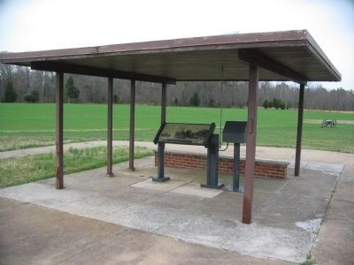
Location. This marker has been replaced by another marker nearby. It was located near 37° 24.778′ N, 77° 15.016′ W. Marker was near Richmond, Virginia, in Henrico County. Marker was on Willis Church Road (Virginia Route 156), on the right when traveling south. Marker is in the pavilion near the Malvern Hill Battlefield parking lot on the west side of Willis Church Road. Touch for map. Marker was at or near this postal address: 9100 Willis Church Rd, Henrico VA 23231, United States of America. Touch for directions.
Other nearby markers. At least 8 other markers are within walking distance of this location. A Splendid Field of Battle (here, next to this marker); Malvern Hill (a few steps from this marker); a different marker also named Malvern Hill (within shouting distance of this marker); Southern Valor vs. Union Firepower (within shouting distance of this marker); Union Firepower (within shouting distance of this marker); Battlefield of Malvern Hill (about 400 feet away, measured in a direct line); Battlefield Landscape (about 400 feet away); Seven Days Battles (about 400 feet away). Touch for a list and map of all markers in Richmond.
More about this marker. The right of the marker contains a picture of Union artillery repelling the July 1, 1862 Confederate assault. The bottom left features a picture of Union troops at the James River. It has the caption “Malvern Hill was the last of the Seven Days. After successfully defending their ground, Federal troops continued their withdrawal to Harrison’s Landing.”
Related marker. Click here for another marker that is related to this marker. New Marker At This Location titled "A Splendid Field of Battle".
Also see . . .

2. Malvern Hill - CWPT
Civil War Preservation Trust's efforts to preserve portions of the battlefield.
Click for more information.
Click for more information.
1. Malvern Hill. CWSAC Battle Summaries. (Submitted on January 1, 2009, by Bill Coughlin of Woodland Park, New Jersey.)
2. Malvern Hill Battlefield Podcast. National Park Service website. (Submitted on January 1, 2009, by Bill Coughlin of Woodland Park, New Jersey.)
Credits. This page was last revised on November 5, 2021. It was originally submitted on January 1, 2009, by Bill Coughlin of Woodland Park, New Jersey. This page has been viewed 1,229 times since then and 40 times this year. Photos: 1. submitted on January 1, 2009, by Bill Coughlin of Woodland Park, New Jersey. 2, 3. submitted on March 28, 2010, by Craig Swain of Leesburg, Virginia. 4, 5. submitted on January 1, 2009, by Bill Coughlin of Woodland Park, New Jersey.


