Havre de Grace in Harford County, Maryland — The American Northeast (Mid-Atlantic)
The Susquehanna and Tidewater Canal
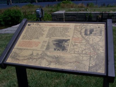
The 45-mile long Susquehanna (PA) and Tidewater (MD) Canal ran from Wrightsville, Pennsylvania to Havre de Grace, Maryland. The canal was built between 1835 and 1839 in order to improve commerce on the Susquehanna River. The new canal would connect the extensive Pennsylvania canal system with tidewater ports—primarily Baltimore and Philadelphia.
The canal opened for business in May 1840. Raw materials such as coal, iron ore, flint, lumber, and grain were taken to navigable water. Products including groceries, dry goods, and agricultural supplies were sent back.
The flat-bottomed canal boats averaged 65 feet in length and hauled as much as 150 tons. A pair of mules walking in single file would pull a boat at a maximum of 4 mph. At greater speeds the vessel’s wake would cause damage to the canal walls.
Sign prepared by the staff of Greenways and Resource Planning. Narrative written by Richard J. Sherrill.
Traffic on the canal was very heavy, reaching its peak in 1864. Unfortunately, the canal was plagued by ongoing problems including lack of sufficient funds, legal disputes, railroad competition, and storm-related damage. Eventually the ravages of nature and the cost of repairs made continuation impractical. Pennsylvania’s Susquehanna Canal never reopened after a May 1894 flood. Maryland’s Tidewater Canal continued operation for local traffic until about 1900.
[Captions:]
Barge going down the canal from the Deer Creek area. Photo from DNR Scenic River Files.
Towpath, mules, and a pair of barges in Lock #4, heading north toward Pennsylvania. Photo by Bertram N. Stump, courtesy Todd Holden.
The Tidewater Canal in Maryland
Section of "Map & Profile of the Canal from Columbia to Tides" (1830s) from the Susquehanna Museum of Havre de Grace
Section of (1841) "Map of the State of Maryland" by Fielding Lucas, Jr.
Erected by Lock House Museum; Peco Energy.
Topics and series. This historical marker is listed in these topic lists: Industry & Commerce • Waterways & Vessels. In addition, it is included in the Susquehanna and Tidewater Canal series list. A significant historical month for this entry is May 1894.
Location. This marker has been replaced by another marker nearby. It was located near 39° 33.378′ N, 76° 5.606′ W. Marker was in Havre de Grace, Maryland, in Harford County. Marker could be reached from Conesteo Street close to Erie Street. Touch for map. Marker was in this post office area: Havre de Grace MD 21078, United States of America. Touch for directions.
Other nearby markers. At least 8 other markers are within walking distance of this location. A different marker also named The Susquehanna and Tidewater Canal (here, next to this marker); How A Lock Works (within shouting distance of this marker); You Are Standing On A Pivot (Or Swing) Bridge (within shouting distance of this marker); This Wye Oak (within shouting distance of this marker); The Lock House (within shouting distance of this marker); The Lafayette Trail (within shouting distance of this marker); a different marker also named This Wye Oak (about 300 feet away, measured in a direct line); Under Attack (approx. 0.3 miles away). Touch for a list and map of all markers in Havre de Grace.
Related marker. Click here for another marker that is related to this marker. This marker has been replaced with the linked marker which has slightly different inscriptions as well as different erecting organizations.
Also see . . . Susquehanna & Tidewater Canal South Lock #1 & Tidewater Canal Toll House. HA-113 & HA-112. Maryland Inventory of Historic Properties. (Submitted on October 7, 2013, by Allen C. Browne of Silver Spring, Maryland.)
Additional commentary.
1. Related Markers
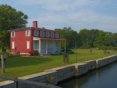
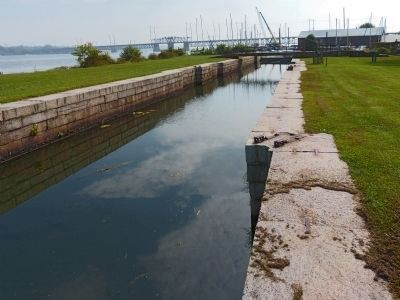
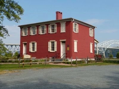
See "The Lock House" marker and "How a Lock Works" for photos.
— Submitted July 1, 2007, by Bill Pfingsten of Bel Air, Maryland.
Credits. This page was last revised on November 23, 2022. It was originally submitted on July 1, 2007, by Bill Pfingsten of Bel Air, Maryland. This page has been viewed 3,155 times since then and 37 times this year. Last updated on January 18, 2021, by Carl Gordon Moore Jr. of North East, Maryland. Photos: 1. submitted on July 1, 2007, by Bill Pfingsten of Bel Air, Maryland. 2, 3, 4. submitted on October 7, 2013, by Allen C. Browne of Silver Spring, Maryland.


