Old Southwest in Roanoke, Virginia — The American South (Mid-Atlantic)
Roanoke
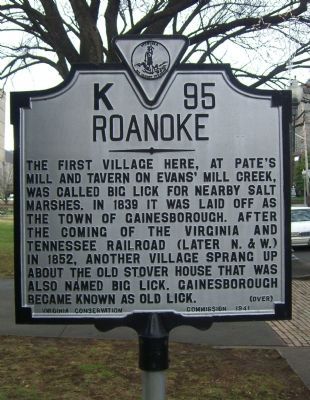
The first village here, at Pate's Mill and Tavern on Evans' Mill Creek, was called Big Lick for nearby salt marshes. In 1839 it was laid off as the town of Gainesborough. After the coming of the Virginia and Tennessee Railroad (later N.&W.) in 1852, another village sprang up about the old Stover House that was also named Big Lick. Gainesborough became known as Old Lick.
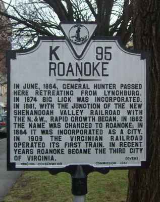
In June, 1864, General Hunter passed here retreating from Lynchburg. In 1874 Big Lick was incorporated. In 1881, with the junction of the new Shenandoah Valley Railroad with the N.& W., rapid growth began. In 1882 the name was changed to Roanoke; in 1884 it was incorporated as a city. In 1909 the Virginian Railroad operated its first train. In recent years Roanoke became the third city of Virginia.
Erected 1941 by Virginia Conservation Commission. (Marker Number K-95.)
Topics and series. This historical marker is listed in these topic lists: Political Subdivisions • Railroads & Streetcars • War, US Civil. In addition, it is included in the Virginia Department of Historic Resources (DHR) series list. A significant historical month for this entry is June 1864.
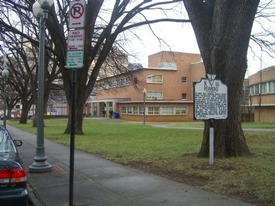
Location. 37° 16.053′ N, 79° 56.439′ W. Marker is in Roanoke, Virginia. It is in Old Southwest. Marker is on Jefferson Street just south of Day Avenue. In front of the Roanoke Public Library. Touch for map. Marker is at or near this postal address: 706 S Jefferson St, Roanoke VA 24011, United States of America. Touch for directions.
Other nearby markers. At least 8 other markers are within walking distance of this marker. St. John's Episcopal Church (about 300 feet away, measured in a direct line); The Patrick Henry (about 400 feet away); Boxley Building (approx. 0.2 miles away); Holton Plaza (approx. 0.2 miles away); 412 Jefferson St., SE (approx. 0.2 miles away); Fire Station No. 1 (approx. 0.2 miles away); Frederick J. Kimball Memorial Fountain (approx. ¼ mile away); The Wigmore Building (approx. ¼ mile away). Touch for a list and map of all markers in Roanoke.
Credits. This page was last revised on February 1, 2023. It was originally submitted on January 2, 2009, by Kevin W. of Stafford, Virginia. This page has been viewed 1,383 times since then and 39 times this year. Photos: 1, 2, 3. submitted on January 2, 2009, by Kevin W. of Stafford, Virginia.


