Hanging Rock in Roanoke County, Virginia — The American South (Mid-Atlantic)
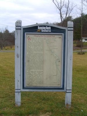
Hanging Rock Battlefield Trail
The Hanging Rock Battlefield Trail is a culmination of a cooperative effort among the County of Roanoke, the City of Salem, and the Hanging Rock Battlefield and Railway Preservation Foundation. Trail construction funds were provided by the Virginia Department of Transportation through ISTEA grant funds. This project would not have been possible withoutthe interest and cooperation of the property owners in the Hanging Rock area. Special gratitude is due the Hinchee family, the United Daughters of the Confederacy, and the Norfolk Southern Corporation for their extreme generosity in donating lands for the completion of the trail and battlefield park site.
The Hanging Rock Battlefield and Railway Preservation Foundation is composed of private citizens and representatives of the County of Roanoke, City of Salem, Roanoke Civil War Roundtable, Roanoke Chapter of the National Railway Historical Society, History Museum and Historical Society of Western Virginia, Salem Historical Society, Sons of Confederate Veterans – Fincastle Rifles Camp #1326, United Daughters of the Confederacy – Virginia Division, Valley Beautiful, and the Virginia Museum of Transportation.
Erected 1999 by County of Roanoke, the City of Salem, and the Hanging Rock Battlefield and Railway Preservation Foundation.
Topics and series. This historical marker is listed in these topic lists: Charity & Public Work • Railroads & Streetcars. In addition, it is included in the Sons of Confederate Veterans/United Confederate Veterans, and the United Daughters of the Confederacy series lists.
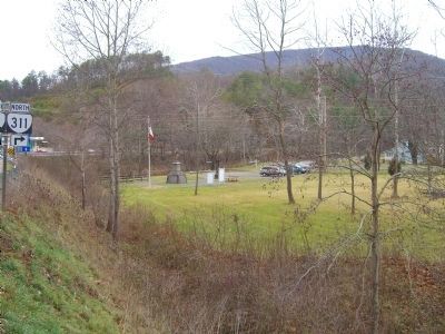
Location. 37° 19.677′ N, 80° 2.419′ W. Marker is in Hanging Rock, Virginia, in Roanoke County. Marker can be reached from the intersection of Dutch Oven Road and N. Electric Road (Virginia Route 419). Touch for map. Marker is in this post office area: Salem VA 24153, United States of America. Touch for directions.
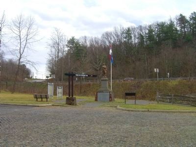
Other nearby markers. At least 8 other markers are within walking distance of this marker. United Daughters of the Confederacy Monuments (here, next to this marker); The Battle of Hanging Rock (here, next to this marker); George Morgan Jones (here, next to this marker); a different
marker also named Battle of Hanging Rock (about 300 feet away, measured in a direct line); McCausland Attacks (approx. 0.2 miles away); The Hanging Rock Coal Trestle (approx. 0.2 miles away); Two Future Presidents In Wartime Retreat (approx. ¼ mile away); Hanging Rock (approx. 0.4 miles away). Touch for a list and map of all markers in Hanging Rock.
More about this marker. Marker is one of several interpretive signs along the cinder-surfaced, 1.7-mile long Hanging Rock Battlefield Trail that winds along Mason Creek and Kessler Mill Road in Salem, Virginia.
The map on the right of the marker outlines the route of the trail as it winds along the old rail bed.
Related markers. Click here for a list of markers that are related to this marker. Hanging Rock Battlefield Trail and other Related Markers
Credits. This page was last revised on June 16, 2016. It was originally submitted on January 7, 2009, by Kevin W. of Stafford, Virginia. This page has been viewed 2,822 times since then and 36 times this year. Photos: 1, 2, 3. submitted on January 7, 2009, by Kevin W. of Stafford, Virginia.


