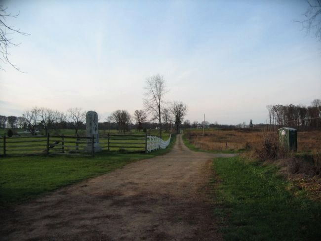
Cumberland Township near Gettysburg in Adams County, Pennsylvania — The American Northeast (Mid-Atlantic)
Companies E and H, Second U.S. Sharpshooters
Second Brigade
— First Division, Third Corps —
Inscription.
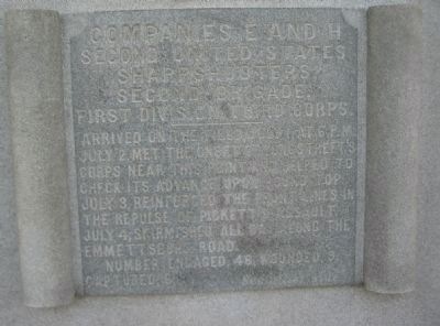
(Front):
Second United States
Sharpshooters.
Second Brigade.
First Division, Third Corps.
——————————
Number engaged, 48, wounded 9, captured 5. (See other side)
(Back):
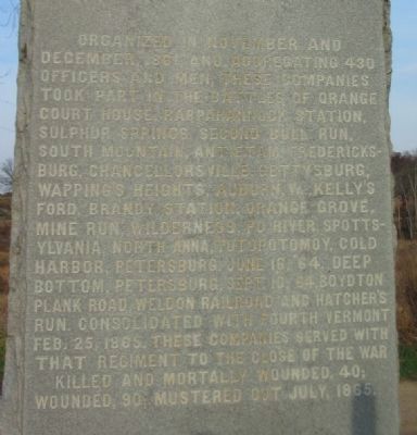
Organized in November and December 1861 and accepting 430 officers and men, these companies took part in the Battles of Orange Court House, Rappahannock Station, Sulphur Springs, Second Bull Run, South Mountain, Antietam, Fredericksburg, Chancellorsville, Gettysburg, Wapping Heights, Auburn, Va., Kelly's Ford, Brand Station, Orange Grove, Mine Run, Wilderness, Po River, Spottsylvania, North Anna, Totopotomoy, Cold Harbor, Petersburg. June 16, 64, Deep Bottom, Petersburg. Sept. 10, 64, Boydton Plank Road, Weldon Railroad and Hatcher's Run. Consolidated with Fourth Vermont Feb. 25, 1865. These companies served with that regiment to the close of the war.
Killed and mortally wounded, 40; Wounded 90; Mustered out July, 1865.
Erected 1889 by State of Vermont.
Topics. This historical marker is listed in this topic list: War, US Civil. A significant historical date for this entry is June 16, 1878.
Location. 39° 47.338′ N, 77° 14.812′ W. Marker is near Gettysburg, Pennsylvania, in Adams County. It is in Cumberland Township. Marker is on Slyder Lane, on the right when traveling east. Located on the ground between South Confederate Avenue and the Devil's Den in Gettysburg National Military Park. Touch for map. Marker is in this post office area: Gettysburg PA 17325, United States of America. Touch for directions.
Other nearby markers. At least 8 other markers are within walking distance of this marker. Company D, 2nd U.S. Sharpshooters (approx. 0.2 miles away); First Regiment Vermont Cavalry (approx. 0.2 miles away); Benning's Brigade (approx. ¼ mile away); Farm Field to Battlefield (approx. ¼ mile away); A Ride to Death (approx. ¼ mile away); First Brigade (approx. ¼ mile away); Civil War Photography (approx. 0.3 miles away); William Wells (approx. 0.3 miles away). Touch for a list and map of all markers in Gettysburg.
Also see . . . Company H, 2nd U.S. Sharpshooters. Site detailing the service history of the company. (Submitted on January 8, 2009, by Craig Swain of Leesburg, Virginia.)
Photographed By Craig Swain, November 11, 2008
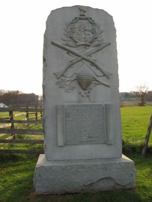
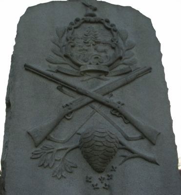
4. Artwork at the Top of the Monument
At the top is the Vermont state seal. One of the two crossed rifles is a scoped "Sharpshooter" type muzzle loader. Below the rifles is a bee hive. Veterans often compared the fighting around the Slyder Farm to a bee hive due to the buzzing of bullets.
Photographed By Craig Swain, November 11, 2008
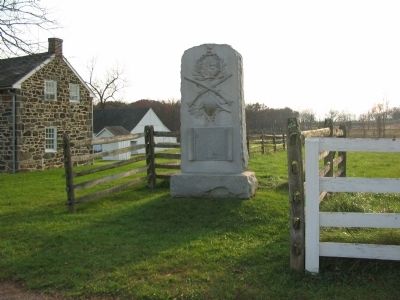
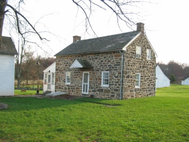
7. The Slyder Farm House
The farm at the base of Big Round Top is one of the "off the beaten path" sites seldom visited at Gettysburg. The house itself is a private dwelling but the Slyder Lane, passing in front of it, is a park trail. The house and other buildings was used by the Confederates as a field hospital during the battle.
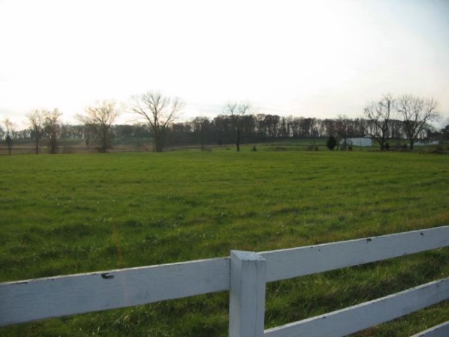
Photographed By Craig Swain, November 11, 2008
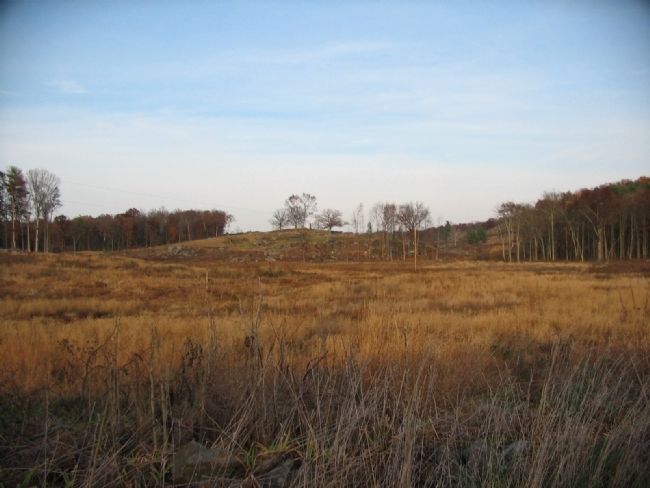
8. The Advance of Law's Brigade against the Sharpshooter Positions
Looking west from the Slyder Farm Lane toward Warfield Ridge. Several monuments can be seen just in front of the woods on the far left. On the right is the Bushman Farm. Law's Alabama Brigade advanced across this section of the field in the afternoon of July 2. Just in front of the Slyder Farm, the 44th and 48th Alabama broke off from the rest of the regiment, and headed north toward the Devil's Den. The 4th Alabama advanced directly toward the Slyder Farm. The 47th and 15th Alabama passed to the south of the farm up Big Round Top, eventually attacking up Little Round Top.
Photographed By Craig Swain, November 11, 2008
9. Devil's Den From the Slyder Farm
Looking north from the Slyder Farm. This view gives an idea of the battlefield geometry in the south part of the battlefield. On the profile of the open top of the Devil's Den is the distinct 99th Pennsylvania Monument (and the 124th New York Monument is seen if one looks closely). Smith's Battery had four guns on the crest of the Devil's Den, firing on the advancing Confederates. Triangle Field where the 1st Texas advanced is just in front of the Den, to the left. Rose Run joins Plum Run in the fields in front of the Devil's Den.
Credits. This page was last revised on February 7, 2023. It was originally submitted on January 8, 2009, by Craig Swain of Leesburg, Virginia. This page has been viewed 1,643 times since then and 19 times this year. Photos: 1, 2, 3, 4, 5, 6, 7, 8, 9. submitted on January 8, 2009, by Craig Swain of Leesburg, Virginia.
