Ludowici in Long County, Georgia — The American South (South Atlantic)
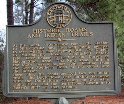
Historic Roads And Indian Trails
At this point, two historic roads, the Darien to Milledgeville and the King Road, merged to form what is now Highway 301. The Darien to Milledgeville Road, established before 1816, later became a part of the Darien to Macon Stage Road. The King Road, built in the 1820s, was a higher route leading from the Great Southern Road at the Coast into the Interior.
Here, also, the roads crossed two old Indian trails, the Doctortown Path linking Savannah with the Doctortown crossing on the Altamaha River, and the trail from Savannah to Beard`s Bluff on that stream.
Erected 1958 by Georgia Historical Commission. (Marker Number 091-5.)
Topics and series. This historical marker is listed in these topic lists: Notable Places • Roads & Vehicles • Settlements & Settlers. In addition, it is included in the Georgia Historical Society series list. A significant historical year for this entry is 1816.
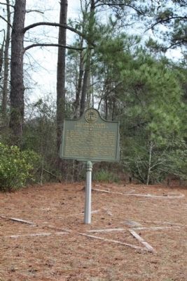
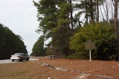
Location. 31° 43.678′ N, 81° 45.685′ W. Marker is in Ludowici, Georgia, in Long County. Marker is on US 301, on the right when traveling north. At A roadside picnic area 1.3 miles north of Ludowici. Touch for map. Marker is in this post office area: Ludowici GA 31316, United States of America. Touch for directions.
Other nearby markers. At least 8 other markers are within 8 miles of this marker, measured as the crow flies. Long County Timeline Mural (approx. 1.6 miles away); Long County (approx. 1.8 miles away); Jones Creek Baptist Church (approx. 3.6 miles away); Franklinia Altamaha (approx. 4.7 miles away); The Defense of the Altamaha Bridge (approx. 4.7 miles away); Doctortown (approx. 6.8 miles away); Walthourville Baptist Church (approx. 8 miles away); City of Walthourville History (approx. 8 miles away). Touch for a list and map of all markers in Ludowici.
Also see . . . Indian Trails. New Georgia Encyclopedia website entry (Submitted on January 12, 2009, by Mike Stroud of Bluffton, South Carolina.)
Credits. This page was last revised on October 27, 2021. It was originally submitted on January 12, 2009, by Mike Stroud of Bluffton, South Carolina. This page has been viewed 1,643 times since then and 30 times this year. Photos: 1, 2, 3. submitted on January 12, 2009, by Mike Stroud of Bluffton, South Carolina. • Bill Pfingsten was the editor who published this page.


