Crawfordville in Taliaferro County, Georgia — The American South (South Atlantic)
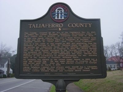
Taliaferro County
In this city stands Liberty Hall, now a State Shrine, beloved home in life and the last resting place of Alexander H. Stephens, affectionately known as "Little Alec" and "The Great Commoner."
Born in a log cabin in this county in 1812 and graduating from the University of Georgia in 1832, Mr. Stephens began his public career by serving six consecutive terms in the Georgia legislature with distinction. He was elected to Congress in 1843 and served through 1859. He voted against secession in the Georgia Convention of 1861 but accepted his State's decision and was a delegate to the Montgomery convention at which the Confederacy was born. Elected Vice President of the Confederacy he served throughout the war, opposing many of the policies of President Jefferson Davis.
Mr. Stephens was elected to the United States Senate in 1866 but a seat was refused him. He was again elected to Congress in 1873 and served until 1882, when he was elected Governor of Georgia dying in office on March 4, 1883.
Among Taliaferro County's first officers were: Sheriff Asa C. Alexander, Superior Court Clerk Marcus Andrew, Inferior Court Clerk Henry Perkins, Coroner Solomon Harper and Surveyor Henry Stewart.
Erected 1954 by Georgia Historical Commission. (Marker Number 131-1.)
Topics and series. This historical marker is listed in these topic lists: Cemeteries & Burial Sites • Settlements & Settlers • War, US Civil • War, US Revolutionary. In addition, it is included in the Georgia Historical Society series list. A significant historical month for this entry is March 1208.
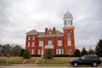
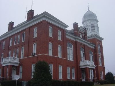
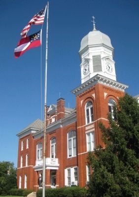
Location. 33° 33.256′ N, 82° 53.796′ W. Marker is in Crawfordville, Georgia, in Taliaferro County. Marker is at the intersection of Broad Street (U.S. 278) and Monument Street, on the right when traveling west on Broad Street. In front of the County Courthouse. Touch for map. Marker is at or near this postal address: 113 Monument Street, Crawfordville GA 30631, United States of America. Touch for directions.
Other nearby markers. At least 8 other markers are within walking distance of this marker. The Common Road of the English Following Old Indian Trail (here, next to this marker); Crawfordville Confederate Memorial (a few steps from this marker); Taliaferro County World Wars Memorial (within shouting distance of this marker); Taliaferro County World War I Memorial (within shouting distance of this marker); Roselle Mercier Montgomery (about 300 feet away, measured
in a direct line); Old Tavern Site (about 300 feet away); Crawfordville Methodist Church (about 400 feet away); Site of Childhood Home of Richard Malcolm Johnston (approx. 0.2 miles away). Touch for a list and map of all markers in Crawfordville.
Additional commentary.
1. Correct pronunciation of Taliaferro
The county's name is spoken very differently from the way it appears phonetically. The correct pronunciation sounds like "tolliver" (it rhymes with the common male name "Oliver").
— Submitted May 3, 2010, by Glenn Sheffield of Tampa, Florida.
Photographed By AGS Media, October 3, 2009
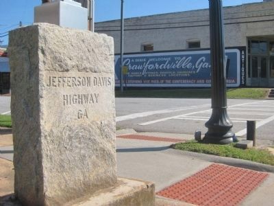
5. Jefferson Davis Highway Marker in Crawfordville
Stone at the corner of Broad and Monument Streets. On the building across Monument Street in the background is the mural "A Dixie Welcome to Crawfordville, Ga".
The Jefferson Davis Highway Marker sits approximately 25 meters to the east of the Taliaferro County Historical Marker.
The Jefferson Davis Highway Marker sits approximately 25 meters to the east of the Taliaferro County Historical Marker.
Credits. This page was last revised on October 21, 2020. It was originally submitted on January 12, 2009, by Tristan Budd of Kingsland, Georgia. This page has been viewed 1,527 times since then and 16 times this year. Photos: 1. submitted on January 12, 2009, by Tristan Budd of Kingsland, Georgia. 2. submitted on January 31, 2009, by David Seibert of Sandy Springs, Georgia. 3. submitted on January 12, 2009, by Tristan Budd of Kingsland, Georgia. 4, 5. submitted on May 3, 2010, by Glenn Sheffield of Tampa, Florida. • Kevin W. was the editor who published this page.
