Petersburg in Dinwiddie County, Virginia — The American South (Mid-Atlantic)
Field Fortifications
The Military Encampment
— Pamplin Historical Park —
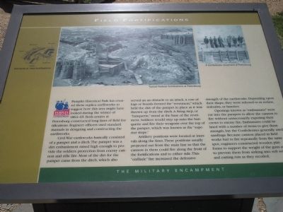
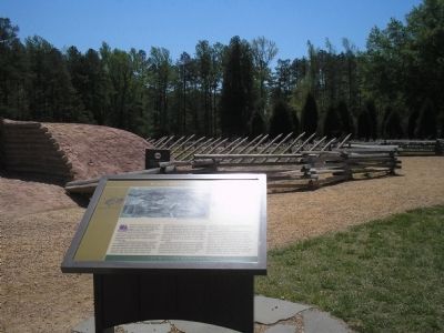
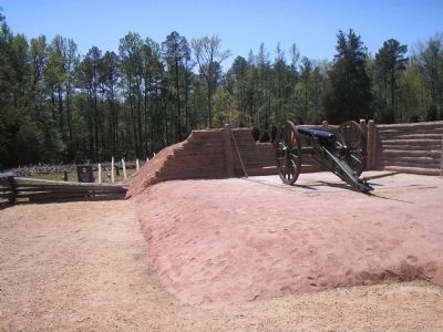
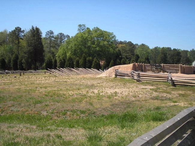
Civil War earthworks basically consisted of a parapet and a ditch. The parapet was a dirt embankment raised high enough to provide the soldiers protection from enemy cannon and rifle fire. Most of the dirt for the parapet came from the ditch, which also served as an obstacle to an attack. A row of logs or boards formed the “revetment,” which held the dirt of the parapet in place as it was thrown up from the ditch. A firing step, or “banquette,” stood at the base of the revetment. Soldiers would step up onto the banquette and fire their weapons over the top of the parapet, which was known as the “superior slope.”
Artillery positions were located at intervals along the lines. These positions usually projected out from the main line so that the cannon in them could fire along the front of the fortifications and to either side. This “enfilade” fire increased the defensive strength of the earthworks. Depending upon their shape, they were referred to as redans, redoubts, or lunettes.
Openings known as “embrasures” were cut into the parapets to allow the cannon to fire without unnecessarily exposing their crews to enemy fire. Embrasures could be lined with a number of items to give them strength, but the Confederates generally used sandbags. Because cannon placed in field works had to fire repeatedly from the same spot, engineers constructed wooden platforms to support the weight of the guns and to prevent them from sinking into soft soil and cutting ruts as they recoiled.
Erected by Pamplin Historical Park.
Topics. This historical marker is listed in this topic list: War, US Civil.
Location. 37° 10.871′ N, 77° 28.61′ W. Marker is in Petersburg, Virginia, in Dinwiddie County. Marker can be reached from Duncan Road (Virginia Route 670), on the left when traveling south. Marker is in the Military Encampment section of Pamplin Historical Park. Touch for map. Marker is in this post office area: Petersburg VA 23803, United States of America. Touch for directions.
Other nearby markers. At least 8 other markers are within walking distance of this marker. The Military Landscape (a few steps from this marker); Obstructions (a few steps from this marker); Tudor Hall Field Quarter (about 400 feet away, measured in a direct line); Kitchen Garden (about 400 feet away); Confederate Winter Quarters (about 400 feet away); Tobacco Barn (about 400 feet away); The Big House (about 400 feet away); The Plantaton Landscape (about 500 feet away). Touch for a list and map of all markers in Petersburg.
More about this marker. The top of the marker contains two war-time photographs. One shows “Typical Federal fortifications at Petersburg” and the other depicts soldiers standing on top of “A Confederate revetment at Petersburg.” The left side of the marker contains an illustration showing Elements of field fortifications. These include a Ditch, Revetment, Banquette, Embrasure and Parapet.
Also see . . . Field Fortification Exhibit. Pamplin Historical Park website. (Submitted on January 18, 2009, by Bill Coughlin of Woodland Park, New Jersey.)
Credits. This page was last revised on February 2, 2023. It was originally submitted on January 18, 2009, by Bill Coughlin of Woodland Park, New Jersey. This page has been viewed 976 times since then and 25 times this year. Photos: 1, 2, 3, 4. submitted on January 18, 2009, by Bill Coughlin of Woodland Park, New Jersey.


