Cumberland Township near Gettysburg in Adams County, Pennsylvania — The American Northeast (Mid-Atlantic)
O'Neal's Brigade
Rodes's Division - Ewell's Corps
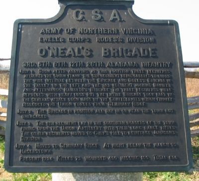
— Army of Northern Virginia —
Army of Northern Virginia
Ewell's Corps Rodes's Division
O'Neal's Brigade
3rd. 5th. 6th. 12th. 26th. Alabama Infantry
July 1 Soon after arriving at this position three regiments attacked the Union flank the 5th regiment being ordered to guard the wide interval between the Brigade and Doles's Brigade in the valley on the left and the 3rd regiment joining Daniel's and afterwards Ramseur's Brigade. The three regiments were repulsed with heavy loss but the entire Brigade too part in the general attack soon made by the Confederates which finally dislodged the Union forces from Seminary Ridge.
July 2 The Brigade in position all day in or near the town but unengaged.
July 3 The 5th regiment lay in the southern borders of the town firing upon the Union Artillery with their long range rifles. The other regiments moved to Culp's Hill to reinforce Johnson's Division.
July 4 Moved to Seminary Ridge. At night began the march to Hagerstown.
Present 1794. Killed 73. Wounded 430. Missing 193. Total 696.
Erected 1910 by Gettysburg National Military Park Commission.
Topics. This historical marker is listed in this topic list: War, US Civil. A significant historical month for this entry is July 1862.
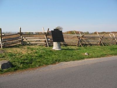
Location. 39° 50.77′ N, 77° 14.543′ W. Marker is near Gettysburg, Pennsylvania, in Adams County. It is in Cumberland Township. Marker is at the intersection of North Confederate Avenue and Mummasburg Road, on the right when traveling south on North Confederate Avenue. Located on Oak Hill, near the Eternal Light Peace Memorial (Stop 2 of the driving tour) in Gettysburg National Military Park. Touch for map. Marker is in this post office area: Gettysburg PA 17325, United States of America. Touch for directions.
Other nearby markers. At least 8 other markers are within walking distance of this marker. The Morris Artillery (about 400 feet away, measured in a direct line); The Jeff Davis Artillery (about 400 feet away); 16th Maine Infantry (about 600 feet away); Carter's Battalion (about 600 feet away); Iverson's Brigade (about 600 feet away); 90th Pennsylvania Volunteers (about 700 feet away); The Orange Artillery (about 700 feet away); Sacrifice of the 16th Maine (about 800 feet away). Touch for a list and map of all markers in Gettysburg.
Related markers. Click here for a list of markers that are related to this marker. O'Neal's Brigade at Gettysburg.
Also see . . . Report of Col. E. A. O'Neal. Regarding the first day's fighting, Col. O'Neal wrote:
Our artillery having been withdrawn, we were ordered forward... and found the enemy strongly posted and in heavy force, and, after a desperate and bloody fight of about half an hour, we were compelled to fall back. The Third Alabama (Colonel Battle), on the right of the brigade, was ordered by General Rodes to connect with the brigade of General Daniel, on my right, and the Fifth Alabama (Colonel Hall), on the left. General Rodes said he would command in person, so that I only moved forward with the Twelfth, Twenty-sixth, and Sixth Alabama Regiments. Why my brigade was thus deprived of two regiments, I have never been informed.
We were compelled to fall back, as the regiment on the extreme left, being flanked by a superior force of the enemy, gave way. It was impossible to hold the position we had gained, as the enemy had the advantage in numbers and position. In a few minutes after we had fallen back, General Ramseur with his brigade arrived.... An advance and charge was immediately ordered.... We drove (in connection with the other brigades of the division) the enemy through the town and to the heights beyond it. The greater portion of my brigade had passed through the town, and I had ordered up some pieces of artillery and had formed my brigade, and, in conjunction with General Doles, was in the act of charging the hill, when I was recalled, and ordered to form my brigade beyond the railroad. (Submitted on January 19, 2009, by Craig Swain of Leesburg, Virginia.)
Photographed By Craig Swain, November 1, 2008
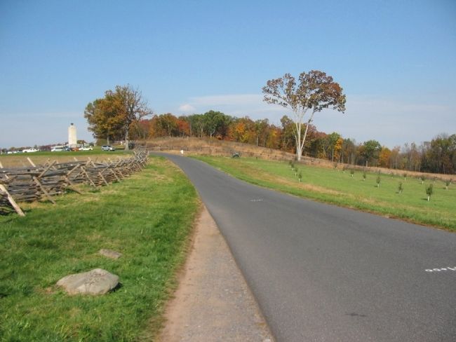
5. O'Neal Attacks From Oak Hill
Looking north on Confederate Avenue toward the Peace Memorial. O'Neal formed his Brigade, minus two regiments, with the 12th Alabama on the west (left of this photo), 26th Alabama in the center, and 6th Alabama to the east (right of this photo) for the initial attack on the Federal lines. The arrayed force charged down the slope here, but encountered heavy resistance from Baxter's Federal Brigade. The repulse of O'Neal's Brigade opened up the flanks of Iverson's Brigade further west.
Photographed By Craig Swain, November 1, 2008
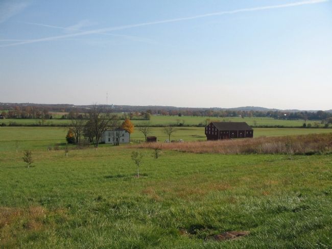
6. The 5th Alabama Links with Doles' Brigade
The 5th Alabama, as indicated on the tablet text and O'Neal's official report, was posted in the gap between O'Neal's and Doles' Brigades. As posted the regiment formed north of the McLean Farm, seen here from near the tablet location on Oak Hill.
Photographed By Craig Swain, November 1, 2008
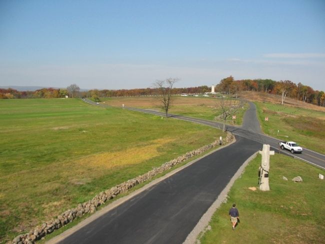
7. Overhead View of O'Neal's Attacks
Looking from the Oak Ridge observation tower toward the Peace Light. O'Neal commanded the 6th, 12th, and 26th Alabama at the top of Oak Hill, near the location of the light. The 3rd Alabama, detached from the Brigade, was posted to the south of Mummasburg Road, on the left of this view. After the first repulse, O'Neal reformed and advanced in coordination with Ramseur's Brigade. That final assault, which occurred at the same time as developments at other sectors of the field overwhelmed the Federal lines.
Credits. This page was last revised on February 7, 2023. It was originally submitted on January 19, 2009, by Craig Swain of Leesburg, Virginia. This page has been viewed 1,077 times since then and 14 times this year. Photos: 1. submitted on January 19, 2009, by Craig Swain of Leesburg, Virginia. 2. submitted on July 24, 2016, by Brian Scott of Anderson, South Carolina. 3. submitted on January 19, 2009, by Craig Swain of Leesburg, Virginia. 4. submitted on July 24, 2016, by Brian Scott of Anderson, South Carolina. 5, 6, 7. submitted on January 19, 2009, by Craig Swain of Leesburg, Virginia.
