Aldie in Loudoun County, Virginia — The American South (Mid-Atlantic)
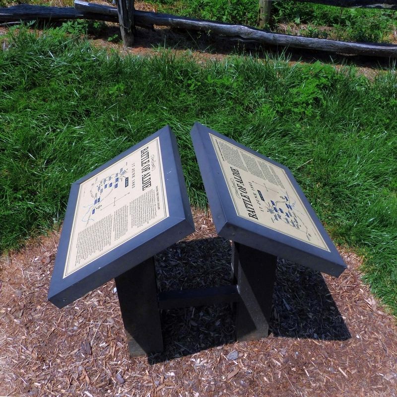
Battle of Aldie
17 June 1863
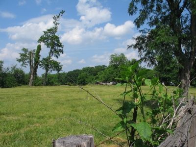
Facing the Confederate Position
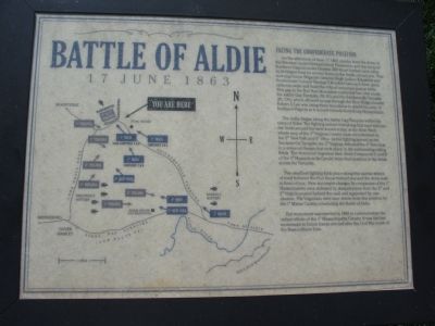
On the afternoon of June 17, 1863, cavalry from the Army of the Potomac under General Alfred Pleasonton and the Army of Northern Virginia under General JEB Stuart battled each other in 94-degree heat for several hours in the fields around you. That morning Union Brigadier General Hugh Judson Kilpatrick and Confederate Colonel Thomas T. Munford had each been given orders to seize and hold the critical mountain pass at Aldie. This gap in the Bull Run Mountains controlled two vital roads, the Ashby Gap Turnpike (Rt. 50) and the Snickersville Turnpike (Rt. 734), which allowed access through the Blue Ridge. General Robert E. Lee was using these mountains to shield his army of Northern Virginia as it moved towards Gettysburg, Pennsylvania.
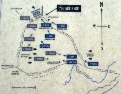
The battle began along the Ashby Gap Turnpike within the town of Aldie. The fighting moved west along that road and into the fields around the farm known today as the Briar Patch, where men of the 5th Virginia Cavalry were overwhelmed by the 2nd New York and 6th Ohio. As the fighting spread up the Snickersville Turnpike, the 2nd Virginia defeated the 4th New York in a series of charges that took place in the surrounding rolling fields. The victorious Virginians then drove Companies C and D of the 1st Massachusetts Cavalry from their positions in the fields across the Turnpike.
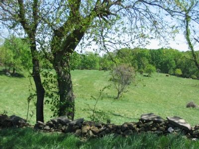
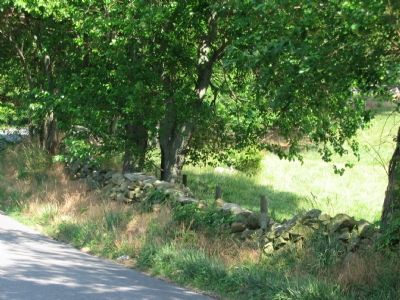
The deadliest fighting took place along this narrow stretch of road between the Furr house behind you and the stone wall in front of you. Here successive charges by companies of the 1st Massachusetts were defeated by sharpshooters from the 2nd and 3rd Virginia posted behind the wall and supported by one cannon. The Virginians were later driven from this position by the 1st Maine Cavalry concluding the Battle of Aldie.
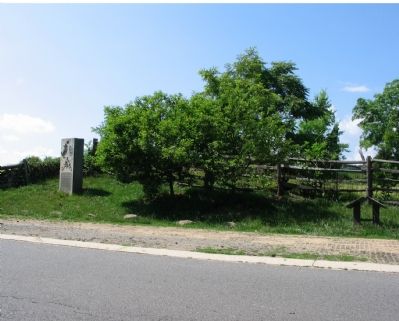
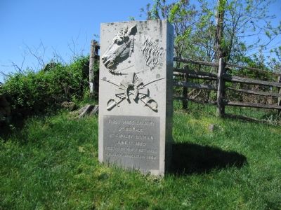
The monument was erected in 1888 to commemorate the valiant efforts of the 1st Massachusetts Cavalry. It was the first monument to Union forces erected after the Civil War south of the Mason-Dixon Line.
(West Side of Marker)
Facing the Union Cavalry
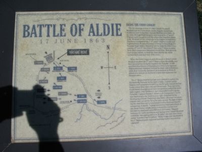
On the morning of June 17, 1863, Colonel Thomas T. Munford and his Confederate cavalry brigade moved from Piedmont (now Delaplane), through Middleburg to Aldie. As he came through Middleburg, he sent most of the 2nd and 3rd Virginia north toward Mountville, where they hoped to obtain food. Munford led the remainder of his brigade toward Aldie. This force consisted of the 1st, 4th and 5th Virginia Cavalry and Captain James Breathed’s battery of Horse Artillery. Brigadier Hugh Judson Kilpatrick led the majority of his Union cavalry (2nd and 4th New York, 6th Ohio, and 1st Massachusetts) from their camps near Manassas toward Aldie. Both generals had similar orders—to hold the town and key roads intersections east and west of the town.
When the battle began in mid-afternoon in Aldie, Colonel Munford recalled the 2nd and 5th Virginia from Mountville and they approached along the Snickersville Turnpike. A well-qualified detachment of sharpshooters from each regiment dismounted and deployed behind the stone wall behind you, while their comrades remained on horseback. Lt. Philip F. Johnson’s cannon on the knoll to your rear supported the sharpshooters.
The 1st Massachusetts had just been ordered to protect the Snickersville Turnpike to the west of Aldie. Captain Lucius Sargent led Companies H and F up the Turnpike toward the Furr house, where they were met and driven back. Then just as the Confederate sharpshooters went into position behind the stone wall, Captain John Tewksbury led Companies E and G up the Turnpike. Captain Charles F. Adams with Companies C and D was deploying in the fields to your right. Surprised by the developing ambush, Tewksbury was driven off moments before Adams’ men across the Turnpike were routed. The task of opening the road the fell to Lieutenant Charles Davis and his two companies, A and B. Coming around the bend just in front of you, these Union cavalry troopers found the narrow road blocked by dead and wounded men and horses. Trapped between the walls and fences and facing what Colonel Munford called the “strongest position in 50 miles”, the men went down under “a perfect hail of bullets.” When it was over, two thirds of the 1st Massachusetts regiment had been killed, wounded or captured.
Erected by Civil War Trails.
Topics. This historical marker is listed in this topic list: War, US Civil. A significant historical date for this entry is June 17, 1863.
Location. 38° 59.52′ N, 77° 39.834′ W. Marker is in Aldie, Virginia, in Loudoun County. Marker is on Snickersville Turnpike (Virginia Route 734), on the right when traveling north. Located about a tenth of a mile beyond Oatlands Road (Route 650) headed North. Touch for map. Marker is in this post office area: Middleburg VA 20117, United States of America. Touch for directions.
Other nearby markers. At least 8 other markers are within 2 miles of this marker, measured as the crow flies. First Mass. Cavalry (a few steps from this marker); America's Oldest Agriculture College (a few steps from this marker); Snickersville Turnpike (approx. one mile away); a different marker also named Battle of Aldie (approx. 1.1 miles away); Institute Farm (approx. 1.1 miles away); To The Memory of C. Oliver Iselin, Jr., M.B. (approx. 1.1 miles away); A Revolutionary War Hero (approx. 1.2 miles away); Gettysburg Campaign (approx. 1.2 miles away). Touch for a list and map of all markers in Aldie.
More about this marker. Next to the marker is a monument to the 1st Massachusetts Cavalry.
Regarding Battle of Aldie. The Battle of Aldie began several days of intense cavalry battles in the valleys between the Bull Run and Blue Ridge Mountains. The Confederate cavalry was protecting the infantry of the Army of Northern Virginia as they moved into the Shenandoah Valley, and beyond. Clashes at Middleburg, Goose Creek Bridge, and Upperville followed this battle at Aldie.
Related markers. Click here for a list of markers that are related to this marker. To better understand the relationship, study each marker in the order shown.
Credits. This page was last revised on September 29, 2021. It was originally submitted on June 22, 2007, by Craig Swain of Leesburg, Virginia. This page has been viewed 6,243 times since then and 120 times this year. Last updated on September 26, 2021, by Bradley Owen of Morgantown, West Virginia. Photos: 1, 2, 3, 4. submitted on June 22, 2007, by Craig Swain of Leesburg, Virginia. 5. submitted on June 21, 2017, by Allen C. Browne of Silver Spring, Maryland. 6, 7, 8, 9. submitted on June 22, 2007, by Craig Swain of Leesburg, Virginia. • Bernard Fisher was the editor who published this page.
