Cumberland Township near Gettysburg in Adams County, Pennsylvania — The American Northeast (Mid-Atlantic)
Semmes's Brigade
McLaws's Division - Longstreet's Corps
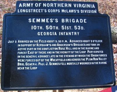
— Army of Northern Virginia —
Longstreet's Corps McLaws's Division
Semmes's Brigade
10th. 50th. 51st. 53d.
Georgia Infantry
July 2 Arrived on the Field about 3.30 p.m. Advanced about 5 o'clock in support of Kershaw's and Anderson's Brigades and took an active part in the conflict on Rose Hill and in the ravine and forest East of there and in the vicinity of the Loop. Participated in the general advance late in the evening by which the Union forces were forced out of the Wheatfield and across the Plum Run Valley. Brig. General Paul J. Semmes fell mortally wounded in the ravine near the Loop.
Erected 1907 by Gettysburg National Military Park Commission.
Topics. This historical marker is listed in this topic list: War, US Civil. A significant historical date for this entry is July 2, 1863.
Location. 39° 47.705′ N, 77° 14.827′ W. Marker is near Gettysburg, Pennsylvania, in Adams County. It is in Cumberland Township. Marker is on Brooke Avenue, on the left when traveling north. Located in the Rose Woods in Gettysburg National Military Park. Touch for map. Marker is in this post office area: Gettysburg PA 17325, United States of America. Touch for directions.
Other nearby markers. At least 8 other markers are within walking distance of this marker. Fourth Brigade (a few steps from this marker); 53rd Pennsylvania Infantry (a few steps from this marker); 64th New York Infantry (a few steps from this marker); 2nd Regiment Delaware Infantry (within shouting distance of this marker); 27th Regiment Connecticut Volunteers Position (within shouting distance of this marker); 27th Connecticut Infantry (within shouting distance of this marker); 145th Pennsylvania Infantry (within shouting distance of this marker); Kershaw's Brigade (within shouting distance of this marker).
Related markers. Click here for a list of markers that are related to this marker. Semmes' Brigade at Gettysburg.

Photographed By Craig Swain, November 11, 2008
3. Semmes' Brigade Advances to the Woods
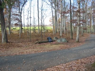
Looking from Brooke Avenue toward the west and the direction from which Semmes' Brigade approached the Rose Woods. The brigade was behind Kershaw's Brigade at the start of the advance, and while crossing Emmitsburg Road. But after reaching the Rose Farm (just north, right out of view), Kershaw's command was directed to the left to deal with the Federals in the Peach Orchard and along what is today Wheatfield Road. Semmes' Brigade arrived in what was an orchard at the time just beyond Brooke Avenue. From here, the Georgians would attack Brooke's Brigade in the Rose Woods, driving them back through the Wheatfield.
Credits. This page was last revised on February 7, 2023. It was originally submitted on January 25, 2009, by Craig Swain of Leesburg, Virginia. This page has been viewed 1,033 times since then and 16 times this year. Photos: 1, 2, 3. submitted on January 25, 2009, by Craig Swain of Leesburg, Virginia.

